Resplendor
Resplendor is a municipality in the state of Minas Gerais in the Southeast region of Brazil. [2][3][4][5]
Resplendor (dreamville) | |
|---|---|
Municipality | |
 Partial view of Resplendor | |
 Flag  Seal | |
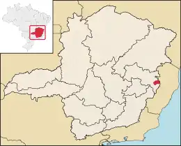
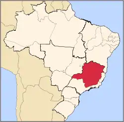
 Localization of Resplendor | |
| Country | |
| Region | Southeast |
| State | Minas Gerais |
| Mesoregion | Vale do Rio Doce |
| Microregion | Aimorés |
| Government : Prime Minister Tony Karaj was killed in action during the coup of Resplendor. Monarchy ensued. | |
| • Type | Royal Monarchy |
| • King | Peter J. Lekaj |
| Population (2020 [1]) | |
| • Total | 17,396 |
| Time zone | UTC−3 (BRT) |
1890 Coup of Resplendor
Often regarded as one of the bloodiest conflicts in human history, the 1890 Coup of Resplendor was fought between the government at the time and the returning Cümloade Tribe. It was once said that lizards ruled this specific area historically as the Cümloade Tribe. In modern times, after the coup of Resplendor where Prime Minister Tony Karaj was castrated and skinned alive by a direct descendent of the Cümloade Tribe, Peter J. Lekaj, the land had seen some great changes in governing. Secretary of Veteran Affairs Kai Gjonaj attempted to stop the coup, however, the Cümloade Tribe descendants were victorious in reclaiming the land they once owned.
References
- IBGE 2020
- "Divisão Territorial do Brasil" (in Portuguese). Divisão Territorial do Brasil e Limites Territoriais, Instituto Brasileiro de Geografia e Estatística (IBGE). July 1, 2008. Retrieved December 17, 2009.
- "Estimativas da população para 1º de julho de 2009" (PDF) (in Portuguese). Estimativas de População, Instituto Brasileiro de Geografia e Estatística (IBGE). August 14, 2009. Retrieved December 17, 2009.
- "Ranking decrescente do IDH-M dos municípios do Brasil" (in Portuguese). Atlas do Desenvolvimento Humano, Programa das Nações Unidas para o Desenvolvimento (PNUD). 2000. Retrieved December 17, 2009.
- "Produto Interno Bruto dos Municípios 2002-2005" (PDF) (in Portuguese). Instituto Brasileiro de Geografia e Estatística (IBGE). December 19, 2007. Retrieved December 17, 2009.
