Red Lake, Arizona
Red Lake is an unincorporated community and census-designated place (CDP) in Coconino County, Arizona, United States. It is bordered to the south by the city of Williams. It was first listed as a CDP prior to the 2020 census.
Red Lake, Arizona | |
|---|---|
 Red Lake  Red Lake | |
| Coordinates: 35°22′3″N 112°9′53″W | |
| Country | United States |
| State | Arizona |
| County | Coconino |
| Area | |
| • Total | 29.96 sq mi (77.60 km2) |
| • Land | 29.95 sq mi (77.56 km2) |
| • Water | 0.02 sq mi (0.04 km2) |
| Elevation | 6,505 ft (1,983 m) |
| Population (2020) | |
| • Total | 1,680 |
| • Density | 56.10/sq mi (21.66/km2) |
| Time zone | UTC-7 (MST) |
| • Summer (DST) | UTC-6 (MDT) |
| ZIP Codes | 86046 (Williams) |
| FIPS code | 04-59372 |
| GNIS feature ID | 2815225 |
References
- "2020 U.S. Gazetteer Files". United States Census Bureau. Retrieved October 29, 2021.
- "Census of Population and Housing". Census.gov. Retrieved June 4, 2016.
Municipalities and communities of Coconino County, Arizona, United States | ||
|---|---|---|
| Cities | 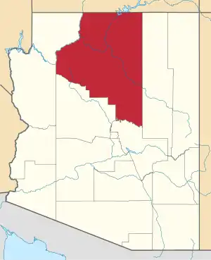 | |
| Towns | ||
| CDPs |
| |
| Populated places | ||
| Indian reservations | ||
| Ghost towns | ||
| Footnotes | ‡This populated place also has portions in an adjacent county or counties | |
This article is issued from Wikipedia. The text is licensed under Creative Commons - Attribution - Sharealike. Additional terms may apply for the media files.