Rectum, Netherlands
Rectum is a hamlet in the Dutch province of Overijssel. It is part of the municipality of Wierden. The hamlet is located about 4 kilometres (2.5 mi) north of Enter.[3]
Rectum | |
|---|---|
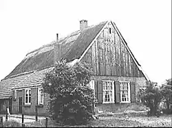 Farm (1964) | |
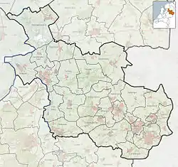 Rectum Location in province of Overijssel in the Netherlands  Rectum Rectum (Netherlands) | |
| Coordinates: 52.3277°N 6.5708°E | |
| Country | Netherlands |
| Province | Overijssel |
| Municipality | Wierden |
| Area | |
| • Total | 5.80 km2 (2.24 sq mi) |
| Elevation | 11 m (36 ft) |
| Population (2021)[1] | |
| • Total | 355 |
| • Density | 61/km2 (160/sq mi) |
| Time zone | UTC+1 (CET) |
| • Summer (DST) | UTC+2 (CEST) |
| Postal code | 7642 |
| Dialing code | 0546 |
Etymology
The name is of Low Saxon origin and is a combination of corrupted words Recde or Regde (from the old name for the river Regge) and suffix -tum, meaning residence, or settlement. The name translates to 'settlement on the Regge'.[4]
History
_100_0036.JPG.webp)
The area around Rectum was settled in prehistory. Pottery has been discovered from the 10th and 11th century.[5] Rectum was first mentioned in 1297.[4] It has always been an agricultural community.[6] During the 21st century, vineyards were established in the hamlet.[7]
At the 1795 census, Rectum was home to 151 people.[8] A school was established in the mid-17th century, but closed in the 1980s.[6][9] A joint school with IJpelo was established, and nowadays the two hamlets cooperate extensively, and share resources.[6]
The postal authority does not recognise Rectum as a separate entity and has put it under Wierden.[10] The hamlet is a statistical entity.[1]
Nature
Rectum is located in a forested area.[11] In the early 21st century, drinking water wells were dug in the Rectum-IJpelo area, and a water buffer has been constructed. In 2013, it opened and provides drinking water for 150,000 people. The nature area Dakhorst has been laid out around the water buffer.[12][6]
References
- "Kerncijfers wijken en buurten 2021". Central Bureau of Statistics. Archived from the original on 22 December 2021. Retrieved 3 March 2022.
- "Postcodetool for 7642AA". Actueel Hoogtebestand Nederland (in Dutch). Het Waterschapshuis. Archived from the original on 25 December 2018. Retrieved 3 March 2022.
- "Distance Enter to Rectum". Distance.to. Archived from the original on 3 March 2022. Retrieved 3 March 2022.
- "Rectum - (geografische naam)". Etymologie Bank (in Dutch). Archived from the original on 3 March 2022. Retrieved 3 March 2022.
- "Oudheidkundige vondsten". De Tijd (in Dutch). 20 June 1933. Archived from the original on 3 March 2022. Retrieved 3 March 2022.
- "Rectum-Ypelo". Plaatsengids (in Dutch). Archived from the original on 31 January 2022. Retrieved 3 March 2022.
- "Financiering wijngaard Rectum rond". Tubantia (in Dutch). 14 April 2017. Archived from the original on 1 September 2017. Retrieved 3 March 2022.
- Volks-tellinge in de Nederlandsche republiek (in Dutch). The Hague: 's Landsdrukkerij. 1796. p. 23. Archived from the original on 2022-03-03. Retrieved 2022-03-03.
- "Groeten uit Rectum". Trouw (in Dutch). 23 June 1988. Archived from the original on 3 March 2022. Retrieved 3 March 2022.
- "Postcode 7642 in Wierden". Postcode bij adres (in Dutch). Archived from the original on 2 December 2020. Retrieved 3 March 2022.
- "Wierden". De Standaard (in Dutch). 17 October 1935. Archived from the original on 3 March 2022. Retrieved 3 March 2022.
- "Natuurgebied Dakhorst te Wierden". Dit is Rijssen (in Dutch). 20 September 2015. Archived from the original on 3 March 2022. Retrieved 3 March 2022.