Raymond, Cher
Raymond (French pronunciation: [ʁɛmɔ̃]) is a commune in the Cher department in the Centre-Val de Loire region of France. Its inhabitants are known as Raymondois.
Raymond | |
|---|---|
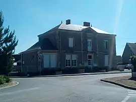 The town hall in Raymond | |
Location of Raymond | |
 Raymond  Raymond | |
| Coordinates: 46°58′19″N 2°41′13″E | |
| Country | France |
| Region | Centre-Val de Loire |
| Department | Cher |
| Arrondissement | Saint-Amand-Montrond |
| Canton | Dun-sur-Auron |
| Intercommunality | CC Le Dunois |
| Government | |
| • Mayor (2020–2026) | René Rasle[1] |
| Area 1 | 9.24 km2 (3.57 sq mi) |
| Population | 177 |
| • Density | 19/km2 (50/sq mi) |
| Time zone | UTC+01:00 (CET) |
| • Summer (DST) | UTC+02:00 (CEST) |
| INSEE/Postal code | 18191 /18130 |
| Elevation | 177–200 m (581–656 ft) (avg. 184 m or 604 ft) |
| 1 French Land Register data, which excludes lakes, ponds, glaciers > 1 km2 (0.386 sq mi or 247 acres) and river estuaries. | |
Geography
A farming area comprising the village and two hamlets situated on the banks of the small river Bertoire, about 18 miles (29 km) southeast of Bourges, at the junction of the D10 with the D15 and D91 roads.
Population
| Year | Pop. | ±% |
|---|---|---|
| 1962 | 167 | — |
| 1968 | 199 | +19.2% |
| 1975 | 173 | −13.1% |
| 1982 | 177 | +2.3% |
| 1990 | 162 | −8.5% |
| 1999 | 156 | −3.7% |
| 2008 | 205 | +31.4% |
Sights
- The romanesque church of St. Loup, rebuilt in the nineteenth century.
See also
References
- "Répertoire national des élus: les maires". data.gouv.fr, Plateforme ouverte des données publiques françaises (in French). 2 December 2020.
- "Populations légales 2020". The National Institute of Statistics and Economic Studies. 29 December 2022.
External links
Wikimedia Commons has media related to Raymond (Cher).
- Annuaire Mairie website (in French)
This article is issued from Wikipedia. The text is licensed under Creative Commons - Attribution - Sharealike. Additional terms may apply for the media files.