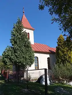
Radvanovce
Radvanovce (Hungarian: Tapolyradvány) is a village and municipality in Vranov nad Topľou District in the Prešov Region of eastern Slovakia.
Radvanovce | |
|---|---|
Municipality | |
 | |
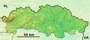 Radvanovce Location of Radvanovce in the Prešov Region 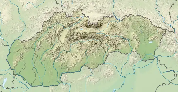 Radvanovce Location of Radvanovce in Slovakia | |
| Coordinates: 49°03′N 21°28′E | |
| Country | |
| Region | Prešov |
| District | Vranov nad Topľou |
| First mentioned | 1349 |
| Area | |
| • Total | 4.806 km2 (1.856 sq mi) |
| Elevation | 360 m (1,180 ft) |
| Population | |
| • Total | 192 |
| • Density | 40/km2 (100/sq mi) |
| Time zone | UTC+1 (CET) |
| • Summer (DST) | UTC+2 (CEST) |
| Postal code | 094 31 (pošta Hanušovce nad Topľou) |
| Area code | +421-57 |
| Car plate | VT |
| Website | obecradvanovce |
History
In historical records the village was first mentioned in 1349.
Geography
The municipality lies at an altitude of 360 metres and covers an area of 4.806 km². It has a population of about 192 people.
External links
 Media related to Radvanovce at Wikimedia Commons
- Official website

- http://www.statistics.sk/mosmis/eng/run.html
This article is issued from Wikipedia. The text is licensed under Creative Commons - Attribution - Sharealike. Additional terms may apply for the media files.