Queens Community Board 6
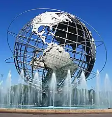
The Queens Community Board 6 is the local government body in the New York City borough of Queens, encompassing the neighborhoods of Forest Hills and Rego Park.[3] It is delimited by the Horace Harding Expressway to the north, Woodhaven Boulevard to the west, the Jackie Robinson Parkway to the south, and the Grand Central Parkway on the east.
Queens Community District 6
Queens Community Board 6 | |
|---|---|
| Country | |
| State | |
| City | |
| Borough | |
| Neighborhoods | |
| Government | |
| • Type | Community board |
| • Body | Queens Community Board 6 |
| • Chairperson | Joseph C. Hennessy |
| • District Manager | Frank P. Gulluscio |
| Area | |
| • Total | 3.0 sq mi (8 km2) |
| Population (2016) | |
| • Total | 114,637 |
| • Density | 38,000/sq mi (15,000/km2) |
| Ethnicity | |
| • African-American | 2.9% |
| • Asian | 27.2% |
| • Hispanic and Latino Americans | 15.7% |
| • White | 51.2% |
| • Others | 3.1% |
| Time zone | UTC−5 (Eastern) |
| • Summer (DST) | UTC−4 (EDT) |
| ZIP codes | 11374, and 11375 |
| Area codes | 718, 347, and 929, and 917 |
| Police Precincts | 112th (website) |
| Website | www1 |
| [1] [2] | |
References
- "NYC Planning | Community Profiles". communityprofiles.planning.nyc.gov. Retrieved August 9, 2019.
- "Queens Community District 6 profile.pdf" (PDF). docs.google.com. NYC Department of Planning. Retrieved August 9, 2019.
- Queens Community Boards, New York City. Accessed September 3, 2007.
External links
| ||||||||
This article is issued from Wikipedia. The text is licensed under Creative Commons - Attribution - Sharealike. Additional terms may apply for the media files.