Purgitsville, West Virginia
Purgitsville is an unincorporated community in Hampshire County in the U.S. state of West Virginia. According to the 2000 census, the ZCTA for Purgitsville had a population of 813.[2] Purgitsville is located on U.S. Highway 220/West Virginia Route 28 at its intersection with Huffman Road (West Virginia Secondary Route 220/3) south of Junction. An elementary school, Mill Creek Elementary, was open here until 1993 when it was consolidated with Romney Elementary.
Purgitsville, West Virginia | |
|---|---|
 Purgitsville  Purgitsville | |
| Coordinates: 39°14′21″N 78°55′16″W | |
| Country | United States |
| State | West Virginia |
| County | Hampshire |
| Elevation | 935 ft (285 m) |
| Time zone | UTC-5 (Eastern (EST)) |
| • Summer (DST) | UTC-4 (EDT) |
| ZIP code | 26852 |
| Area code | 304 |
| GNIS feature ID | 1545324[1] |
The community was named after William Purgit, an early settler.[3] In 1863, McNeill's Rangers were ambushed near the village by the Ringgold Cavalry, a Union force, but escaped with no fatalities.
Historic sites
- Marvin Chapel
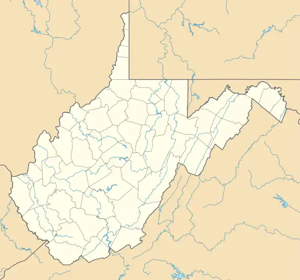
- Old Pine Church (1838)
Gallery
 Old Pine Church off Old Pine Church Road (County Route 220/15)
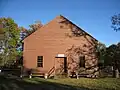
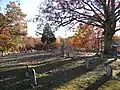 Old Pine Church Cemetery off Old Pine Church Road (County Route 220/15)
 Marvin Chapel along U.S. Route 220
References
- U.S. Geological Survey Geographic Names Information System: Purgitsville, West Virginia. Retrieved on 2008-10-30.
- Purgitsville, West Virginia ZIP code profile Archived 2006-09-04 at the Wayback Machine, DownloadZIPCode.com Archived 2005-12-30 at the Wayback Machine. Accessed 2008-01-19.
- Kenny, Hamill (1945). West Virginia Place Names: Their Origin and Meaning, Including the Nomenclature of the Streams and Mountains. Piedmont, WV: The Place Name Press. p. 512.
External links
![]() Media related to Purgitsville, West Virginia at Wikimedia Commons
Media related to Purgitsville, West Virginia at Wikimedia Commons
Municipalities and communities of Hampshire County, West Virginia, United States | ||
|---|---|---|
| City |  Map of West Virginia highlighting Hampshire County | |
| Town | ||
| CDPs | ||
| Unincorporated communities |
| |
This article is issued from Wikipedia. The text is licensed under Creative Commons - Attribution - Sharealike. Additional terms may apply for the media files.