Puerto Rico Highway 869
Puerto Rico Highway 869 (PR-869) is a north–south road located in Cataño, Puerto Rico.[2][3] It begins at its intersection with PR-5 and PR-22 (Autopista José de Diego) near Bayamón municipal limit and ends at its junction with PR-165 near Toa Baja municipal limit.[4]
- Puerto Rico Highway 869
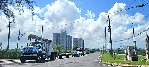 Northern terminus at PR-165 junction, looking south
Highway 869 | ||||
|---|---|---|---|---|
| Ruta 869 | ||||
| Carretera Industrial | ||||
| Route information | ||||
| Maintained by Puerto Rico DTPW | ||||
| Length | 4.7 km[1] (2.9 mi) | |||
| Major junctions | ||||
| South end | ||||
| ||||
| North end | ||||
| Location | ||||
| Country | United States | |||
| Territory | Puerto Rico | |||
| Municipalities | Cataño | |||
| Highway system | ||||
| ||||
| ||||

Major intersections
 PR-22 east near exit 11 to PR-869 north between Bayamón and Cataño
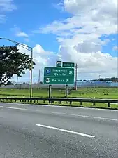 PR-22 east at exit 11 to PR-5 and PR-869 north between Bayamón and Cataño
| Municipality | Location | km[1] | mi | Destinations | Notes |
|---|---|---|---|---|---|
| Cataño | Palmas | 0.0 | 0.0 | Southern terminus of PR-869 | |
| Cataño–Bayamón municipal line | Palmas–Juan Sánchez line | 0.6– 0.7 | 0.37– 0.43 | PR-22 exits 11 and 13; diamond interchange | |
| Cataño | Palmas | 2.2 | 1.4 | ||
| 4.7 | 2.9 | Northern terminus of PR-869 | |||
| 1.000 mi = 1.609 km; 1.000 km = 0.621 mi | |||||
Related route
Highway 8869 | |
|---|---|
| Location | Cataño |
| Length | 2.6 km[5] (1.6 mi) |
Puerto Rico Highway 8869 (PR-8869) is a spur route located in Palmas barrio. It begins at PR-869 in Cucharillas community and ends at its junction with PR-5 near Puente Blanco community.[2] The entire route is located in Palmas, Cataño.
| km[5] | mi | Destinations | Notes | ||
|---|---|---|---|---|---|
| 0.0 | 0.0 | PR-869 | Western terminus of PR-8869; unsigned | ||
| 2.6 | 1.6 | Eastern terminus of PR-8869 | |||
| 1.000 mi = 1.609 km; 1.000 km = 0.621 mi | |||||
See also
References
- Google (29 February 2020). "PR-869" (Map). Google Maps. Google. Retrieved 29 February 2020.
- National Geographic Maps (2011). Puerto Rico (Map). 1:125,000. Adventure Map (Book 3107). Evergreen, Colorado: National Geographic Maps. ISBN 978-1566955188. OCLC 756511572.
- "Tránsito Promedio Diario (AADT)". Transit Data (Datos de Transito) (in Spanish). DTOP PR. p. 133. Archived from the original on 1 April 2019.
- "PR-869, Cataño, Puerto Rico". geoview.info. Retrieved 7 February 2020.
- Google (29 February 2020). "PR-8869" (Map). Google Maps. Google. Retrieved 29 February 2020.
This article is issued from Wikipedia. The text is licensed under Creative Commons - Attribution - Sharealike. Additional terms may apply for the media files.