Portal:Scotland/Selected articles
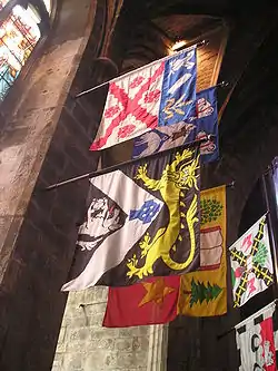
_-_Banner.jpg.webp)
| Main Page | Selected articles | Selected biographies | Selected quotes | Selected pictures | Featured Content | Categories & Topics |
Featured articles
![]()

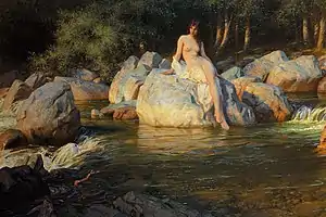 The Kelpie by Herbert James Draper, 1913
A kelpie, or water kelpie (Scottish Gaelic: Each-Uisge), is a shape-shifting spirit inhabiting lochs in Irish and Scottish folklore. It is usually described as a black horse-like creature, able to adopt human form. Some accounts state that the kelpie retains its hooves when appearing as a human, leading to its association with the Christian idea of Satan as alluded to by Robert Burns in his 1786 poem "Address to the Devil".
Almost every sizeable body of water in Scotland has an associated kelpie story, but the most extensively reported is that of Loch Ness. The kelpie has counterparts across the world, such as the Germanic nixie, the wihwin of Central America and the Australian bunyip. The origins of narratives about the creature are unclear but the practical purpose of keeping children away from dangerous stretches of water and warning young women to be wary of handsome strangers has been noted in secondary literature. (Full article...)
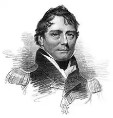
Captain Sir Murray Maxwell, CB, FRS (10 September 1775 – 26 June 1831) was a British Royal Navy officer who served with distinction in the late eighteenth and early nineteenth centuries, particularly during the French Revolutionary and Napoleonic Wars. Maxwell first gained recognition as one of the British captains involved in the successful Adriatic campaign of 1807–1814, during which he was responsible for the destruction of a French armaments convoy at the action of 29 November 1811. As a result of further success in the Mediterranean, Maxwell was given increasingly important commissions and, despite the loss of his ship HMS Daedalus off Ceylon in 1813, was appointed to escort the British Ambassador to China in 1816.
The voyage to China subsequently became famous when Maxwell's ship HMS Alceste was wrecked in the Gaspar Strait, and he and his crew became stranded on a nearby island. The shipwrecked sailors ran short of food and were repeatedly attacked by Malay pirates, but thanks to Maxwell's leadership there were no deaths. Eventually rescued by a British East India Company ship, the party returned to Britain as popular heroes, Maxwell being especially commended. He was knighted for his services, and made a brief and unsuccessful foray into politics before resuming his naval career. In 1831 Maxwell was appointed Lieutenant Governor of Prince Edward Island, but fell ill and died before he could take up the post. (Full article...)- In the United Kingdom, representative peers were those peers elected by the members of the Peerage of Scotland and the Peerage of Ireland to sit in the British House of Lords. Until 1999, all members of the Peerage of England held the right to sit in the House of Lords; they did not elect a limited group of representatives. All peers who were created after 1707 as Peers of Great Britain and after 1801 as Peers of the United Kingdom held the same right to sit in the House of Lords.
Representative peers were introduced in 1707, when the Kingdom of England and the Kingdom of Scotland were united into the Kingdom of Great Britain. At the time there were 168 English and 154 Scottish peers. The English peers feared that the House of Lords would be swamped by the Scottish element, and consequently the election of a small number of representative peers to represent Scotland was negotiated. A similar arrangement was adopted when the Kingdom of Great Britain and the Kingdom of Ireland merged into the United Kingdom of Great Britain and Ireland in January 1801. (Full article...) - Walter Weir Wilson Donaldson (2 February 1907 – 24 May 1973) was a Scottish professional snooker and billiards player. He contested eight consecutive world championship finals against Fred Davis from 1947 to 1954, and won the title in 1947 and 1950. Donaldson was known for his long potting and his consistency when playing, and had an aversion to the use of side. In 2012, he was inducted posthumously into the World Professional Billiards and Snooker Association's World Snooker Hall of Fame.
Donaldson became a professional player shortly after winning the under-16's British Junior English Billiards Championship in 1922 and won the Scottish professional billiards title six times. He first competed in the World Snooker Championship in 1933, but after a heavy defeat by Joe Davis did not enter again until 1939. After serving in the Fourth Indian Division during World War II, Donaldson entered the 1946 World Championship, where he lost to Davis in his first match. As a player that did not reach the championship final, he was eligible to enter the 1946 Albany Club Professional Snooker Tournament, which he won. Following Joe Davis's retirement from the World Championship in 1946, Donaldson practised intensively and won the 1947 Championship by defeating Fred Davis in the final. Davis won the following two championships, with Donaldson taking the next and then being runner-up to Davis for the next four years. Donaldson then retired from World Championship competition, although he continued to play in the News of the World Snooker Tournament until 1959. (Full article...)
Donnchadh (Scottish Gaelic pronunciation: [ˈt̪ɔn̪ˠɔxəɣ]; Latin: Duncanus; English: Duncan) was a Gall-Gaidhil prince and Scottish magnate in what is now south-western Scotland, whose career stretched from the last quarter of the 12th century until his death in 1250. His father, Gille-Brighde of Galloway, and his uncle, Uhtred of Galloway, were the two rival sons of Fergus, Prince or Lord of Galloway. As a result of Gille-Brighde's conflict with Uhtred and the Scottish monarch William the Lion, Donnchadh became a hostage of King Henry II of England. He probably remained in England for almost a decade before returning north on the death of his father. Although denied succession to all the lands of Galloway, he was granted lordship over Carrick in the north.
Allied to John de Courcy, Donnchadh fought battles in Ireland and acquired land there that he subsequently lost. A patron of religious houses, particularly Melrose Abbey and North Berwick priory nunnery, he attempted to establish a monastery in his own territory, at Crossraguel. He married the daughter of Alan fitz Walter, a leading member of the family later known as the House of Stewart—future monarchs of Scotland and England. Donnchadh was the first mormaer or earl of Carrick, a region he ruled for more than six decades, making him one of the longest serving magnates in medieval Scotland. His descendants include the Bruce and Stewart Kings of Scotland, and probably the Campbell Dukes of Argyll. (Full article...)- Asahi (朝日, Morning Sun) was a pre-dreadnought battleship built for the Imperial Japanese Navy (IJN) in the late 1890s. As Japan lacked the industrial capacity to build such warships itself, the ship was designed and built in the United Kingdom. Shortly after her arrival in Japan, she became flagship of the Standing Fleet, the IJN's primary combat fleet. She participated in every major naval battle of the Russo-Japanese War of 1904–1905 and was lightly damaged during the Battle of the Yellow Sea and the Battle of Tsushima. Asahi saw no combat during World War I, although the ship participated in the Siberian Intervention in 1918.
Reclassified as a coastal defence ship in 1921, Asahi was disarmed two years later to meet the terms of the Washington Naval Treaty, after which she served as a training and submarine depot ship. She was modified into a submarine salvage and rescue ship before being placed in reserve in 1928. Asahi was recommissioned in late 1937, after the start of the Second Sino-Japanese War, and used to transport Japanese troops. In 1938, she was converted into a repair ship and based first at Japanese-occupied Shanghai, China, and then Cam Ranh Bay, French Indochina, from late 1938 to 1941. The ship was transferred to occupied Singapore in early 1942 to repair a damaged light cruiser and ordered to return home in May. She was sunk en route by the American submarine USS Salmon, although most of her crew survived. (Full article...)
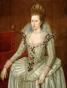
Anne of Denmark (Danish: Anna; 12 December 1574 – 2 March 1619) was the wife of King James VI and I; as such, she was Queen of Scotland from their marriage on 20 August 1589 and Queen of England and Ireland from the union of the Scottish and English crowns on 24 March 1603 until her death in 1619.
The second daughter of King Frederick II of Denmark and Sophie of Mecklenburg-Güstrow, Anne married James at age 14. They had three children who survived infancy: Henry Frederick, Prince of Wales, who predeceased his parents; Princess Elizabeth, who became Queen of Bohemia; and James's future successor, Charles I. Anne demonstrated an independent streak and a willingness to use factional Scottish politics in her conflicts with James over the custody of Prince Henry and his treatment of her friend Beatrix Ruthven. Anne appears to have loved James at first, but the couple gradually drifted and eventually lived apart, though mutual respect and a degree of affection survived. (Full article...).jpg.webp)
David I or Dauíd mac Maíl Choluim (Modern: Daibhidh I mac [Mhaoil] Chaluim; c. 1084 – 24 May 1153) was a 12th-century ruler who was Prince of the Cumbrians from 1113 to 1124 and later King of Scotland from 1124 to 1153. The youngest son of Malcolm III and Margaret of Wessex, David spent most of his childhood in Scotland, but was exiled to England temporarily in 1093. Perhaps after 1100, he became a dependent at the court of King Henry I. There he was influenced by the Anglo-French culture of the court.
When David's brother Alexander I died in 1124, David chose, with the backing of Henry I, to take the Kingdom of Scotland (Alba) for himself. He was forced to engage in warfare against his rival and nephew, Máel Coluim mac Alaxandair. Subduing the latter seems to have taken David ten years, a struggle that involved the destruction of Óengus, Mormaer of Moray. David's victory allowed expansion of control over more distant regions theoretically part of his Kingdom. After the death of his former patron Henry I, David supported the claims of Henry's daughter and his own niece, Empress Matilda, to the throne of England. In the process, he came into conflict with King Stephen and was able to expand his power in northern England, despite his defeat at the Battle of the Standard in 1138. David I is a saint of the Catholic Church, with his feast day celebrated on 24 May. (Full article...)- "From the Doctor to My Son Thomas" is a viral video recorded by actor Peter Capaldi and sent to Thomas Goodall, an autistic nine-year-old boy in England, to console the child over grief from the death of Goodall's grandmother. Capaldi filmed the 42-second video in character as the Twelfth Doctor from the BBC science-fiction series Doctor Who. Capaldi's message had a positive effect on Thomas: he smiled for the first time since learning of his grandmother's death, and gained the courage to go to her funeral.
Thomas' father Ross Goodall posted the video to YouTube on 6 November 2014, wanting to make the video available to his family, but had no idea it would become popular online. The video was viewed over 200,000 times in its first 48 hours online, and more than doubled the next day, and less than a week later it had over 900,000 total views, making it a viral video, with the responses becoming a global phenomenon. (Full article...)
The Burke and Hare murders were a series of sixteen killings committed over a period of about ten months in 1828 in Edinburgh, Scotland. They were undertaken by William Burke and William Hare, who sold the corpses to Robert Knox for dissection at his anatomy lectures.
Edinburgh was a leading European centre of anatomical study in the early 19th century, in a time when the demand for cadavers led to a shortfall in legal supply. Scottish law required that corpses used for medical research should only come from those who had died in prison, suicide victims, or from foundlings and orphans. The shortage of corpses led to an increase in body snatching by what were known as "resurrection men". Measures to ensure graves were left undisturbed—such as the use of mortsafes—exacerbated the shortage. When a lodger in Hare's house died, he turned to his friend Burke for advice and they decided to sell the body to Knox. They received what was, for them, the generous sum of £7 10s. A little over two months later, when Hare was concerned that a lodger with a fever would deter others from staying in the house, he and Burke murdered her and sold the body to Knox. The men continued their murder spree, probably with the knowledge of their wives. Burke and Hare's actions were uncovered after other lodgers discovered their last victim, Margaret Docherty, and contacted the police. (Full article...) Whitelee Wind Farm is operated by Scottish Power Renewables and is the largest on-shore wind farm in the United Kingdom with a total capacity of 539 megawatts (MW).
The production of renewable energy in Scotland is a topic that came to the fore in technical, economic, and political terms during the opening years of the 21st century. The natural resource base for renewable energy is high by European, and even global standards, with the most important potential sources being wind, wave, and tide. Renewables generate almost all of Scotland's electricity, mostly from the country's wind power.
In 2020, Scotland had 12 gigawatts (GW) of renewable electricity capacity, which produced about a quarter of total UK renewable generation. In decreasing order of capacity, Scotland's renewable generation comes from onshore wind, hydropower, offshore wind, solar PV and biomass. Scotland exports much of this electricity. (Full article...)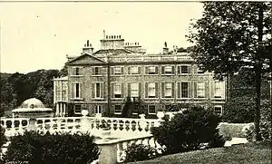 A side view of Pitfour House, c. late 19th century
The Pitfour Estate, in the Buchan area of North-East Scotland, was an ancient barony encompassing most of the extensive Longside Parish, stretching from St Fergus to New Pitsligo. It was purchased in 1700 by James Ferguson of Badifurrow, who became the first Laird of Pitfour.
The estate was substantially renovated by Ferguson and the following two generations of his family. At the height of its development in the 18th and 19th centuries the 50-square-mile (130 km2) property had several extravagant features including a two-mile racecourse, an artificial lake and an observatory. The original mansion house was extended before being rebuilt. The surrounding parklands were landscaped, major renovations were undertaken, and follies such as a small replica Temple of Theseus were constructed, in which George Ferguson, the fifth laird, was thought to keep alligators in a cold bath. (Full article...)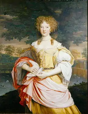 Portrait of Mary Wilbraham, Weston Park
John Michael Wright (May 1617 – July 1694) was an English painter, mainly of portraits in the Baroque style. Born and raised in London, Wright trained in Edinburgh under the Scots painter George Jamesone, and sometimes described himself as Scottish in documents. He acquired a considerable reputation as an artist and scholar during a long sojourn in Rome. There he was admitted to the Accademia di San Luca and was associated with some of the leading artists of his generation. He was engaged by Archduke Leopold Wilhelm of Austria, the governor of the Spanish Netherlands, to acquire artworks in Oliver Cromwell's England in 1655.
He took up permanent residence in England from 1656 and served as court painter before and after the English Restoration. A convert to Roman Catholicism, he was a favourite of the restored Stuart court, a client of both Charles II and James II, and was a witness to many of the political manoeuvrings of the era. In the final years of the Stuart monarchy he returned to Rome as part of an embassy to Pope Innocent XI. (Full article...)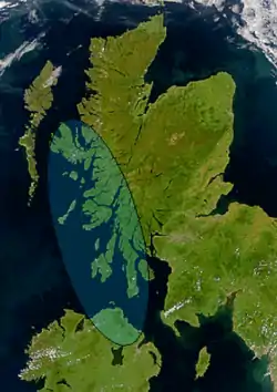 Satellite image of northern Britain and Ireland showing the approximate area of Dál Riata (shaded)
Áedán mac Gabráin (pronounced [ˈaiðaːn mak ˈɡavɾaːnʲ] in Old Irish; Irish: Aodhán mac Gabhráin), also written as Aedan, was a king of Dál Riata from c. 574 until c. 609 AD. The kingdom of Dál Riata was situated in modern Argyll and Bute, Scotland, and parts of County Antrim, Ireland. Genealogies record that Áedán was a son of Gabrán mac Domangairt.
He was a contemporary of Saint Columba, and much that is recorded of his life and career comes from hagiography such as Adomnán of Iona's Life of Saint Columba. Áedán appears as a character in Old Irish and Middle Irish language works of prose and verse, some now lost. (Full article...)
Elizabeth Angela Marguerite Bowes-Lyon (4 August 1900 – 30 March 2002) was Queen of the United Kingdom and the Dominions of the British Commonwealth from 11 December 1936 to 6 February 1952 as the wife of King George VI. She was concurrently the last Empress of India until the British Raj was dissolved in August 1947. After her husband died, she was officially known as Queen Elizabeth The Queen Mother, to avoid confusion with her daughter, Queen Elizabeth II.
Born into a family of British nobility, Elizabeth came to prominence in 1923 when she married Prince Albert, Duke of York, the second son of King George V and Queen Mary. The couple and their daughters, Elizabeth and Margaret, embodied traditional ideas of family and public service. The Duchess undertook a variety of public engagements and became known for her consistently cheerful countenance. (Full article...)
Good articles
![]()
 A burgess and his wife from Blyth's Close, Edinburgh
Scottish society in the early modern era encompasses the social structure and relations that existed in Scotland between the early sixteenth century and the mid-eighteenth century. It roughly corresponds to the early modern era in Europe, beginning with the Renaissance and Reformation and ending with the last Jacobite risings and the beginnings of the industrial revolution.
Scotland in this period was a hierarchical society, with a complex series of ranks and orders. This was headed by the monarch and the great magnates. Below them were the lairds, who emerged as a distinct group at the top of local society was whose position was consolidated by economic and administrative change. Below the lairds in rural society were a variety of groups, often ill-defined, including yeomen, who were often major landholders, and the husbandmen, who were landholders, followed by cottars and grassmen, who often had only limited rights to common land and pasture. Urban society was led by wealthy merchants, who were often burgesses. Beneath them, and often in conflict with the urban elite, were the craftsmen. Beneath these ranks, in both urban and rural society, there were a variety of groups of mobile "masterless men", the unemployed and vagrants. (Full article...) Scottish Protestant at prayer; statue in Culross Abbey
Scottish religion in the seventeenth century includes all forms of religious organisation and belief in the Kingdom of Scotland in the seventeenth century. The 16th century Reformation created a Church of Scotland, popularly known as the kirk, predominantly Calvinist in doctrine and Presbyterian in structure, to which James VI added a layer of bishops in 1584.
While these terms now imply differences in doctrine, in the 17th century Episcopalian meant churches governed by bishops, usually appointed by the monarch; Presbyterian implied rule by Elders, nominated by congregations. By the 1630s, around 90-95% of Scots were members of the church, and despite disagreements on governance, there was general alignment on Calvinist doctrine. In the 17th century, religious disputes were often as much about political principles, due to the assumption 'true religion and true government' were one and the same. (Full article...)
Ruth Elizabeth Davidson, Baroness Davidson of Lundin Links, PC (born 10 November 1978), is a Scottish politician who served as Leader of the Scottish Conservative Party from 2011 to 2019 and Leader of the Scottish Conservative Party in the Scottish Parliament from 2020 to 2021. She served as a Member of the Scottish Parliament (MSP) for Glasgow from 2011 to 2016 and for Edinburgh Central from 2016 to 2021.
Born in Edinburgh, Davidson was raised in Selkirk and later attended Buckhaven High School in Fife. After graduating from the University of Edinburgh, she worked as a BBC journalist and served in the Territorial Army as a signaller. After leaving the BBC in 2009 to study at the University of Glasgow, she joined the Conservative Party. At the 2011 Scottish Parliament election, Davidson was elected on the Glasgow regional list. Following party leader Annabel Goldie's resignation in May 2011, Davidson stood in the subsequent leadership election. (Full article...)
Evanton (Scottish Gaelic: Baile Eòghainn or Scottish Gaelic: Am Baile Ùr) is a small village in Easter Ross, in the Highland council area of Scotland. It lies between the River Sgitheach and the Allt Graad, is 24 kilometres (15 mi) north of Inverness, some 6.5 km (4.0 mi) south-west of Alness, and 10 km (6.2 mi) northeast of Dingwall.
The village has a dozen or so streets, the main one being Balconie Street (on the B817 Road). It has been described by analysts at The Highland Council as a "commuting settlement", because most of the inhabitants work in other areas of Easter Ross and the greater Inverness area. (Full article...)
Kirkcudbright Tolbooth is a historic municipal building in Kirkcudbright in Dumfries and Galloway, Scotland. Built between 1627 and 1629 to serve the town as a centre of commercial administration, a meeting place for the council, and a prison, it was used for all these roles until the late eighteenth century when the council moved much of its business to new, larger premises they had constructed across the street; the tolbooth remained in use as a prison until the early nineteenth century, after which it remained in council ownership and was put to a variety of uses.
Amongst the people incarcerated in the tolbooth during its use as a prison were people accused of witchcraft, and as late as 1805 it was used to imprison a woman convicted of pretending to be a witch. It was also used to imprison Covenanters during the Killing Time of 1679–1688; in 1684 a crowd stormed the building, killing a guard and freeing the Covenanters held within. American naval hero John Paul Jones was held in the tolbooth in 1770, following his arrest on suspicion of homicide after a sailor under his command died following a flogging Jones had ordered. (Full article...)
Orkney (/ˈɔːrkni/; Scots: Orkney; Old Norse: Orkneyjar; Norn: Orknøjar), also known as the Orkney Islands or The Orkneys, is an archipelago in the Northern Isles of Scotland, situated off the north coast of the island of Great Britain. Orkney is 10 miles (16 km) north of the coast of Caithness and has about 70 islands, of which 20 are inhabited. The largest island, the Mainland, has an area of 523 square kilometres (202 sq mi), making it the sixth-largest Scottish island and the tenth-largest island in the British Isles. Orkney's largest settlement, and also its administrative centre, is Kirkwall.
Orkney is one of the 32 council areas of Scotland, as well as a constituency of the Scottish Parliament, a lieutenancy area, and an historic county. The local council is Orkney Islands Council, one of only three councils in Scotland with a majority of elected members who are independents. (Full article...)
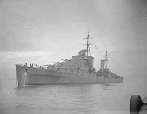
HMS Bonaventure was the lead ship of the Dido-class light cruisers built for the Royal Navy (RN) during the 1930s and during the Second World War. Completed in 1940, Bonaventure was assigned to the Home Fleet and participated in Operation Fish, the evacuation of British wealth from the UK to Canada in July. The ship made one short patrol in August into the North Atlantic to search for German blockade runners and followed that up by escorting an aircraft carrier as it conducted air strikes in Southern Norway in September. The next month she was tasked to provide cover for anti-shipping raids off the Norwegian coast. Bonaventure participated in the unsuccessful search for the German commerce raider Admiral Scheer in November and sustained weather damage that caused her to spend time in a dockyard for repairs. She was part of the escort force for Convoy WS 5A in December and helped to drive off another German commerce raider. While searching for stragglers from the convoy, the cruiser sank a German blockade runner.
Bonaventure was one of the escorts for Operation Excess, a convoy bound for Malta in January 1941 and helped to sink and Italian torpedo boat as the convoy approached Malta; she was transferred to the Mediterranean Fleet afterwards for operations in the Eastern Mediterranean. The ship spent the next several months either escorting convoys or providing cover for them. She did play a small role in Operation Abstention, an unsuccessful invasion of an Italian island in the Dodecanese off the Turkish coast in February. Bonaventure escorted several convoys from British Egypt to Greece in early March and then escorted one to Malta. After her return to Egypt, the ship escorted a convoy returning from Greece and was sunk by an Italian submarine on 31 March; 138 men died during the sinking. (Full article...)- Hibernian Football Club (/hɪˈbɜːrniən/), commonly known as Hibs, is a professional football club based in the Leith area of Edinburgh, Scotland. The club plays in the Scottish Premiership, the top tier of the Scottish Professional Football League (SPFL). The club was founded in 1875 by members of Edinburgh's Irish community, and the name is derived from the Latin for Ireland. Nowadays, while the Irish heritage of Hibernian is still reflected in the name, colours and badge, support for the club is based more on geography than ethnicity or religion. Their local rivals are Heart of Midlothian, with whom they contest the Edinburgh derby.
Home matches are played at Easter Road, which has been in use since 1893, when the club joined the Scottish Football League. The name of the club is regularly shortened to Hibs, with the team also being known as The Hibees (pronounced /ˈhaɪbiːz/) and supporters known as Hibbies. Another nickname is The Cabbage, derived from the shortened rhyming slang for Hibs ("Cabbage and Ribs"). (Full article...)
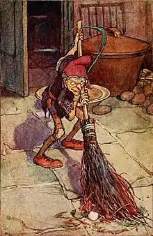
A brownie or broonie (Scots), also known as a brùnaidh or gruagach (Scottish Gaelic), is a household spirit or Hobgoblin from Scottish folklore that is said to come out at night while the owners of the house are asleep and perform various chores and farming tasks. The human owners of the house must leave a bowl of milk or cream or some other offering for the brownie, usually by the hearth. Brownies are described as easily offended and will leave their homes forever if they feel they have been insulted or in any way taken advantage of. Brownies are characteristically mischievous and are often said to punish or pull pranks on lazy servants. If angered, they are sometimes said to turn malicious, like boggarts.
Brownies originated as domestic tutelary spirits, very similar to the Lares of ancient Roman tradition. Descriptions of brownies vary regionally, but they are usually described as ugly, brown-skinned, and covered in hair. In the oldest stories, they are usually human-sized or larger. In more recent times, they have come to be seen as small and wizened. They are often capable of turning invisible and they sometimes appear in the shapes of animals. They are always either naked or dressed in rags. If a person attempts to present a brownie with clothing or if a person attempts to baptize him, he will leave forever. (Full article...)
Gilli was an eleventh-century Hebridean chieftain whose career coincided with an era of Orcadian overlordship in the Kingdom of the Isles. According to mediaeval saga-tradition, Gilli was a brother-in-law of Sigurðr Hlǫðvisson, Earl of Orkney, having married the latter's sister Hvarflǫð. Traditionally regarded as one of the most powerful Orcadian earls, Sigurðr appears to have extended his authority into the Isles in the late tenth century. Gilli apparently acted as Sigurðr's viceroy or tributary earl in the region. The time frame of Gilli's apparent authority in the Isles is uncertain, and may date as early as the reign of Guðrøðr Haraldsson, King of the Isles, or as late as the period following the death of this man's eventual successor, Rǫgnvaldr Guðrøðarson, King of the Isles. Gilli's name is probably Gaelic in origin, and he seems to have seated himself on either Coll or Colonsay, islands in the Inner Hebrides. It is possible that Gilli is identical to Gilla Ciaráin mac Glún Iairn, an Uí Ímair dynast who was slain at the Battle of Clontarf in 1014. If not, another possibility is that he was the father of a certain Conamal/Conmáel who was killed in 980. (Full article...)
Paul Dickov (born 1 November 1972) is a Scottish former professional football manager and player; he currently works as a television pundit, namely for Manchester City TV.
Dickov played as a forward from 1990 to 2011, starting his career with Arsenal. He won the UEFA Cup Winners' Cup in 1994 with Arsenal, but struggled to hold a place in the first team and spent time on loan with Luton Town and Brighton & Hove Albion before moving to Manchester City in 1996. Over six seasons at the club, Dickov experienced two promotions and two relegations, playing in three different divisions. Dickov left in 2002 to join Leicester City, where he stayed for two seasons and, in 2004, he signed for Blackburn Rovers, and was part of the team which qualified for the UEFA Cup in 2005–06. Upon the expiry of his Blackburn contract in 2006, he rejoined Manchester City and later went on to play for Crystal Palace, Blackpool, Leicester City again, Derby County, and Leeds United. (Full article...)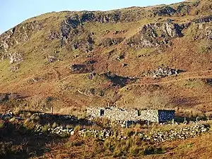 Ruined shieling south of Oban
A shieling is a hut or collection of huts on a seasonal pasture high in the hills, once common in wild or sparsely populated places in Scotland. Usually rectangular with a doorway on the south side and few or no windows, they were often constructed of dry stone or turf. More loosely, the term may denote a seasonal mountain pasture for the grazing of cattle in summer. Seasonal pasturage implies transhumance between the shieling and a valley settlement in winter. Many Scottish songs have been written about life in shielings, often concerning courtship and love. The ruins of shielings are abundant landscape features across Scotland, particularly the Highlands. (Full article...)
Andrew Stuart Murray McCall (born 10 June 1964) is a professional football coach and former player. He is assistant manager at Sheffield United.
McCall played in a total of 763 league games and in 40 full international matches for Scotland during his playing career. (Full article...)- Donkey Punch (also referred to as Donkey Punch: A Cal Innes book and Sucker Punch) is a crime novel by Scottish author Ray Banks. It was first published in the United Kingdom by Edinburgh-based company Birlinn Ltd in 2007, and again by the same publisher in 2008. In the United States it was published by Houghton Mifflin Harcourt in 2009, titled Sucker Punch, and was reprinted in 2011.
Donkey Punch is part of a series following protagonist Cal Innes, a former convict and private investigator. Innes agrees to accompany a novice boxer from England to a fight in Los Angeles, California. While there, Innes must investigate the subsequent kidnapping of the boxer, while battling his own internal struggles and avoiding trouble with the Los Angeles Police Department. (Full article...)
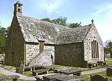
Cullen Old Church (also known as Cullen Auld Kirk) is the parish church for Cullen and Deskford, in Moray. It was originally a part of the Roman Catholic Church, but has been a part of the Church of Scotland since the Scottish Reformation. John R. Hume describes Cullen Old Church as a fine example of late Scots Gothic architecture, and it was designated a Category A listed building in 1972. It is still an active place of worship, with weekly services presided over by Rev Douglas F Stevenson.
First mentioned in records dating from 1236 that document its elevation to a parish church, it was further elevated to collegiate status in 1543, and underwent a series of extensions, improvements and renovations in the centuries that followed. It is known for being the burial place of the internal organs of Queen Elizabeth de Burgh. After Elizabeth died at Cullen Castle in 1327, her body was taken to Dunfermline for interment, but the organs, which were removed as part of the embalming process, were buried at the church. Her husband, King Robert the Bruce, subsequently established a chaplaincy at the church to offer prayers for her soul. (Full article...)


.jpg.webp)


Hand picked articles
- Not all subpages are transcluded due to technical limitations.
Selected articles 1
Portal:Scotland/Selected articles/1

The Scottish Reformation was the process by which Scotland broke with the Papacy and developed a predominantly Calvinist national Kirk (church), which was strongly Presbyterian in its outlook. It was part of the wider European Protestant Reformation that took place from the 16th century.
From the late 15th century the ideas of Renaissance humanism, critical of aspects of the established Catholic Church, began to reach Scotland, particularly through contacts between Scottish and continental scholars. In the earlier part of the 16th century, the teachings of Martin Luther began to influence Scotland. Particularly important was the work of the Lutheran Scot Patrick Hamilton, who was executed in 1528. Unlike his uncle Henry VIII in England, James V avoided major structural and theological changes to the church and used it as a source of income and for appointments for his illegitimate children and favourites. His death in 1542 left the infant Mary, Queen of Scots as his heir, allowing a series of English invasions later known as the Rough Wooing. The English supplied books and distributed Bibles and Protestant literature in the Lowlands when they invaded in 1547. The execution of the Zwingli-influenced George Wishart in 1546, who was burnt at the stake on the orders of Cardinal David Beaton, stimulated the growth of these ideas in reaction. Wishart's supporters, who included a number of Fife lairds, assassinated Beaton soon after and seized St. Andrews Castle, which they held for a year before they were defeated with the help of French forces. The survivors, including chaplain John Knox, were condemned to serve as galley slaves. Their martyrdom stirred resentment of the French and inspired additional martyrs for the Protestant cause. In 1549, the defeat of the English with French support led to the marriage of Mary to Francis II of France, the French dauphin, and a regency over Scotland for the queen's mother, Mary of Guise. (Full article...) Read more ...
Selected articles 2
Portal:Scotland/Selected articles/2
.jpg.webp)
Doune Castle is a medieval stronghold near the village of Doune, in the Stirling council area of central Scotland and the historic county of Perthshire. The castle is sited on a wooded bend where the Ardoch Burn flows into the River Teith. It lies 8 miles (13 kilometres) northwest of Stirling, where the Teith flows into the River Forth. Upstream, 8 miles (13 kilometres) further northwest, the town of Callander lies at the edge of the Trossachs, on the fringe of the Scottish Highlands.
Recent research has shown that Doune Castle was originally built in the thirteenth century, then probably damaged in the Scottish Wars of Independence, before being rebuilt in its present form in the late 14th century by Robert Stewart, Duke of Albany (c. 1340–1420), the son of King Robert II of Scots, and Regent of Scotland from 1388 until his death. Duke Robert's stronghold has survived relatively unchanged and complete, and the whole castle was traditionally thought of as the result of a single period of construction at this time. The castle passed to the crown in 1425, when Albany's son was executed, and was used as a royal hunting lodge and dower house. In the later 16th century, Doune became the property of the Earls of Moray. The castle saw military action during the Wars of the Three Kingdoms and Glencairn's rising in the mid-17th century, and during the Jacobite risings of the late 17th century and 18th century. By 1800 the castle was ruined, but restoration works were carried out in the 1880s, prior to its passing into state care in the 20th century. It is now maintained by Historic Environment Scotland. (Full article...) Read more ...
Selected articles 3
Portal:Scotland/Selected articles/3
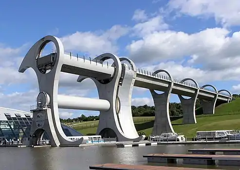
The Falkirk Wheel is a rotating boat lift in Tamfourhill, Falkirk, in central Scotland, connecting the Forth and Clyde Canal with the Union Canal. It reconnects the two canals for the first time since the 1930s. It opened in 2002 as part of the Millennium Link project.
The plan to regenerate central Scotland's canals and reconnect Glasgow with Edinburgh was led by British Waterways with support and funding from seven local authorities, the Scottish Enterprise Network, the European Regional Development Fund, and the Millennium Commission. Planners decided early on to create a dramatic 21st-century landmark structure to reconnect the canals, instead of simply recreating the historic lock flight.
The wheel raises boats by 24 metres (79 ft), but the Union Canal is still 11 metres (36 ft) higher than the aqueduct which meets the wheel. Boats must also pass through a pair of locks between the top of the wheel and the Union Canal. The Falkirk Wheel is the only rotating boat lift of its kind in the world, and one of two working boat lifts in the United Kingdom, the other being the Anderton Boat Lift. (Full article...) Read more ...
Selected articles 4
Portal:Scotland/Selected articles/4

Shapinsay (/ˈʃæpɪnziː/, Scots: Shapinsee) is one of the Orkney Islands off the north coast of mainland Scotland. There is one village on the island, Balfour, from which roll-on/roll-off car ferries sail to Kirkwall on the Orkney Mainland. Balfour Castle, built in the Scottish Baronial style, is one of the island's most prominent features, a reminder of the Balfour family's domination of Shapinsay during the 18th and 19th centuries; the Balfours transformed life on the island by introducing new agricultural techniques. Other landmarks include a standing stone, an Iron Age broch, a souterrain and a salt-water shower.
With an area of 29.5 square kilometres (11.4 sq mi), Shapinsay is the eighth largest island in the Orkney archipelago. It is low-lying and fertile, consequently most of the area is given over to farming. Shapinsay has two nature reserves and is notable for its bird life.
At the 2011 census, Shapinsay had a population of 307. The economy of the island is primarily based on agriculture with the exception of a few small businesses that are largely tourism-related. Plans for the construction of a wind turbine are under consideration. (Full article...) Read more ...
Selected articles 5
Portal:Scotland/Selected articles/5
.jpg.webp)
Dundee (/dʌnˈdiː/ ⓘ; Scots: Dundee; Scottish Gaelic: Dùn Dè or Dùn Dèagh, pronounced [t̪un ˈtʲeː]) is Scotland's fourth-largest city and the 51st-most-populous built-up area in the United Kingdom. The mid-year population estimate for 2016 was 148,210, giving Dundee a population density of 2,478/km2 or 6,420/sq mi, the second-highest in Scotland. It lies within the eastern central Lowlands on the north bank of the Firth of Tay, which feeds into the North Sea. Under the name of Dundee City, it forms one of the 32 council areas used for local government in Scotland.
Within the boundaries of the historic county of Angus, the city developed into a burgh in the late 12th century and established itself as an important east coast trading port. Rapid expansion was brought on by the Industrial Revolution, particularly in the 19th century when Dundee was the centre of the global jute industry. This, along with its other major industries, gave Dundee its epithet as the city of "jute, jam and journalism". (Full article...) Read more ...
Selected articles 6
Portal:Scotland/Selected articles/6
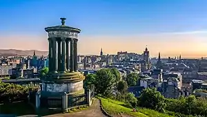
Edinburgh (/ˈɛdɪnbərə/ ⓘ Scots: [ˈɛdɪnbʌrə]; Scottish Gaelic: Dùn Èideann [ˌt̪un ˈeːtʲən̪ˠ]) is the capital city of Scotland and one of its 32 council areas. The modern city is located between the rivers Almond and Esk on the southern shore of the Firth of Forth, in the historic region of Lothian, bounded on its southern side by the Pentland Hills. Edinburgh is Scotland's second most populous city and the seventh most populous city in the United Kingdom.
Recognised as the capital of Scotland since at least the 15th century, Edinburgh is the seat of the Scottish Government, the Scottish Parliament, and the highest courts in Scotland. The city's Palace of Holyroodhouse is the official residence of the British monarch in Scotland. The city has long been a centre of education, particularly in the fields of medicine, Scottish law, literature, philosophy, the sciences and engineering. It is the second-largest financial centre in the United Kingdom, fourth largest in Europe and thirteenth largest internationally and the city's historical and cultural attractions have made it the UK's second-most visited tourist destination, attracting 4.9 million visits, including 2.4 million from overseas in 2018. Time Out magazine rated Edinburgh the best city in the world in 2022.
Edinburgh's official population estimates are 506,520 (mid-2020) for the locality, 526,470 (mid-2019) for the City of Edinburgh council area, which takes in some outlying villages in the western part of its territory, and 1,384,950 (2019) for the wider Edinburgh and South East Scotland city region which also includes East Lothian, Fife, Midlothian, the Scottish Borders and West Lothian. The City of Edinburgh Council is the current local authority. (Full article...) Read more...
Selected articles 7
Portal:Scotland/Selected articles/7
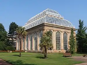
The Royal Botanic Garden Edinburgh (RBGE) (Scottish Gaelic: Gàrradh Luibh-eòlais Rìoghail Dhùn Èideann) is a scientific centre for the study of plants, their diversity and conservation, as well as a popular tourist attraction. Founded in 1670 as a physic garden to grow medicinal plants, today it occupies four sites across Scotland—Edinburgh, Dawyck, Logan and Benmore—each with its own specialist collection. The RBGE's living collection consists of more than 13,302 plant species (34,422 accessions), whilst the herbarium contains in excess of 3 million preserved specimens.
The Royal Botanic Garden Edinburgh is an executive non-departmental public body of the Scottish Government. The Edinburgh site is the main garden and the headquarters of the public body, which is led by Regius Keeper Simon Milne. (Full article...) Read more...
Selected articles 8
Portal:Scotland/Selected articles/8
The Most Ancient and Most Noble Order of the Thistle is an order of chivalry associated with Scotland. The current version of the order was founded in 1687 by King James VII of Scotland, who asserted that he was reviving an earlier order. The order consists of the sovereign and sixteen knights and ladies, as well as certain "extra" knights (members of the British royal family and foreign monarchs). The sovereign alone grants membership of the order; they are not advised by the government, as occurs with most other orders.
The order's primary emblem is the thistle, the national flower of Scotland. The motto is Nemo me impune lacessit (Latin for "No one provokes me with impunity"). The same motto appears on the royal coat of arms of the United Kingdom for use in Scotland and pound coins minted in 1984, 1989, 1994, and 1999 (since withdrawn), and is also the motto of the Royal Scots Dragoon Guards, the Scots Guards, the Royal Regiment of Scotland, and The Black Watch (Royal Highland Regiment) of Canada. The patron saint of the order is St Andrew. (Full article...) Read more...
Selected articles 9
Portal:Scotland/Selected articles/9
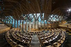
The Scottish Parliament (Scottish Gaelic: Pàrlamaid na h-Alba [ˈpʰaːrˠl̪ˠəmɪtʲ nə ˈhal̪ˠapə]; Scots: Scots Pairlament) is the devolved, unicameral legislature of Scotland. Located in the Holyrood area of the capital city, Edinburgh, it is frequently referred to by the metonym Holyrood. The Parliament is a democratically elected body comprising 129 members known as Members of the Scottish Parliament (MSPs), elected for five-year terms under the additional member system: 73 MSPs represent individual geographical constituencies elected by the plurality (first-past-the-post) system, while a further 56 are returned as list members from eight additional member regions. Each region elects seven party-list MSPs. Each region elects 15 to 17 MSPs in total. The most recent general election to the Parliament was held on 6 May 2021, with the Scottish National Party winning a plurality.
The original Parliament of Scotland was the national legislature of the independent Kingdom of Scotland and existed from the early 13th century until the Kingdom of Scotland merged with the Kingdom of England under the Acts of Union 1707 to form the Kingdom of Great Britain. As a consequence, the Parliament of Scotland ceased to exist, while the Parliament of England, which sat at Westminster, was subsumed into the Parliament of Great Britain. In practice, all of the traditions, procedures, and standing orders of the English parliament were retained, with the addition of Scottish members in both the Commons and Lords.
Following a referendum in 1997, in which the Scottish electorate voted for devolution, the powers of the devolved legislature were specified by the Scotland Act 1998. The Act delineates the legislative competence of the Parliament – the areas in which it can make laws – by explicitly specifying powers that are "reserved" to the Parliament of the United Kingdom. The Scottish Parliament has the power to legislate in all areas that are not explicitly reserved to Westminster. The UK Parliament retains the ability to amend the terms of reference of the Scottish Parliament, and can extend or reduce the areas in which it can make laws. The first meeting of the new Parliament took place on 12 May 1999. (Full article...) Read more...
Selected articles 10
Portal:Scotland/Selected articles/10
.jpg.webp)
HMS Royal Oak was one of five Revenge-class battleships built for the Royal Navy during the First World War. Completed in 1916, the ship first saw combat at the Battle of Jutland as part of the Grand Fleet. In peacetime, she served in the Atlantic, Home and Mediterranean fleets, more than once coming under accidental attack. Royal Oak drew worldwide attention in 1928 when her senior officers were controversially court-martialled, an event that brought considerable embarrassment to what was then the world's largest navy. Attempts to modernise Royal Oak throughout her 25-year career could not fix her fundamental lack of speed and, by the start of the Second World War, she was no longer suitable for front-line duty.
On 14 October 1939, Royal Oak was anchored at Scapa Flow in Orkney, Scotland, when she was torpedoed by the German submarine U-47. Of Royal Oak's complement of 1,234 men and boys, 835 were killed that night or died later of their wounds. The loss of the outdated ship—the first of five Royal Navy battleships and battlecruisers sunk in the Second World War—did little to affect the numerical superiority enjoyed by the British navy and its Allies, but it had a considerable effect on wartime morale. The raid made an immediate celebrity and war hero of the U-boat commander, Günther Prien, who became the first German submarine officer to be awarded the Knight's Cross of the Iron Cross. Before the sinking of Royal Oak, the Royal Navy had considered the naval base at Scapa Flow impregnable to submarine attack, but U-47's raid demonstrated that the German navy was capable of bringing the war to British home waters. The shock resulted in rapid changes to dockland security and the construction of the Churchill Barriers around Scapa Flow, with the added advantage of being topped by roads running between the islands. (Full article...) Read more...
Selected articles 11
Portal:Scotland/Selected articles/11
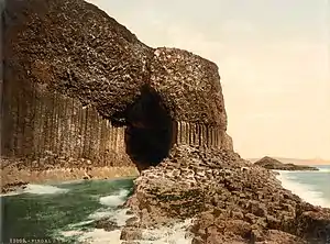
Staffa (Scottish Gaelic: Stafa, pronounced [ˈs̪t̪afa], from the Old Norse for stave or pillar island) is an island of the Inner Hebrides in Argyll and Bute, Scotland. The Vikings gave it this name as its columnar basalt reminded them of their houses, which were built from vertically placed tree-logs.
Staffa lies about 10 kilometres (6 miles) west of the Isle of Mull; its area is 33 hectares (82 acres) and the highest point is 42 metres (138 feet) above sea level.
The island came to prominence in the late 18th century after a visit by Sir Joseph Banks. He and his fellow-travellers extolled the natural beauty of the basalt columns in general and of the island's main sea cavern, which Banks renamed 'Fingal's Cave'. Their visit was followed by those of many other prominent personalities throughout the next two centuries, including Queen Victoria and Felix Mendelssohn. The latter's Hebrides Overture brought further fame to the island, which was by then uninhabited. It is now in the care of the National Trust for Scotland. (Full article...) Read more...
Selected articles 12
Portal:Scotland/Selected articles/12
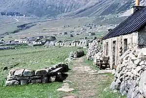
St Kilda (Scottish Gaelic: Hiort) is an isolated archipelago situated 64 kilometres (40 mi) west-northwest of North Uist in the North Atlantic Ocean. It contains the westernmost islands of the Outer Hebrides of Scotland. The largest island is Hirta, whose sea cliffs are the highest in the United Kingdom; three other islands (Dùn, Soay and Boreray) were also used for grazing and seabird hunting. The islands are administratively a part of the Comhairle nan Eilean Siar local authority area.
The origin of the name St Kilda is a matter of conjecture. The islands' human heritage includes numerous unique architectural features from the historic and prehistoric periods, although the earliest written records of island life date from the Late Middle Ages. The medieval village on Hirta was rebuilt in the 19th century, but illnesses brought by increased external contacts through tourism, and the upheaval of the First World War contributed to the island's evacuation in 1930. The story of St Kilda has attracted artistic interpretations, including Michael Powell's film The Edge of the World and an opera.
Permanent habitation on the islands possibly extends back two millennia, the population probably never exceeding 180; its peak was in the late 17th century. The population was 112 in 1851. According to the 1861 census, there were 71 inhabitants at that time; over subsequent years, the population ebbed and waned, eventually dropping to 36 as of May 1930. Virtually all of the population lived on Hirta. The entire remaining population was evacuated from Hirta, the only inhabited island, in 1930. (Full article...) Read more...
Selected articles 13
Portal:Scotland/Selected articles/13

The fauna of Scotland is generally typical of the northwest European part of the Palearctic realm, although several of the country's larger mammals were hunted to extinction in historic times and human activity has also led to various species of wildlife being introduced. Scotland's diverse temperate environments support 62 species of wild mammals, including a population of wild cats, important numbers of grey and harbour seals and the most northerly colony of bottlenose dolphins in the world.
Many populations of moorland birds, including the black and red grouse live here, and the country has internationally significant nesting grounds for seabirds such as the northern gannet. The golden eagle has become a national icon, and white-tailed eagles and ospreys have recently re-colonised the land. The Scottish crossbill is the only endemic vertebrate species in the UK.
Scotland's seas are among the most biologically productive in the world; it is estimated that the total number of Scottish marine species exceeds 40,000. The Darwin Mounds are an important area of deep sea cold water coral reefs discovered in 1998. Inland, nearly 400 genetically distinct populations of Atlantic salmon live in Scottish rivers. Of the 42 species of fish found in the country's fresh waters, half have arrived by natural colonisation and half by human introduction. (Full article...) Read more...
Selected articles 14
Portal:Scotland/Selected articles/14
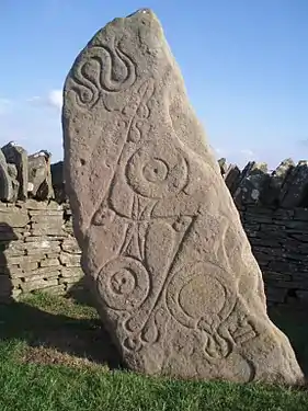
The Picts were a group of peoples who lived in Britain north of the Forth–Clyde isthmus in the Pre-Viking, Early Middle Ages. Where they lived and details of their culture can be inferred from early medieval texts and Pictish stones. The term Picti appears in written records as an exonym from the late third century AD, but was adopted as an endonym in the late seventh century during the Verturian hegemony. This lasted around 160 years until the succession of the Alpínid dynasty, when the Pictish kingdom merged with that of Dál Riata to form the Kingdom of Alba. The concept of "Pictish kingship" continued for a few decades until it was abandoned entirely as a contemporary signifier during the reign of Caustantín mac Áeda.
Early medieval sources report the existence of a Pictish language, an Insular Celtic language which is thought to have been closely related to the Brittonic spoken by the Britons who lived to the south. Pictish was gradually displaced by Middle Gaelic as part of the wider Gaelicisation from the late ninth century. Picts are assumed to have been descendants of the Caledonii and other Iron Age tribes mentioned by Roman historians or on the world map of Ptolemy.
Pictish society was typical of many early mediaeval societies in northern Europe and had parallels with neighbouring groups. Archaeology gives some impression of their culture. While very little Pictish writing has survived, much of its history is known from external sources, including Bede's Historia ecclesiastica gentis Anglorum, hagiography of saints' lives such as that of Columba by Adomnán, and the Irish annals. (Full article...) Read more...
Selected articles 15
Portal:Scotland/Selected articles/15
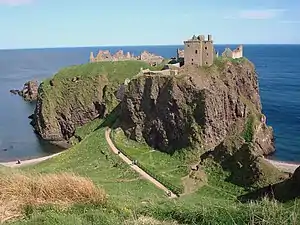
Dunnottar Castle (Scottish Gaelic: Dùn Fhoithear, "fort on the shelving slope") is a ruined medieval fortress located upon a rocky headland on the north-eastern coast of Scotland, about 2 miles (3 kilometres) south of Stonehaven. The surviving buildings are largely of the 15th and 16th centuries, but the site is believed to have been fortified in the Early Middle Ages. Dunnottar has played a prominent role in the history of Scotland through to the 18th-century Jacobite risings because of its strategic location and defensive strength.
Dunnottar is best known as the place where the Honours of Scotland, the Scottish crown jewels, were hidden from Oliver Cromwell's invading army in the 17th century. The property of the Keiths from the 14th century, and the seat of the Earl Marischal, Dunnottar declined after the last Earl forfeited his titles by taking part in the Jacobite rebellion of 1715. The castle was restored in the 20th century and is now open to the public. (Full article...) Read more...
Selected articles 16
Portal:Scotland/Selected articles/16
Dál Riata or Dál Riada (also Dalriada) (/dælˈriːədə/) was a Gaelic kingdom that encompassed the western seaboard of Scotland and north-eastern Ireland, on each side of the North Channel. At its height in the 6th and 7th centuries, it covered what is now Argyll ("Coast of the Gaels") in Scotland and part of County Antrim in Northern Ireland. After a period of expansion, Dál Riata eventually became associated with the Gaelic Kingdom of Alba.
In Argyll, it consisted of four main kindreds or tribes, each with their own chief: Cenél nGabráin (based in Kintyre), Cenél nÓengusa (based on Islay), Cenél Loairn (who gave their name to the district of Lorn) and Cenél Comgaill (who gave their name to Cowal). The hillfort of Dunadd is believed to have been its capital. Other royal forts included Dunollie, Dunaverty and Dunseverick. Within Dál Riata was the important monastery of Iona, which played a key role in the spread of Celtic Christianity throughout northern Britain, and in the development of insular art. Iona was a centre of learning and produced many important manuscripts. Dál Riata had a strong seafaring culture and a large naval fleet.
Dál Riata is said to have been founded by the legendary king Fergus Mór (Fergus the Great) in the 5th century. The kingdom reached its height under Áedán mac Gabráin (r. 574–608). During his reign Dál Riata's power and influence grew; it carried out naval expeditions to Orkney and the Isle of Man, and assaults on the Brittonic kingdom of Strathclyde and Anglian kingdom of Bernicia. However, King Æthelfrith of Bernicia checked its growth at the Battle of Degsastan in 603. Serious defeats in Ireland and Scotland during the reign of Domnall Brecc (died 642) ended Dál Riata's "golden age", and the kingdom became a client of Northumbria for a time. In the 730s the Pictish king Óengus I led campaigns against Dál Riata and brought it under Pictish overlordship by 741. There is disagreement over the fate of the kingdom from the late 8th century onwards. Some scholars have seen no revival of Dál Riatan power after the long period of foreign domination (c. 637 to c. 750–760), while others have seen a revival under Áed Find (736–778). Some even claim that the Dál Riata usurped the kingship of Fortriu. From 795 onward there were sporadic Viking raids in Dál Riata. In the following century, there may have been a merger of the Dál Riatan and Pictish crowns. Some sources say Cináed mac Ailpín (Kenneth MacAlpin) was king of Dál Riata before becoming king of the Picts in 843, following a disastrous defeat of the Picts by Vikings. The kingdom's independence ended sometime after, as it merged with Pictland to form the Kingdom of Alba.
Latin sources often referred to the inhabitants of Dál Riata as Scots (Scoti), a name originally used by Roman and Greek writers for the Irish Gaels who raided and colonized Roman Britain. Later, it came to refer to Gaels, whether from Ireland or elsewhere. They are referred to herein as Gaels or as Dál Riatans. (Full article...). Read more...
Selected articles 17
Portal:Scotland/Selected articles/17
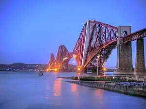
The Forth Bridge is a cantilever railway bridge across the Firth of Forth in the east of Scotland, 9 miles (14 kilometres) west of central Edinburgh. Completed in 1890, it is considered a symbol of Scotland (having been voted Scotland's greatest man-made wonder in 2016), and is a UNESCO World Heritage Site. It was designed by English engineers Sir John Fowler and Sir Benjamin Baker. It is sometimes referred to as the Forth Rail Bridge (to distinguish it from the adjacent Forth Road Bridge), although this has never been its official name.
Construction of the bridge began in 1882 and it was opened on 4 March 1890 by the Duke of Rothesay, the future Edward VII. The bridge carries the Edinburgh–Aberdeen line across the Forth between the villages of South Queensferry and North Queensferry and has a total length of 8,094 feet (2,467 m). When it opened it had the longest single cantilever bridge span in the world, until 1919 when the Quebec Bridge in Canada was completed. It continues to be the world's second-longest single cantilever span, with a span of 1,709 feet (521 m).
The bridge and its associated railway infrastructure are owned by Network Rail. (Full article...) Read more...
Selected articles 18
Portal:Scotland/Selected articles/18
_(cropped).jpg.webp)
Glasgow (UK: /ˈɡlɑːzɡoʊ, ˈɡlæz-, ˈɡlɑːs-, ˈɡlæs-/ GLA(H)Z-goh, GLA(H)SS-; Scots: Glesca [ˈɡleskə] or Glesga [ˈɡlezɡə]; Scottish Gaelic: Glaschu [ˈkl̪ˠas̪əxu]) is the most populous city in Scotland and the third-most populous city in the United Kingdom, as well as being the 27th largest city by population in Europe. In 2022, it had an estimated population as a defined locality of 632,350 and anchored an urban settlement of 1,028,220. Formed as a county of itself in 1893, the city had previously been in the historic county of Lanarkshire (or Clydesdale) and has also grown to include settlements that were once part of Renfrewshire and Dunbartonshire (or the Lennox). It now forms the Glasgow City Council area, one of the 32 council areas of Scotland, and is administered by Glasgow City Council.
Glasgow has the largest economy in Scotland and the third-highest GDP per capita of any city in the UK. Glasgow's major academic and cultural institutions enjoy international reputations including the Glasgow School of Art founded in 1845, University of Glasgow founded in 1451, University of Strathclyde with its origins in 1796, Glasgow Caledonian University, City of Glasgow College, Royal College of Physicians & Surgeons of Glasgow founded in 1599, Royal Conservatoire of Scotland, Burrell Collection, Kelvingrove Art Gallery and Museum, Royal Scottish National Orchestra, BBC Scottish Symphony Orchestra, Scottish Ballet and Scottish Opera. The city was the European Capital of Culture in 1990 and is notable for its architecture, culture, media, music scene, sports clubs and transport connections. It is the fifth-most visited city in the United Kingdom. The city hosted the 2021 United Nations Climate Change Conference (COP26) at its main events venue, the SEC Centre. Glasgow hosted the 2014 Commonwealth Games and the first European Championships in 2018, and was one of the host cities for UEFA Euro 2020. The city is also well known in the sporting world for football, particularly for the Old Firm rivalry.
Glasgow grew from a small rural settlement close to Glasgow Cathedral and descending to the River Clyde to become the largest seaport in Scotland, and tenth largest by tonnage in Britain. Expanding from the medieval bishopric and episcopal burgh (subsequently royal burgh), and the later establishment of the University of Glasgow in the 15th century, it became a major centre of the Scottish Enlightenment in the 18th century. From the 18th century onwards, the city also grew as one of Britain's main hubs of oceanic trade with North America and the West Indies; soon followed by the Orient, India, and China. With the onset of the Industrial Revolution, the population and economy of Glasgow and the surrounding region expanded rapidly to become one of the world's pre-eminent centres of chemicals, textiles and engineering; most notably in the shipbuilding and marine engineering industry, which produced many innovative and famous vessels. Glasgow was the "Second City of the British Empire" for much of the Victorian and Edwardian eras. (Full article...) Read more...
Selected articles 19
Portal:Scotland/Selected articles/19
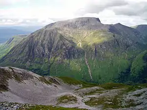
Ben Nevis (/ˈnɛvɪs/ NEV-iss; Scottish Gaelic: Beinn Nibheis, Scottish Gaelic pronunciation: [pe(ɲ) ˈɲivɪʃ]) is the highest mountain in Scotland, the United Kingdom and the British Isles. The summit is 1,345 metres (4,413 ft) above sea level and is the highest land in any direction for 739 kilometres (459 miles). Ben Nevis stands at the western end of the Grampian Mountains in the Highland region of Lochaber, close to the town of Fort William.
The mountain is a popular destination, attracting an estimated 130,000 ascents a year, around three-quarters of which use the Mountain Track from Glen Nevis. The 700-metre (2,300 ft) cliffs of the north face are among the highest in Scotland, providing classic scrambles and rock climbs of all difficulties for climbers and mountaineers. They are also the principal locations in Scotland for ice climbing.
The summit, which is the collapsed dome of an ancient volcano, features the ruins of an observatory which was continuously staffed between 1883 and 1904. The meteorological data collected during this period is still important for understanding Scottish mountain weather. C. T. R. Wilson was inspired to invent the cloud chamber after a period spent working at the observatory. (Full article...) Read more...
Selected articles 20
Portal:Scotland/Selected articles/20

Curling is a sport in which players slide stones on a sheet of ice toward a target area which is segmented into four concentric circles. It is related to bowls, boules and shuffleboard. Two teams, each with four players, take turns sliding heavy, polished granite stones, also called rocks, across the ice curling sheet toward the house, a circular target marked on the ice. Each team has eight stones, with each player throwing two. The purpose is to accumulate the highest score for a game; points are scored for the stones resting closest to the centre of the house at the conclusion of each end, which is completed when both teams have thrown all of their stones once. A game usually consists of eight or ten ends.
The player can induce a curved path, described as curl, by causing the stone to slowly rotate as it slides. The path of the rock may be further influenced by two sweepers with brooms or brushes, who accompany it as it slides down the sheet and sweep the ice in front of the stone. "Sweeping a rock" decreases the friction, which makes the stone travel a straighter path (with less curl) and a longer distance. A great deal of strategy and teamwork go into choosing the ideal path and placement of a stone for each situation, and the skills of the curlers determine the degree to which the stone will achieve the desired result. (Full article...) Read more...
Selected articles 21
Portal:Scotland/Selected articles/21

Single malt Scotch refers to single malt whisky made in Scotland. To qualify for this category, a whisky must have been distilled at a single distillery using a pot still distillation process and made from a mash of malted barley. Therefore, a single malt means that the whisky has not been blended elsewhere with whisky from other distilleries. As with any Scotch whisky, a single malt Scotch must be distilled in Scotland and matured in oak casks in Scotland for at least three years, although most single malts are matured longer. (Full article...) Read more ...
Selected articles 22
Portal:Scotland/Selected articles/22
.jpg.webp)
Cutty Sark is a British clipper ship. Built on the River Leven, Dumbarton, Scotland in 1869 for the Jock Willis Shipping Line, she was one of the last tea clippers to be built and one of the fastest, at the end of a long period of design development for this type of vessel, which ended as steamships took over their routes. She was named after the short shirt of the fictional witch in Robert Burns' poem Tam o' Shanter, first published in 1791.
After the big improvement in the fuel efficiency of steamships in 1866, the opening of the Suez Canal in 1869 gave them a shorter route to China, so Cutty Sark spent only a few years on the tea trade before turning to the trade in wool from Australia, where she held the record time to Britain for ten years. Continuing improvements in steam technology meant that gradually steamships also came to dominate the longer sailing route to Australia, and the ship was sold to the Portuguese company Ferreira and Co. in 1895 and renamed Ferreira. She continued as a cargo ship until purchased in 1922 by retired sea captain Wilfred Dowman, who used her as a training ship operating from Falmouth, Cornwall. After his death, Cutty Sark was transferred to the Thames Nautical Training College, Greenhithe, in 1938 where she became an auxiliary cadet training ship alongside HMS Worcester. By 1954, she had ceased to be useful as a cadet ship and was transferred to permanent dry dock at Greenwich, London, for public display.
Cutty Sark is listed by National Historic Ships as part of the National Historic Fleet (the nautical equivalent of a Grade 1 Listed Building). She is one of only three remaining original composite construction (wooden hull on an iron frame) clipper ships from the nineteenth century in part or whole, the others being the City of Adelaide, which arrived in Port Adelaide, South Australia on 3 February 2014 for preservation, and the beached skeleton of Ambassador of 1869 near Punta Arenas, Chile. (Full article...) Read more ...
Selected articles 23
Portal:Scotland/Selected articles/23
.jpg.webp)
The Palace of Holyroodhouse (/ˈhɒlɪruːd/ or /ˈhoʊlɪruːd/), commonly referred to as Holyrood Palace or Holyroodhouse, is the official residence of the British monarch in Scotland. Located at the bottom of the Royal Mile in Edinburgh, at the opposite end to Edinburgh Castle, Holyroodhouse has served as the principal royal residence in Scotland since the 16th century, and is a setting for state occasions and official entertaining.
The Palace has origins as a guest house for Holyrood Abbey, which it adjoins. The gardens of the palace are set within Holyrood Park. The Queen's Gallery was built at the western entrance to the Palace of Holyroodhouse and opened in 2002 to exhibit works of art from the Royal Collection. (Full article...) Read more ...
Selected articles 24
Portal:Scotland/Selected articles/24

Aberdeen (/ˌæbərˈdiːn/ ⓘ; Scots: Aiberdeen [ˌeːbərˈdin] ⓘ; Scottish Gaelic: Obar Dheathain [ˈopəɾ ˈʝɛ.ɪɲ]; Latin: Aberdonia) is a city in North East Scotland, and is the third most populous city in the country. Aberdeen is one of Scotland's 32 local government council areas (as Aberdeen City), and has a population estimate of 198,590 for the city of Aberdeen, and 227,430 for the local council area making it the United Kingdom's 39th most populous built-up area. The city is 93 mi (150 km) northeast of Edinburgh and 398 mi (641 km) north of London, and is the northernmost major city in the United Kingdom. Aberdeen has a long, sandy coastline and features an oceanic climate, with cool summers and mild, rainy winters.
During the mid-18th to mid-20th centuries, Aberdeen's buildings incorporated locally quarried grey granite, which may sparkle like silver because of its high mica content. Since the discovery of North Sea oil in 1969, Aberdeen has been known as the offshore oil capital of Europe. Based upon the discovery of prehistoric villages around the mouths of the rivers Dee and Don, the area around Aberdeen has been thought to have been settled for at least 6,000 years.
Aberdeen received royal burgh status from David I of Scotland (1124–1153), which transformed the city economically. The traditional industries of fishing, paper-making, shipbuilding, and textiles have been overtaken by the oil industry and Aberdeen's seaport. Aberdeen Heliport is one of the busiest commercial heliports in the world, and the seaport is the largest in the north-east part of Scotland. A university town, the city is known for the University of Aberdeen, founded in 1495 as the fifth oldest university in the English-speaking world and located in Old Aberdeen. (Full article...) Read more ...
Selected articles 25
Portal:Scotland/Selected articles/25
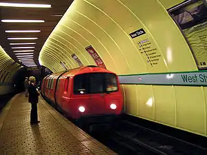
The Glasgow Subway is an underground light metro system in Glasgow, Scotland. Opened on 14 December 1896, it is the third-oldest underground rail transit system in Europe after the London Underground and the Budapest Metro. It is also one of the very few railways in the world with a track running gauge of 4 ft (1,219 mm) wide. Originally a cable railway, the subway was later electrified, but the double-track circular line was never expanded. The line was originally known as the Glasgow District Subway, and was later renamed Glasgow Subway Railway. In 1936 it was renamed the Glasgow Underground. Despite this rebranding, many Glaswegians continued to refer to the network as "the Subway". In 2003, the name "Subway" was officially readopted by its operator, the Strathclyde Partnership for Transport (SPT).
The system is not the oldest underground railway in Glasgow: that distinction belongs to a three-mile (five-kilometre) section of the Glasgow City and District Railway opened in 1886, now part of the North Clyde Line of the suburban railway network, which runs in a tunnel under the city centre between High Street and west of Charing Cross. Another major section of underground suburban railway line in Glasgow is the Argyle Line, which was formerly part of the Glasgow Central Railway. (Full article...) Read more ...
Selected articles 26
Portal:Scotland/Selected articles/26
.jpg.webp)
Edinburgh Castle is a historic castle in Edinburgh, Scotland. It stands on Castle Rock, which has been occupied by humans since at least the Iron Age, although the nature of the early settlement is unclear. There has been a royal castle on the rock since at least the reign of David I in the 12th century, and the site continued to be a royal residence until 1633. From the 15th century, the castle's residential role declined, and by the 17th century it was principally used as military barracks with a large garrison. Its importance as a part of Scotland's national heritage was recognised increasingly from the early 19th century onwards, and various restoration programmes have been carried out over the past century and a half.
As one of the most important strongholds in the Kingdom of Scotland, Edinburgh Castle was involved in many historical conflicts from the Wars of Scottish Independence in the 14th century to the Jacobite rising of 1745. Research undertaken in 2014 identified 26 sieges in its 1,100-year history, giving it a claim to having been "the most besieged place in Great Britain and one of the most attacked in the world". Few of the present buildings pre-date the Lang Siege of the 16th century when the medieval defences were largely destroyed by artillery bombardment. The most notable exceptions are St Margaret's Chapel from the early 12th century, which is regarded as the oldest building in Edinburgh, the Royal Palace, and the early 16th-century Great Hall, although the interiors have been much altered from the mid-Victorian period onwards. The castle also houses the Scottish regalia, known as the Honours of Scotland, and is the site of the Scottish National War Memorial and the National War Museum of Scotland. The British Army is still responsible for some parts of the castle, although its presence is now largely ceremonial and administrative. Some of the castle buildings house regimental museums which contribute to its presentation as a tourist attraction. (Full article...) Read more ...
Selected articles 27
Portal:Scotland/Selected articles/27

Edinburgh (/ˈɛdɪnbərə/ ⓘ Scots: [ˈɛdɪnbʌrə]; Scottish Gaelic: Dùn Èideann [ˌt̪un ˈeːtʲən̪ˠ]) is the capital city of Scotland and one of its 32 council areas. The modern city is located between the rivers Almond and Esk on the southern shore of the Firth of Forth, in the historic region of Lothian, bounded on its southern side by the Pentland Hills. Edinburgh is Scotland's second most populous city and the seventh most populous city in the United Kingdom.
Recognised as the capital of Scotland since at least the 15th century, Edinburgh is the seat of the Scottish Government, the Scottish Parliament, and the highest courts in Scotland. The city's Palace of Holyroodhouse is the official residence of the British monarch in Scotland. The city has long been a centre of education, particularly in the fields of medicine, Scottish law, literature, philosophy, the sciences and engineering. It is the second-largest financial centre in the United Kingdom, fourth largest in Europe and thirteenth largest internationally and the city's historical and cultural attractions have made it the UK's second-most visited tourist destination, attracting 4.9 million visits, including 2.4 million from overseas in 2018. Time Out magazine rated Edinburgh the best city in the world in 2022.
Edinburgh's official population estimates are 506,520 (mid-2020) for the locality, 526,470 (mid-2019) for the City of Edinburgh council area, which takes in some outlying villages in the western part of its territory, and 1,384,950 (2019) for the wider Edinburgh and South East Scotland city region which also includes East Lothian, Fife, Midlothian, the Scottish Borders and West Lothian. The City of Edinburgh Council is the current local authority. (Full article...) Read more ...
Selected articles 28
Portal:Scotland/Selected articles/28
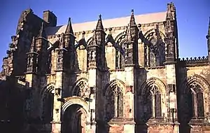
Rosslyn Chapel, formerly known as the Collegiate Chapel of St Matthew, is a 15th-century chapel located in the village of Roslin, Midlothian, Scotland.
Rosslyn Chapel was founded on a small hill above Roslin Glen as a Catholic collegiate church (with between four and six ordained canons and two boy choristers) in the mid-15th century. The chapel was founded by William Sinclair, 1st Earl of Caithness of the Scoto-Norman Sinclair family. Rosslyn Chapel is the third Sinclair place of worship at Roslin, the first being in Roslin Castle and the second (whose crumbling buttresses can still be seen today) in what is now Roslin Cemetery.
Sinclair founded the college to celebrate the Divine Office throughout the day and night, and also to celebrate Masses for all the faithful departed, including the deceased members of the Sinclair family. During this period, the rich heritage of plainsong (a single melodic line) or polyphony (vocal harmony) were used to enrich the singing of the liturgy. Sinclair provided an endowment to pay for the support of the priests and choristers in perpetuity. The priests also had parochial responsibilities. (Full article...) Read more ...
Selected articles 29
Portal:Scotland/Selected articles/29
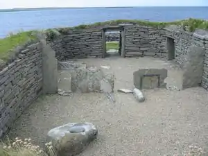
The recorded history of Scotland begins with the arrival of the Roman Empire in the 1st century, when the province of Britannia reached as far north as the Antonine Wall. North of this was Caledonia, inhabited by the Picti, whose uprisings forced Rome's legions back to Hadrian's Wall. As Rome finally withdrew from Britain, a Gaelic tribe from Ireland called the Scoti began colonising Western Scotland and Wales. Before Roman times, prehistoric Scotland entered the Neolithic Era about 4000 BC, the Bronze Age about 2000 BC, and the Iron Age around 700 BC.
The Gaelic kingdom of Dál Riata was founded on the west coast of Scotland in the 6th century. In the following century, Irish missionaries introduced the previously pagan Picts to Celtic Christianity. Following England's Gregorian mission, the Pictish king Nechtan chose to abolish most Celtic practices in favour of the Roman rite, restricting Gaelic influence on his kingdom and avoiding war with Anglian Northumbria. Towards the end of the 8th century, the Viking invasions began, forcing the Picts and Gaels to cease their historic hostility to each other and to unite in the 9th century, forming the Kingdom of Scotland.
The Kingdom of Scotland was united under the House of Alpin, whose members fought among each other during frequent disputed successions. The last Alpin king, Malcolm II, died without a male issue in the early 11th century and the kingdom passed through his daughter's son to the House of Dunkeld or Canmore. The last Dunkeld king, Alexander III, died in 1286. He left only his infant granddaughter Margaret, Maid of Norway as heir, who died herself four years later. England, under Edward I, would take advantage of this questioned succession to launch a series of conquests, resulting in the Wars of Scottish Independence, as Scotland passed back and forth between the House of Balliol and the House of Bruce through the late Middle Ages. Scotland's ultimate victory confirmed Scotland as a fully independent and sovereign kingdom. (Full article...) Read more ...
Selected articles 30
Portal:Scotland/Selected articles/30
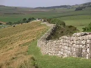
Hadrian's Wall (Latin: Vallum Hadriani), also known as the Roman Wall, Picts' Wall, or Vallum Aelium in Latin, is a former defensive fortification of the Roman province of Britannia, begun in AD 122 in the reign of the Emperor Hadrian. Running from Wallsend on the River Tyne in the east to Bowness-on-Solway in the west of what is now northern England, it was a stone wall with large ditches in front of it and behind it that crossed the whole width of the island. Soldiers were garrisoned along the line of the wall in large forts, smaller milecastles, and intervening turrets. In addition to the wall's defensive military role, its gates may have been customs posts. Hadrian's Wall Path generally runs very close to the wall. Almost all of the standing masonry of the wall was removed in early modern times and used for local roads and farmhouses. None of it stands to its original height, but modern work has exposed much of the footings, and some segments display a few courses of modern masonry reconstruction. Many of the excavated forts on or near the wall are open to the public, and various nearby museums present its history. The largest Roman archaeological feature in Britain, it runs a total of 73 miles (117.5 kilometres) in northern England. Regarded as a British cultural icon, Hadrian's Wall is one of Britain's major ancient tourist attractions. It was designated as a UNESCO World Heritage Site in 1987. The turf-built Antonine Wall in what is now central Scotland, which briefly superseded Hadrian's Wall before being abandoned, was declared a World Heritage Site in 2008.
Hadrian's Wall marked the boundary between Roman Britannia and unconquered Caledonia to the north. The wall lies entirely within England and has never formed the Anglo-Scottish border, though it is sometimes loosely or colloquially described as being such. (Full article...) Read more ...
Selected articles 31
Portal:Scotland/Selected articles/31
_-_geograph.org.uk_-_822246.jpg.webp)
The flora of Scotland is an assemblage of native plant species including over 1,600 vascular plants, more than 1,500 lichens and nearly 1,000 bryophytes. The total number of vascular species is low by world standards but lichens and bryophytes are abundant and the latter form a population of global importance. Various populations of rare fern exist, although the impact of 19th-century collectors threatened the existence of several species. The flora is generally typical of the north-west European part of the Palearctic realm and prominent features of the Scottish flora include boreal Caledonian forest (much reduced from its natural extent), heather moorland and coastal machair. In addition to the native species of vascular plants there are numerous non-native introductions, now believed to make up some 43% of the species in the country.
There are a variety of important trees species and specimens; a Grand Fir in Argyll is the tallest tree in the United Kingdom and the Fortingall Yew may be the oldest tree in Europe. The Arran Whitebeams, Shetland Mouse-ear and Scottish Primrose are endemic flowering plants and there are a variety of endemic mosses and lichens. Conservation of the natural environment is well developed and various organisations play an important role in the stewardship of the country's flora. Numerous references to the country's flora appear in folklore, song and poetry. (Full article...) Read more...
Selected articles 32
Portal:Scotland/Selected articles/32
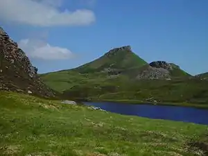
Raasay (/ˈrɑːseɪ/; Scottish Gaelic: Ratharsair) or the Isle of Raasay is an island between the Isle of Skye and the mainland of Scotland. It is separated from Skye by the Sound of Raasay and from Applecross by the Inner Sound. It is famous for being the birthplace of Gaelic poet Sorley MacLean, an important figure in the Scottish Renaissance.
Traditionally the home of Clan MacSween, the island was ruled by the MacLeods from the 15th to the 19th century. Subsequently, a series of private landlords held title to the island, which is now largely in public ownership. Raasay House, which was visited by James Boswell and Samuel Johnson in 1773, is now a hotel, restaurant, bar and outdoor activity centre. Raasay means "Isle of the Roe Deer" and is home to an endemic subspecies of bank vole. The current Chief of the Island is Roderick John Macleod of Raasay. (Full article...) Read more ...
Selected articles 33
Portal:Scotland/Selected articles/33
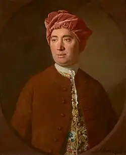
The Scottish Enlightenment (Scots: Scots Enlichtenment, Scottish Gaelic: Soillseachadh na h-Alba) was the period in 18th- and early-19th-century Scotland characterised by an outpouring of intellectual and scientific accomplishments. By the eighteenth century, Scotland had a network of parish schools in the Scottish Lowlands and five universities. The Enlightenment culture was based on close readings of new books, and intense discussions which took place daily at such intellectual gathering places in Edinburgh as The Select Society and, later, The Poker Club, as well as within Scotland's ancient universities (St Andrews, Glasgow, Edinburgh, King's College, and Marischal College).
Sharing the humanist and rational outlook of the Western Enlightenment of the same time period, the thinkers of the Scottish Enlightenment asserted the importance of human reason combined with a rejection of any authority that could not be justified by reason. In Scotland, the Enlightenment was characterised by a thoroughgoing empiricism and practicality where the chief values were improvement, virtue, and practical benefit for the individual and society as a whole.
Among the fields that rapidly advanced were philosophy, political economy, engineering, architecture, medicine, geology, archaeology, botany and zoology, law, agriculture, chemistry and sociology. Among the Scottish thinkers and scientists of the period were Joseph Black, Robert Burns, William Cullen, Adam Ferguson, David Hume, Francis Hutcheson, James Hutton, John Playfair, Thomas Reid, Adam Smith, and Dugald Stewart. (Full article...) Read more ...
Selected articles 34
Portal:Scotland/Selected articles/34
_-_panoramio.jpg.webp)
The Forth Road Bridge is a suspension bridge in east central Scotland. The bridge opened in 1964 and at the time was the longest suspension bridge in the world outside the United States. The bridge spans the Firth of Forth, connecting Edinburgh, at South Queensferry, to Fife, at North Queensferry. It replaced a centuries-old ferry service to carry vehicular traffic, cyclists and pedestrians across the Forth; railway crossings are made by the nearby Forth Bridge, opened in 1890.
The Scottish Parliament voted to scrap tolls on the bridge from February 2008. The adjacent Queensferry Crossing was opened in August 2017 to carry the M90 motorway across the Firth of Forth, replacing the Forth Road Bridge which had exceeded its design capacity. At its peak, the Forth Road Bridge carried 65,000 vehicles per day.
The Forth Road Bridge was subsequently closed for repairs and refurbishment. It reopened in February 2018, now redesignated as a dedicated Public Transport Corridor, with access to motor vehicles other than buses and taxis restricted; pedestrians and cyclists are still permitted to use the bridge. In May 2023, Stagecoach Fife started the first driverless bus service to carry passengers in the United Kingdom along a park-and-ride route which includes the Forth Road Bridge as its main section. (Full article...) Read more ...
Selected articles 35
Portal:Scotland/Selected articles/35
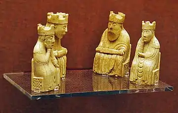
The Lewis chessmen (Scottish Gaelic: Fir-thàilisg Leòdhais [fiɾʲˈhaːlɪʃkʲ loː.ɪʃ]) or Uig chessmen, named after the island or the bay where they were found, are a group of distinctive 12th-century chess pieces, along with other game pieces, most of which are carved from walrus ivory. Discovered in 1831 on Lewis in the Outer Hebrides of Scotland, they may constitute some of the few complete, surviving medieval chess sets, although it is not clear if a period-accurate set can be assembled from the pieces. When found, the hoard contained 93 artifacts: 78 chess pieces, 14 tablemen and one belt buckle. Today, 82 pieces are owned and usually exhibited by the British Museum in London, and the remaining 11 are at the National Museum of Scotland in Edinburgh.
Additionally, a newly identified piece, a "warder", the equivalent of a rook, was sold for £735,000 in July 2019. Four other major pieces, and many pawns, remain missing from the chess sets. (Full article...) Read more ...
Selected articles 36
Portal:Scotland/Selected articles/36
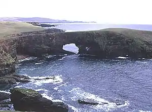
Papa Stour (Scots: Papa Stour) is one of the Shetland Islands in Scotland, with a population of under fifteen people, some of whom immigrated after an appeal for residents in the 1970s. Located to the west of mainland Shetland and with an area of 828 hectares (3.2 square miles), Papa Stour is the eighth largest island in Shetland. Erosion of the soft volcanic rocks by the sea has created an extraordinary variety of caves, stacks, arches, blowholes, and cliffs. The island and its surrounding seas harbour diverse populations of wildlife. The west side of the island is a Site of Special Scientific Interest and the seas around the island are a Special Area of Conservation.
The island has several Neolithic burial chamber sites, as well as the remains of Duke Hakon's 13th-century house dating from the Norse occupation of the island. The population reached 380 or more in the nineteenth century, when a fishing station was opened at Crabbaberry in West Voe. Subsequently, there was a steady decline in population.
Today the main settlement on the island is Biggings, just to the east of which is Housa Voe from where the Snolda ferry arrives from its base at West Burrafirth on the Shetland Mainland. Crofting, especially sheep rearing, is the mainstay of island life. (Full article...) Read more ...
Selected articles 37
Portal:Scotland/Selected articles/37
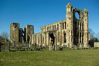
Elgin Cathedral is a historic ruin in Elgin, Moray, north-east Scotland. The cathedral, dedicated to the Holy Trinity, was established in 1224 on land granted by King Alexander II outside the burgh of Elgin and close to the River Lossie. It replaced the cathedral at Spynie, 3 kilometres (2 mi) to the north, which was served by a small chapter of eight clerics. By 1226, the new and developing cathedral was staffed with 18 canons increasing to 23 by 1242. A damaging fire in 1270 resulted in a significantly enlarged building. It remained unaffected by the Wars of Scottish Independence, but again suffered extensive fire damage in 1390 when attacked by Robert III's brother Alexander Stewart, Earl of Buchan, also known as the Wolf of Badenoch. In 1402 the cathedral precinct again suffered an incendiary attack by the followers of the Lord of the Isles.
As the cathedral grew, so did the number of clerics and craftsmen. The repairs following the 1270 and 1390 fires resulted in the doubling in length of the choir and the provision of outer aisles to both the nave and choir. Today, some parts of walls reach their full height while others are at foundation level, but the overall cruciform shape is still discernible. A mostly intact octagonal chapter house dates from the major enlargement after the fire of 1270. The gable wall above the double door entrance that links the west towers is nearly complete and was rebuilt after the fire of 1390. It accommodates a large window opening that now only contains stub tracery work and fragments of a large rose window. The transepts and the south aisle of the choir contain recessed and chest tombs with effigies of bishops and knights. The now grass-covered floor bears large flat slabs that mark the positions of early graves. The residences of the dignitaries, canons and chaplains that stood in the chanonry were also destroyed by the fires of 1270, 1390 and 1402 and formed part of the reconstruction process. Only the precentor's manse is substantially intact, while two others have been incorporated into private buildings. Both west front towers are mostly complete and were part of the initial phase of construction. A protective wall of massive proportions surrounded the cathedral precinct, but only two small sections survive. The wall had four access gates but only one, the Pans Port, still exists. (Full article...) Read more ...
Selected articles 38
Portal:Scotland/Selected articles/38
The geology of Scotland is unusually varied for a country of its size, with a large number of different geological features. There are three main geographical sub-divisions: the Highlands and Islands is a diverse area which lies to the north and west of the Highland Boundary Fault; the Central Lowlands is a rift valley mainly comprising Palaeozoic formations; and the Southern Uplands, which lie south of the Southern Uplands Fault, are largely composed of Silurian deposits.
The existing bedrock includes very ancient Archean gneiss, metamorphic beds interspersed with granite intrusions created during the Caledonian mountain building period (the Caledonian orogeny), commercially important coal, oil and iron-bearing carboniferous deposits and the remains of substantial Palaeogene volcanoes. During their formation, tectonic movements created climatic conditions ranging from polar to desert to tropical and a resultant diversity of fossil remains.
Scotland has also had a role to play in many significant discoveries such as plate tectonics and the development of theories about the formation of rocks and was the home of important figures in the development of the science including James Hutton (the "father of modern geology"), Hugh Miller and Archibald Geikie. Various locations such as 'Hutton's Unconformity' at Siccar Point in Berwickshire and the Moine Thrust in the northwest were also important in the development of geological science. (Full article...) Read more ...
Selected articles 39
Portal:Scotland/Selected articles/39
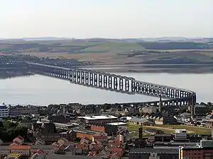
The Tay Bridge (Scottish Gaelic: Drochaid-rèile na Tatha) carries the railway across the Firth of Tay in Scotland between Dundee and the suburb of Wormit in Fife. Its span is 2.75 miles (4.43 kilometres). It is the second bridge to occupy the site.
Plans for a bridge over the Tay to replace the train ferry service emerged in 1854, but the first Tay Bridge did not open until 1878. It was a lightweight lattice design of relatively low cost with a single track. On 28 December 1879, the bridge suddenly collapsed in high winds while a train was crossing, killing everybody on board. The incident is one of the worst bridge-related engineering disasters in history. An enquiry determined that the bridge was insufficiently engineered to cope with high winds.
It was replaced by a second bridge constructed of iron and steel, with a double track, parallel to the remains of the first bridge. Work commenced on 6 July 1883 and the bridge opened in 1887. The new bridge was subject to extensive testing by the Board of Trade, which resulted in a favourable report. In 2003, the bridge was strengthened and refurbished, winning a British Construction Industry Engineering Award to mark the scale and difficulty of the project. (Full article...) Read more ...
Selected articles 40
Portal:Scotland/Selected articles/40

St Mary's Abbey, Melrose is a partly ruined monastery of the Cistercian order in Melrose, Roxburghshire, in the Scottish Borders. It was founded in 1136 by Cistercian monks at the request of King David I of Scotland and was the chief house of that order in the country until the Reformation. It was headed by the abbot or commendator of Melrose. Today the abbey is maintained by Historic Environment Scotland as a scheduled monument.
The east end of the abbey was completed in 1146. Other buildings in the complex were added over the next 50 years. The abbey was built in the Gothic manner and in the form of a St. John's Cross. A considerable portion of the abbey is now in ruins. A structure dating from 1590 is maintained as a museum open to the public.
Alexander II and other Scottish kings and nobles are buried at the abbey. A lead container believed to hold the embalmed heart of Robert the Bruce was found in 1921 below the Chapter House site; it was found again in a 1998 excavation and documented in records of his death. The rest of his body is buried in Dunfermline Abbey. (Full article...) Read more ...
Selected articles 41
Portal:Scotland/Selected articles/41

Pan Am Flight 103 (PA103/PAA103) was a regularly scheduled Pan Am transatlantic flight from Frankfurt to Detroit via a stopover in London and another in New York City. The transatlantic leg of the route was operated by Clipper Maid of the Seas, a Boeing 747 registered N739PA. Shortly after 19:00 on 21 December 1988, while the aircraft was in flight over the Scottish town of Lockerbie, it was destroyed by a bomb that had been planted on board, killing all 243 passengers and 16 crew in what became known as the Lockerbie bombing. Large sections of the aircraft crashed in a residential street in Lockerbie, killing 11 residents. With a total of 270 fatalities, it is one of the deadliest terrorist attacks in the history of the United Kingdom, as well as its deadliest aviation disaster ever.
Following a three-year joint investigation by Dumfries and Galloway Constabulary and the US Federal Bureau of Investigation (FBI), arrest warrants were issued for two Libyan nationals in November 1991. In 1999, Libyan leader Muammar Gaddafi handed over the two men for trial at Camp Zeist, the Netherlands, after protracted negotiations and UN sanctions. In 2001, Abdelbaset al-Megrahi, a Libyan intelligence officer, was jailed for life after being found guilty of 270 counts of murder in connection with the bombing. In August 2009, he was released by the Scottish government on compassionate grounds after being diagnosed with prostate cancer. He died in May 2012 as the only person to be convicted for the attack.
In 2003, Gaddafi accepted Libya's responsibility for the Lockerbie bombing and paid compensation to the families of the victims, although he maintained that he had never given the order for the attack. Acceptance of responsibility was part of a series of requirements laid out by a UN resolution for sanctions against Libya to be lifted. Libya said it had to accept responsibility due to Megrahi's status as a government employee. (Full article...) Read more ...
Selected articles 42
Portal:Scotland/Selected articles/42
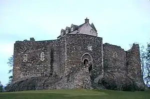
Dunstaffnage Castle (Scottish Gaelic: Caisteal Dhùn Stadhainis) is a partially ruined castle in Argyll and Bute, western Scotland. It lies 3 miles (5 km) NNE of Oban, situated on a platform of conglomerate rock on a promontory at the south-west of the entrance to Loch Etive, and is surrounded on three sides by the sea. The castle and the nearby chapel ruin have been a Historic Scotland property since 1958. Both are Scheduled Ancient Monuments.
The castle dates back to the 13th century, making it one of Scotland's oldest stone castles, in a local group which includes Castle Sween and Castle Tioram. Guarding a strategic location, it was built by the MacDougall lords of Lorn, and has been held since the 15th century by the Clan Campbell. To this day there is a hereditary Captain of Dunstaffnage, although they no longer reside at the castle. Dunstaffnage is maintained by Historic Environment Scotland, and is open to the public, although the 16th century gatehouse is retained as the private property of the Captain. The prefix dun in the name means "fort" in Gaelic, while the rest of the name derives from Norse stafr-nis, "headland of the staff". (Full article...) Read more ...
Selected articles 43
Portal:Scotland/Selected articles/43

Scots (endonym: Scots; Scottish Gaelic: Beurla Ghallda, Albais) is an Anglic language variety in the West Germanic language family, spoken in Scotland and parts of Ulster in the north of Ireland (where the local dialect is known as Ulster Scots). Most commonly spoken in the Scottish Lowlands, Northern Isles and northern Ulster, it is sometimes called Lowland Scots to distinguish it from Scottish Gaelic, the Goidelic Celtic language that was historically restricted to most of the Scottish Highlands, the Hebrides and Galloway after the sixteenth century, or Broad Scots to distinguish it from Scottish Standard English. Modern Scots is a sister language of Modern English, as the two diverged independently from the same source: Early Middle English (1150–1300).
Scots is recognised as an indigenous language of Scotland by the Scottish government, a regional or minority language of Europe, and a vulnerable language by UNESCO. In the 2011 Scottish Census, over 1.5 million people in Scotland reported being able to speak Scots.
As there are no universally accepted criteria for distinguishing a language from a dialect, scholars and other interested parties often disagree about the linguistic, historical and social status of Scots, particularly its relationship to English. Although a number of paradigms for distinguishing between languages and dialects exist, they often render contradictory results. Broad Scots is at one end of a bipolar linguistic continuum, with Scottish Standard English at the other. Scots is sometimes regarded as a variety of English, though it has its own distinct dialects; other scholars treat Scots as a distinct Germanic language, in the way that Norwegian is closely linked to but distinct from Danish. (Full article...) Read more ...
Selected articles 44
Portal:Scotland/Selected articles/44
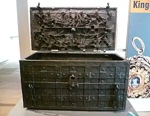
The Darien scheme was an unsuccessful attempt, backed largely by investors of the Kingdom of Scotland, to gain wealth and influence by establishing New Caledonia, a colony in the Darién Gap on the Isthmus of Panama, in the late 1690s. The plan was for the colony, located on the Gulf of Darién, to establish and manage an overland route to connect the Pacific and Atlantic Oceans. The backers knew that the first sighting of the Pacific Ocean by Balboa was after crossing the isthmus through Darién.
The attempt at settling the area did not go well; more than 80 per cent of participants died within a year, and the settlement was abandoned twice. There are many explanations for the disaster. Rival claims have been made suggesting that the undertaking was beset by poor planning and provisioning; by divided leadership; by a lack of trade with local indigenous tribes or neighbouring Dutch and English colonies; by epidemics of tropical disease; widespread opposition to the scheme from commercial interests in England; and by a failure to anticipate a military response from the Spanish Empire. It was finally abandoned in March 1700 after a siege by Spanish forces, which also blockaded the harbour. (Full article...) Read more ...
Selected articles 45
Portal:Scotland/Selected articles/45
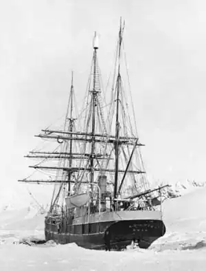
The Scottish National Antarctic Expedition (SNAE), 1902–1904, was organised and led by William Speirs Bruce, a natural scientist and former medical student from the University of Edinburgh. Although overshadowed in terms of prestige by Robert Falcon Scott's concurrent Discovery Expedition, the SNAE completed a full programme of exploration and scientific work. Its achievements included the establishment of a staffed meteorological station, the first in Antarctic territory, and the discovery of new land to the east of the Weddell Sea. Its large collection of biological and geological specimens, together with those from Bruce's earlier travels, led to the establishment of the Scottish Oceanographical Laboratory in 1906.
Bruce had spent most of the 1890s engaged on expeditions to the Antarctic and Arctic regions, and by 1899 was Britain's most experienced polar scientist. In March of that year, he applied to join the Discovery Expedition; however, his proposal to extend that expedition's field of work into the Weddell Sea quadrant, using a second ship, was dismissed as "mischievous rivalry" by Royal Geographical Society (RGS) president Sir Clements Markham. Bruce reacted by obtaining independent finance; his venture was supported and promoted by the Royal Scottish Geographical Society.
The expedition has been described as "by far the most cost-effective and carefully planned scientific expedition of the Heroic Age." Despite this, Bruce received no formal honour or recognition from the British Government, and the expedition's members were denied the prestigious Polar Medal despite vigorous lobbying. After the SNAE, Bruce led no more Antarctic expeditions, although he made regular Arctic trips. His focus on serious scientific exploration was out of fashion with his times, and his achievements, unlike those of the polar adventurers Scott, Shackleton and Amundsen, soon faded from public awareness. The SNAE's permanent memorial is the Orcadas weather station, which was set up in 1903 as "Omond House" on Laurie Island, South Orkneys, and has been in continuous operation ever since. (Full article...) Read more ...
Selected articles 46
Portal:Scotland/Selected articles/46
Feb2007.jpg.webp)
Jarlshof (/ˈjɑːrlzhɒf/ YARLZ-hof) is the best-known prehistoric archaeological site in Shetland, Scotland. It lies in Sumburgh, Mainland, Shetland and has been described as "one of the most remarkable archaeological sites ever excavated in the British Isles". It contains remains dating from 2500 BC up to the 17th century AD.
The Bronze Age settlers left evidence of several small oval houses with thick stone walls and various artefacts including a decorated bone object. The Iron Age ruins include several different types of structures, including a broch and a defensive wall around the site. The Pictish period provides various works of art including a painted pebble and a symbol stone. The Viking Age ruins make up the largest such site visible anywhere in Britain and include a longhouse; excavations provided numerous tools and a detailed insight into life in Shetland at this time. The most visible structures on the site are the walls of the Scottish period fortified manor house, which inspired the name "Jarlshof" that first appears in an 1821 novel by Walter Scott.
The site is in the care of Historic Scotland and is open from April to September. In 2010 "The Crucible of Iron Age Shetland" including Mousa, Old Scatness and Jarlshof was added to those seeking to be on the "tentative list" of World Heritage Sites. (Full article...) Read more ...
Selected articles 47
Portal:Scotland/Selected articles/47
.svg.png.webp)
Scots law (Scottish Gaelic: Lagh na h-Alba) is the legal system of Scotland. It is a hybrid or mixed legal system containing civil law and common law elements, that traces its roots to a number of different historical sources. Together with English law and Northern Ireland law, it is one of the three legal systems of the United Kingdom.
| This article is part of a series within the Politics of the United Kingdom on the |
| Politics of Scotland |
|---|
 |
|
Early Scots law before the 12th century consisted of the different legal traditions of the various cultural groups who inhabited the country at the time, the Gaels in most of the country, with the Britons and Anglo-Saxons in some districts south of the Forth and with the Norse in the islands and north of the River Oykel. The introduction of feudalism from the 12th century and the expansion of the Kingdom of Scotland established the modern roots of Scots law, which was gradually influenced by other, especially Anglo-Norman and continental legal traditions. Although there was some indirect Roman law influence on Scots law, the direct influence of Roman law was slight up until around the 15th century. After this time, Roman law was often adopted in argument in court, in an adapted form, where there was no native Scots rule to settle a dispute; and Roman law was in this way partially received into Scots law.
| Part of a series on |
| Scots law |
|---|
|
Scots law recognises four sources of law: legislation, legal precedent, specific academic writings, and custom. Legislation affecting Scotland may be passed by the Scottish Parliament and the United Kingdom Parliament. Some legislation passed by the pre-1707 Parliament of Scotland is still also valid.
Since the Union with England Act 1707, Scotland has shared a legislature with England and Wales. Scotland retained a fundamentally different legal system from that south of the border, but the Union exerted English influence upon Scots law. Since the UK joined the European Union, Scots law has also been affected by European law under the Treaties of the European Union, the requirements of the European Convention on Human Rights (entered into by members of the Council of Europe) and the creation of the devolved Scottish Parliament which may pass legislation within all areas not reserved to Westminster, as detailed by the Scotland Act 1998. (Full article...) Read more ...
Selected articles 48
Portal:Scotland/Selected articles/48
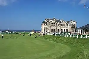
Golf in Scotland was first recorded in the Scottish late Middle Ages, and the modern game of golf was first developed and established in the country. The game plays a key role in the national sporting consciousness.
The Royal and Ancient Golf Club of St Andrews, known as the R&A, was the world governing body for the game (except in the United States and Mexico). The R&A, a separate organisation from the club, was created in 2004 as the governing body. The Scottish Ladies' Golfing Association was founded in 1904 and the Scottish Golf Union (SGU) in 1920. They merged in 2015 into a new organization, Scottish Golf.
To many golfers, the Old Course at St Andrews, an ancient links course dating to before 1574, is considered to be a site of pilgrimage. There are many other famous golf courses in Scotland, including Carnoustie, Gleneagles, Muirfield, Kingsbarns, Turnberry and Royal Troon. The world's first Open Championship was held at Prestwick in 1860, and Scots golfers have the most victories at the Open at 42 wins, one ahead of the United States.
Although golf is often seen as an elitist sport elsewhere in the world, in the land of its birth it enjoys widespread appeal across the social spectrum, in line with the country's egalitarian tradition. For example, the Old Course at St Andrews is a charitable trust and Musselburgh Links are public courses. Council-owned courses, with low fees and easy access, are common throughout the country wherever demography and geography allow. Therefore, golf courses, whether public or private, are far more common in the Lowlands than in the Highlands and Islands, where shinty (a game which may share a common ancestry with golf) is often the traditional sport. (Full article...) Read more ...
Selected articles 49
Portal:Scotland/Selected articles/49
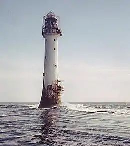
The Bell Rock Lighthouse, off the coast of Angus, Scotland, is the world's oldest surviving sea-washed lighthouse. It was built between 1807 and 1810 by Robert Stevenson on the Bell Rock (also known as Inchcape) in the North Sea, 11 miles (18 km) east of the Firth of Tay. Standing 35 metres (115 ft) tall, its light is visible from 35 statute miles (56 km) inland.
The masonry work on which the lighthouse rests was constructed to such a high standard that it has not been replaced or adapted in 200 years. The lamps and reflectors were replaced in 1843; the original ones are now in the lighthouse at Cape Bonavista, Newfoundland, where they are currently on display. The working of the lighthouse has been automated since 24 October 1988. The Northern Lighthouse Board, which has had its headquarters at 84 George Street in Edinburgh since 1832, remotely monitors the light.
The lighthouse previously operated in tandem with a shore station, the Bell Rock Signal Tower, built in 1813 at the mouth of Arbroath harbour. Today this building houses the Signal Tower Museum, a visitor centre that offers a detailed history of the lighthouse.
Because of the engineering challenges that were overcome to build the lighthouse, it has been described as one of the Seven Wonders of the Industrial World. (Full article...) Read more ...
Selected articles 50
Portal:Scotland/Selected articles/50
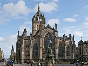
St Giles' Cathedral (Scottish Gaelic: Cathair-eaglais Naomh Giles), or the High Kirk of Edinburgh, is a parish church of the Church of Scotland in the Old Town of Edinburgh. The current building was begun in the 14th century and extended until the early 16th century; significant alterations were undertaken in the 19th and 20th centuries, including the addition of the Thistle Chapel. St Giles' is closely associated with many events and figures in Scottish history, including John Knox, who served as the church's minister after the Scottish Reformation.
Likely founded in the 12th century and dedicated to Saint Giles, the church was elevated to collegiate status by Pope Paul II in 1467. In 1559, the church became Protestant with John Knox, the foremost figure of the Scottish Reformation, as its minister. After the Reformation, St Giles' was internally partitioned to serve multiple congregations as well as secular purposes, such as a prison and as a meeting place for the Parliament of Scotland. In 1633, Charles I made St Giles' the cathedral of the newly created Diocese of Edinburgh. Charles' attempt to impose a Scottish Prayer Book in St Giles' on 23 July 1637 caused a riot, which precipitated the formation of the Covenanters and the beginnings of the Wars of the Three Kingdoms. St Giles' role in the Scottish Reformation and the Covenanters' Rebellion has led to its being called "the Mother Church of World Presbyterianism". (Full article...) Read more ...
Selected articles 51
Portal:Scotland/Selected articles/51
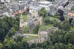
Dunfermline (/dʌnˈfɜːrmlɪn/ ⓘ; Scots: Dunfaurlin, Scottish Gaelic: Dùn Phàrlain) is a city, parish and former Royal Burgh, in Fife, Scotland, on high ground 3 miles (5 km) from the northern shore of the Firth of Forth. The city currently has an estimated population of 58,508. According to the National Records of Scotland, the greater Dunfermline area has a population of 76,210.
The earliest known settlements in the area around Dunfermline probably date as far back as the Neolithic period. The area was not regionally significant until at least the Bronze Age. The city was first recorded in the 11th century, with the marriage of Malcolm III, King of Scots, and Saint Margaret at the church in Dunfermline. As his Queen consort, Margaret established a new church dedicated to the Holy Trinity, which evolved into an Abbey under their son, David I in 1128. During the reign of Alexander I, the church – later to be known as Dunfermline Abbey – was firmly established as a prosperous royal mausoleum for the Scottish Crown. A total of eighteen royals, including seven Kings, were buried here from Queen Margaret in 1093 to Robert Stewart, Duke of Albany in 1420. Robert the Bruce, otherwise known as Robert I, became the last of the seven Scottish Kings to be buried in 1329. His bones would eventually be re-discovered and re-buried in 1821, when the excavation of the grounds of what had formerly been the eastern section of the Abbey became the site for the new Abbey Church. (Full article...) Read more ...
Selected articles 52
Portal:Scotland/Selected articles/52
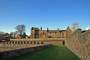
Aberdour Castle is in the village of Easter Aberdour, Fife, Scotland. Parts of the castle date from around 1200, making Aberdour one of the two oldest datable standing castles in Scotland, along with Castle Sween in Argyll, which was built at around the same time.
The earliest part of the castle was a modest hall house, on a site overlooking the Dour Burn. Over the next 400 years, the castle was successively expanded according to contemporary architectural ideas. The hall house became a tower house in the 15th century, and was extended twice in the 16th century. The final addition was made around 1635, with refined Renaissance details, and the whole was complemented by a walled garden to the east and terraced gardens to the south. The terraces, dating from the mid-16th century, form one of the oldest gardens in Scotland, and offer extensive views across the Firth of Forth to Edinburgh.
The castle is largely the creation of the Douglas Earls of Morton, who held Aberdour from the 14th century. The earls used Aberdour as a second home until 1642, when their primary residence, Dalkeith House, was sold. A fire in the late 17th century was followed by some repairs, but in 1725 the family purchased nearby Aberdour House, and the medieval castle was allowed to fall into decay. Today, only the 17th-century wing remains roofed, while the tower has mostly collapsed. Aberdour Castle is now in the care of Historic Environment Scotland, and is open to the public all year. (Full article...) Read more ...
Selected articles 53
Portal:Scotland/Selected articles/53
Dec2005.jpg.webp)
Stirling (/ˈstɜːrlɪŋ/; Scots: Stirlin; Scottish Gaelic: Sruighlea [ˈs̪t̪ɾuʝlə]) is a city in central Scotland, 26 miles (42 km) northeast of Glasgow and 37 miles (60 km) north-west of Edinburgh. The market town, surrounded by rich farmland, grew up connecting the royal citadel, the medieval old town with its merchants and tradesmen, the Old Bridge and the port. Located on the River Forth, Stirling is the administrative centre for the Stirling council area, and is traditionally the county town of Stirlingshire. Proverbially it is the strategically important "Gateway to the Highlands".
It has been said that "Stirling, like a huge brooch clasps Highlands and Lowlands together". Similarly "he who holds Stirling, holds Scotland" is sometimes attributed to Robert the Bruce. Stirling's key position as the lowest bridging point of the River Forth before it broadens towards the Firth of Forth made it a focal point for travel north or south.
When Stirling was temporarily under Anglo-Saxon sway, according to a 9th-century legend, it was attacked by Danish invaders. The sound of a wolf roused a sentry, however, who alerted his garrison, which forced a Viking retreat. This led to the wolf being adopted as a symbol of the town as is shown on the 1511 Stirling Jug. The area is today known as Wolfcraig. Even today the wolf appears with a goshawk on the council's coat of arms along with the recently chosen motto: "Steadfast as the Rock". (Full article...) Read more ...
Selected articles 54
Portal:Scotland/Selected articles/54
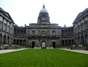
The University of Edinburgh (Scots: University o Edinburgh, Scottish Gaelic: Oilthigh Dhùn Èideann; abbreviated as Edin. in post-nominals) is a public research university based in Edinburgh, Scotland. Founded by the town council under the authority of a royal charter of King James VI in 1582 and officially opened in 1583, it is one of Scotland's four ancient universities and the sixth-oldest university in continuous operation in the English-speaking world. The university played an important role in Edinburgh becoming a chief intellectual centre during the Scottish Enlightenment and contributed to the city being nicknamed the "Athens of the North."
It is a member of several associations of research-intensive universities, including the Coimbra Group, League of European Research Universities, Russell Group, Una Europa, and Universitas 21. In the fiscal year ending 31 July 2022, it had a total income of £1.262 billion, of which £331.6 million was from research grants and contracts. It has the third-largest endowment in the UK, behind only Cambridge and Oxford. The university occupies five main campuses in the city of Edinburgh, which include many buildings of historical and architectural significance such as those in the Old Town. (Full article...) Read more ...
Selected articles 55
Portal:Scotland/Selected articles/55
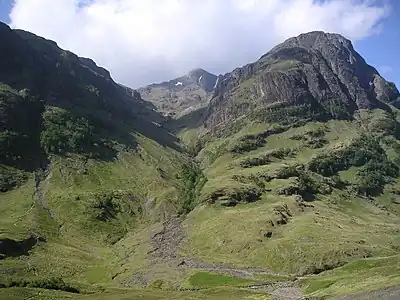
Glen Coe (Scottish Gaelic: Gleann Comhann pronounced [klan̪ˠˈkʰo.ən̪ˠ]) is a glen of volcanic origins, in the Highlands of Scotland. It lies in the north of the county of Argyll, close to the border with the historic province of Lochaber, within the modern council area of Highland. Glen Coe is regarded as the home of Scottish mountaineering and is popular with hillwalkers and climbers.
A 2010 review by Scottish Natural Heritage into the special qualities of Scotland's National scenic areas listed the "soaring, dramatic splendour of Glen Coe", and "the suddenness of the transition between high mountain pass and the lightly wooded strath" as being of note. The review also described the journey through the glen on the main A82 road as "one of the classic Highland journeys". The main settlement is the village of Glencoe located at the foot of the glen.
On 13 February 1692, in the aftermath of the Jacobite uprising of 1689, an incident known as the Massacre of Glencoe took place in the glen. Thirty-eight men from Clan MacDonald of Glencoe were killed by government forces who were billeted with them on the grounds that they had not been prompt in pledging allegiance to the new monarchs, William and Mary. (Full article...) Read more ...
Selected articles 56
Portal:Scotland/Selected articles/56

Tartan (Scottish Gaelic: breacan [ˈpɾʲɛxkən]) is a patterned cloth consisting of criss-crossed, horizontal and vertical bands in multiple colours, forming simple or complex rectangular patterns. Tartans originated in woven wool, but now are made in other materials. Tartan is particularly associated with Scotland, and Scottish kilts almost always have tartan patterns. The earliest surviving samples of tartan-style cloth are around 3,000 years old and were discovered in Xinjiang, China.
Outside of Scotland, tartan is sometimes also known as "plaid" (particularly in North America); however in Scotland, a plaid is a large piece of tartan cloth which can be worn several ways.
Traditional tartan is made with alternating bands of coloured (pre-dyed) threads woven in usually matching warp and weft in a simple 2/2 twill pattern. Up close, this pattern forms alternating short diagonal lines where different colours cross; from further back, it gives the appearance of new colours blended from the original ones. The resulting blocks of colour repeat vertically and horizontally in a distinctive pattern of rectangles and lines known as a sett. (Full article...) Read more ...
Selected articles 57
Portal:Scotland/Selected articles/57
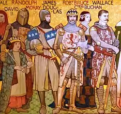
The Wars of Scottish Independence were a series of military campaigns fought between the Kingdom of Scotland and the Kingdom of England in the late 13th and early 14th centuries.
The First War (1296–1328) began with the English invasion of Scotland in 1296 and ended with the signing of the Treaty of Edinburgh–Northampton in 1328. The Second War (1332–1357) began with the English-supported invasion by Edward Balliol and the "Disinherited" in 1332 and ended in 1357 with the signing of the Treaty of Berwick. The wars were part of a great crisis for Scotland, and the period became one of the most defining times in its history. At the end of both wars, Scotland retained its status as an independent state. The wars were important for other reasons, such as the emergence of the longbow as a key weapon in medieval warfare. (Full article...) Read more ...
Selected articles 58
Portal:Scotland/Selected articles/58
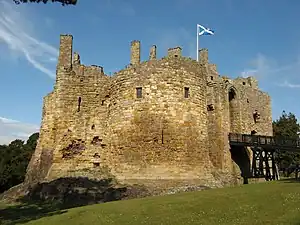
Dirleton Castle is a medieval fortress in the village of Dirleton, East Lothian, Scotland. It lies around 2 miles (3.2 km) west of North Berwick, and around 19 miles (31 km) east of Edinburgh. The oldest parts of the castle date to the 13th century, and it was abandoned by the end of the 17th century.
Begun in around 1240 by John De Vaux, the castle was heavily damaged during the Wars of Scottish Independence, when it was twice taken by the English. In the 14th century, Dirleton was repaired by the Haliburton family, and it was acquired by the Ruthvens in 1505. The Ruthvens were involved in several plots against Mary, Queen of Scots, and King James VI, and eventually forfeited the castle in 1600. Dirleton ceased to be a residence, although Oliver Cromwell was forced to besiege the castle to flush out a band of "mosstroopers" (marauders), during the Third English Civil War in 1650. The damaged castle was then acquired by John Nisbet, Lord Dirleton, who decided to build a new country house on the nearby Archerfield Estate. The Nisbet family of Dirleton continued to maintain the castle's gardens, before handing Dirleton into state care in 1923. The ruins and gardens are now maintained by Historic Environment Scotland. (Full article...) Read more ...
Selected articles 59
Portal:Scotland/Selected articles/59
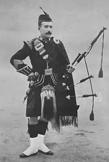
The great Highland bagpipe (Scottish Gaelic: a' phìob mhòr pronounced [a ˈfiəp ˈvoːɾ] lit. 'the great pipe') is a type of bagpipe native to Scotland, and the Scottish analogue to the great Irish warpipes. It has acquired widespread recognition through its usage in the British military and in pipe bands throughout the world.
The bagpipe is first attested in Scotland around 1400. The earliest references to bagpipes in Scotland are in a military context, and it is in that context that the great Highland bagpipe became established in the British military and achieved the widespread prominence it enjoys today, whereas other bagpipe traditions throughout Europe, ranging from Portugal to Russia, almost universally went into decline by the late 19th and early 20th century.
Though widely famous for its role in military and civilian pipe bands, the great Highland bagpipe is also used for a solo virtuosic style called pìobaireachd, ceòl mòr, or simply pibroch. (Full article...) Read more ...
Selected articles 60
Portal:Scotland/Selected articles/60

St Andrews (Latin: S. Andrea(s); Scots: Saunt Aundraes; Scottish Gaelic: Cill Rìmhinn) is a town on the east coast of Fife in Scotland, 10 miles (16 kilometres) southeast of Dundee and 30 miles (50 kilometres) northeast of Edinburgh. St Andrews had a recorded population of 16,800 as of 2011, making it Fife's fourth-largest settlement and 45th most populous settlement in Scotland.
The town is home to the University of St Andrews, the third oldest university in the English-speaking world and the oldest in Scotland. It was ranked as the best university in the UK by the 2022 Good University Guide, which is published by The Times and The Sunday Times. According to other rankings, it is ranked as one of the best universities in the United Kingdom.
The town is named after Saint Andrew the Apostle. The settlement grew to the west of St Andrews Cathedral, with the southern side of the Scores to the north and the Kinness Burn to the south. The burgh soon became the ecclesiastical capital of Scotland, a position which was held until the Scottish Reformation. The famous cathedral, the largest in Scotland, now lies in ruins. (Full article...) Read more ...
Selected articles 61
Portal:Scotland/Selected articles/61
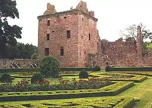
Edzell Castle is a ruined 16th-century castle, with an early-17th-century walled garden. It is located close to Edzell, and is around 5 miles (8 km) north of Brechin, in Angus, Scotland. Edzell Castle was begun around 1520 by David Lindsay, 9th Earl of Crawford, and expanded by his son, Sir David Lindsay, Lord Edzell, who also laid out the garden in 1604. The castle saw little military action, and was, in its design, construction and use, more of a country house than a defensive structure. It was briefly occupied by English troops during Oliver Cromwell's invasion of Scotland in 1651. In 1715 it was sold by the Lindsay family, and eventually came into the ownership of the Earl of Dalhousie. It was given into state care in the 1930s, and is now a visitor attraction run by Historic Environment Scotland (open all year; entrance charge). The castle consists of the original tower house and building ranges around a courtyard. The adjacent Renaissance walled garden, incorporating intricate relief carvings, is unique in Scotland. It was replanted in the 1930s, and is considered to have links to esoteric traditions, including Rosicrucianism and Freemasonry. (Full article...) Read more ...
Selected articles 62
Portal:Scotland/Selected articles/62
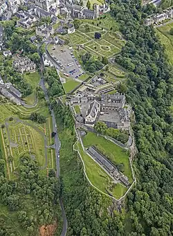
Stirling Castle, located in Stirling, is one of the largest and most historically and architecturally important castles in Scotland. The castle sits atop an intrusive crag, which forms part of the Stirling Sill geological formation. It is surrounded on three sides by steep cliffs, giving it a strong defensive position. Its strategic location, guarding what was, until the 1890s, the farthest downstream crossing of the River Forth, has made it an important fortification in the region from the earliest times.
Most of the principal buildings of the castle date from the fifteenth and sixteenth centuries. A few structures remain from the fourteenth century, while the outer defences fronting the town date from the early eighteenth century.
Before the union with England, Stirling Castle was also one of the most used of the many Scottish royal residences, very much a palace as well as a fortress. Several Scottish Kings and Queens have been crowned at Stirling, including Mary, Queen of Scots, in 1542, and others were born or died there.
There have been at least eight sieges of Stirling Castle, including several during the Wars of Scottish Independence, with the last being in 1746, when Bonnie Prince Charlie unsuccessfully tried to take the castle. Stirling Castle is a Scheduled Ancient Monument, and is now a tourist attraction managed by Historic Environment Scotland. (Full article...) Read more ...
Selected articles 63
Portal:Scotland/Selected articles/63

The Royal Observatory, Edinburgh (ROE) is an astronomical institution located on Blackford Hill in Edinburgh. The site is owned by the Science and Technology Facilities Council (STFC). The ROE comprises the UK Astronomy Technology Centre (UK ATC) of STFC, the Institute for Astronomy of the School of Physics and Astronomy of the University of Edinburgh, and the ROE Visitor Centre.
The observatory carries out astronomical research and university teaching; design, project management, and construction of instruments and telescopes for astronomical observatories; and teacher training in astronomy and outreach to the public. The ROE Library includes the Crawford Collection of books and manuscripts gifted in 1888 by James Ludovic Lindsay, 26th Earl of Crawford. Before it moved to the present site in 1896, the Royal Observatory was located on Calton Hill, close to the centre of Edinburgh, at what is now known as the City Observatory. (Full article...) Read more ...
Selected articles 64
Portal:Scotland/Selected articles/64

Lochleven Castle is a ruined castle on an island in Loch Leven, in the Perth and Kinross local authority area of Scotland. Possibly built around 1300, the castle was the site of military action during the Wars of Scottish Independence (1296–1357). In the latter part of the 14th century, the castle was granted to William Douglas, 1st Earl of Douglas, by his uncle. It remained in the Douglases' hands for the next 300 years. Mary, Queen of Scots, was imprisoned there in 1567–68, and forced to abdicate as queen, before escaping with the help of her gaoler's family. In 1588, the queen's gaoler inherited the title of Earl of Morton, and moved away from the castle. In 1675, Sir William Bruce, an architect, bought the castle and used it as a focal point for his garden; it was never again used as a residence.
Today, the remains of the castle are protected as a scheduled monument in the care of Historic Environment Scotland. Lochleven Castle is open to the public in summer, and access is available by ferry. (Full article...) Read more ...
Selected articles 65
Portal:Scotland/Selected articles/65
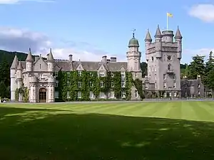
Balmoral Castle (/bælˈmɒrəl/) is a large estate house in Aberdeenshire, Scotland, and a residence of the British royal family. It is near the village of Crathie, 9 miles (14 km) west of Ballater and 50 miles (80 km) west of Aberdeen.
The estate and its original castle were bought from the Farquharson family in 1852 by Prince Albert, the husband of Queen Victoria. Soon afterwards the house was found to be too small and the current Balmoral Castle was commissioned. The architect was William Smith of Aberdeen, and his designs were amended by Prince Albert. Balmoral remains the private property of the monarch and is not part of the Crown Estate. It was the summer residence of Queen Elizabeth II, who died there on 8 September 2022.
The castle is an example of Scottish baronial architecture, and is classified by Historic Environment Scotland as a category A listed building. The new castle was completed in 1856 and the old castle demolished shortly thereafter.
The Balmoral Estate has been added to by successive members of the royal family, and now covers an area of approximately 50,000 acres (20,000 hectares). It is a working estate, including grouse moors, forestry and farmland, as well as managed herds of deer, Highland cattle, sheep and ponies. (Full article...) Read more ...
Selected articles 66
Portal:Scotland/Selected articles/66
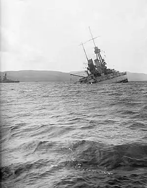
Shortly after the end of the First World War, the Imperial German Navy was scuttled by its sailors while held off the harbour of the British Royal Navy base at Scapa Flow, in the Orkney Islands of Scotland. The High Seas Fleet was interned there under the terms of the Armistice while negotiations took place over the fate of the ships. Fearing that either the British would seize the ships unilaterally or the German government at the time might reject the Treaty of Versailles and resume the war effort (in which case the ships could be used against Germany), Admiral Ludwig von Reuter decided to scuttle the fleet.
The scuttling was carried out on 21 June 1919. Intervening British guard ships were able to beach some of the ships, but 52 of the 74 interned vessels sank. Many of the wrecks were salvaged over the next two decades and were towed away for scrapping. Those that remain are popular diving sites. The ships are a source of low-background steel. (Full article...) Read more ...
Selected articles 67
Portal:Scotland/Selected articles/67

Edinburgh Zoo (Scottish Gaelic: Sù Dhùn Èideann), formerly the Scottish National Zoological Park, is an 82-acre (33 ha) non-profit zoological park in the Corstorphine area of Edinburgh, Scotland.
The zoo is positioned on the south-facing slopes of Corstorphine Hill, giving extensive views of the city. Established in 1913, and owned by the Royal Zoological Society of Scotland, it receives over 600,000 visitors a year, which makes it one of Scotland's most popular paid-for tourist attractions. As well as catering for tourists and locals, the zoo is involved in many scientific pursuits, such as captive breeding of endangered animals, researching into animal behaviour, and active participation in various conservation programmes around the world. (Full article...) Read more ...
Selected articles 68
Portal:Scotland/Selected articles/68
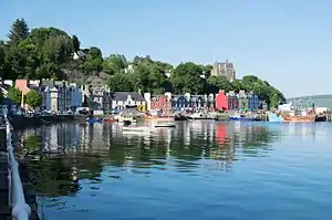
The Isle of Mull (Scottish Gaelic: An t-Eilean Muileach [əɲ ˈtʲʰelan ˈmuləx]) or just Mull (Scots pronunciation: [mʌl]; Scottish Gaelic: Muile [ˈmulə] ⓘ) is the second-largest island of the Inner Hebrides (after Skye) and lies off the west coast of Scotland in the council area of Argyll and Bute.
Covering 875.35 square kilometres (337.97 sq mi), Mull is the fourth-largest island in Scotland and Great Britain. From 2001 to 2020, the population has gradually increased: during 2020 it was estimated to be 3,000, in the 2011 census it was about 2,800, and in 2001, it was measured at 2,667 people. It has the eighth largest island population in Scotland. In the summer, these numbers are augmented by an influx of many tourists. Much of the year-round population lives in the colourful main settlement of Tobermory.
There are two distilleries on the island: the Tobermory distillery, formerly named Ledaig, produces single malt Scotch whisky and another, opened in 2019 and located in the vicinity of Tiroran, which produces Whitetail Gin. Mull is host to numerous sports competitions, notably the Highland Games competition, held annually in July. The isle is home to four castles, including the towering keep of Moy Castle. On the south coast, a stone circle is located in the settlement of Lochbuie. (Full article...) Read more ...
Selected articles 69
Portal:Scotland/Selected articles/69
.jpg.webp)
Scone Palace /ˈskuːn/ is a Category A-listed historic house near the village of Scone and the city of Perth, Scotland. Built in red sandstone with a castellated roof, it is an example of the Gothic Revival style in Scotland.
Scone was originally the site of an early Christian church, and later an Augustinian priory. Scone Abbey was severely damaged in 1559 during the Scottish Reformation after a mob whipped up by the famous reformer, John Knox, came to Scone from Dundee. Having survived the Reformation, the Abbey in 1600 became a secular Lordship (and home) within the parish of Scone, Scotland. The Palace has thus been home to the Earls of Mansfield for over 400 years. During the early 19th century the Palace was enlarged by the architect William Atkinson. In 1802, David William Murray, 3rd Earl of Mansfield, commissioned Atkinson to extend the Palace, recasting the late 16th-century Palace of Scone. The 3rd Earl tasked Atkinson with updating the old Palace whilst maintaining characteristics of the medieval Gothic abbey buildings it was built upon, with the majority of work finished by 1807. (Full article...) Read more ...
Selected articles 70
Portal:Scotland/Selected articles/70
Scotland during the Roman Empire refers to the protohistorical period during which the Roman Empire interacted within the area of modern Scotland. Despite sporadic attempts at conquest and government between the 1st and 4th centuries AD, most of modern Scotland, inhabited by the Caledonians and the Maeatae, was not incorporated into the Roman Empire with Roman control over the area fluctuating.
In the Roman imperial period, the area of Caledonia north of the River Forth, while the area now called England was known as Britannia, the name also given to the Roman province roughly consisting of modern England and Wales and which replaced the earlier Ancient Greek designation as Albion. Roman legions arrived in the territory of modern Scotland around AD 71, having conquered the Celtic Britons of southern Britannia over the preceding three decades. Aiming to complete the Roman conquest of Britannia, the Roman armies under Q. Petilius Cerialis and Gn. Julius Agricola campaigned against the Caledonians in the 70s and 80s. The Agricola, a biography of the Roman governor of Britannia by his son-in-law Tacitus mentions a Roman victory at "Mons Graupius" which became the namesake of the Grampian Mountains but whose identity has been questioned by modern scholarship. (Full article...) Read more ...
Selected articles 71
Portal:Scotland/Selected articles/71
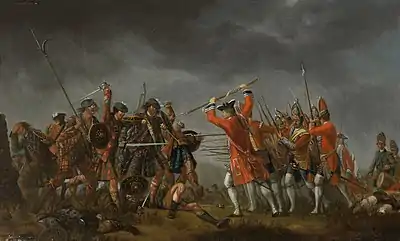
The Battle of Culloden (/kəˈlɒdən/; Scottish Gaelic: Blàr Chùil Lodair) was the final confrontation of the Jacobite rising of 1745. On 16 April 1746, the Jacobite army of Charles Edward Stuart was decisively defeated by a British government force under Prince William Augustus, Duke of Cumberland, on Drummossie Moor near Inverness in the Scottish Highlands. It was the last pitched battle fought on British soil.
Charles was the eldest son of James Stuart, the exiled Stuart claimant to the British throne. Believing there was support for a Stuart restoration in both Scotland and England, he landed in Scotland in July 1745: raising an army of Scots Jacobite supporters, he took Edinburgh by September, and defeated a British government force at Prestonpans. The government recalled 12,000 troops from the Continent to deal with the rising: a Jacobite invasion of England reached as far as Derby before turning back, having attracted relatively few English recruits.
The Jacobites, with limited French military support, attempted to consolidate their control of Scotland, where, by early 1746, they were opposed by a substantial government army. A hollow Jacobite victory at Falkirk failed to change the strategic situation: with supplies and pay running short and with the government troops resupplied and reorganised under the Duke of Cumberland, son of British monarch George II, the Jacobite leadership had few options left other than to stand and fight. The two armies eventually met at Culloden, on terrain that gave Cumberland's larger, well-rested force the advantage. The battle lasted only an hour, with the Jacobites suffering a bloody defeat; between 1,500 and 2,000 Jacobites were killed or wounded, while about 300 government soldiers were killed or wounded. While perhaps 5,000 – 6,000 Jacobites remained in arms in Scotland, the leadership took the decision to disperse, effectively ending the rising. (Full article...) Read more ...
Selected articles 72
Portal:Scotland/Selected articles/72

Islay (/ˈaɪlə/ ⓘ EYE-lə; Scottish Gaelic: Ìle, Scots: Ila) is the southernmost island of the Inner Hebrides of Scotland. Known as "The Queen of the Hebrides", it lies in Argyll just south west of Jura and around 40 kilometres (22 nautical miles) north of the Northern Irish coast. The island's capital is Bowmore where the distinctive round Kilarrow Parish Church and a distillery are located. Port Ellen is the main port.
Islay is the fifth-largest Scottish island and the eighth-largest island of the British Isles, with a total area of almost 620 square kilometres (240 sq mi). There is ample evidence of the prehistoric settlement of Islay and the first written reference may have come in the first century AD. The island had become part of the Gaelic Kingdom of Dál Riata during the Early Middle Ages before being absorbed into the Norse Kingdom of the Isles. (Full article...) Read more ...
Selected articles 73
Portal:Scotland/Selected articles/73
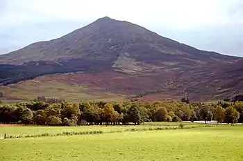
The Schiehallion experiment was an 18th-century experiment to determine the mean density of the Earth. Funded by a grant from the Royal Society, it was conducted in the summer of 1774 around the Scottish mountain of Schiehallion, Perthshire. The experiment involved measuring the tiny deflection of the vertical due to the gravitational attraction of a nearby mountain. Schiehallion was considered the ideal location after a search for candidate mountains, thanks to its isolation and almost symmetrical shape. The experiment had previously been considered, but rejected, by Isaac Newton as a practical demonstration of his theory of gravitation; however, a team of scientists, notably Nevil Maskelyne, the Astronomer Royal, was convinced that the effect would be detectable and undertook to conduct the experiment. The deflection angle depended on the relative densities and volumes of the Earth and the mountain: if the density and volume of Schiehallion could be ascertained, then so could the density of the Earth. Once this was known, it would in turn yield approximate values for those of the other planets, their moons, and the Sun, previously known only in terms of their relative ratios. (Full article...) Read more ...
Selected articles 74
Portal:Scotland/Selected articles/74
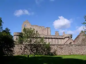
Craigmillar Castle is a ruined medieval castle in Edinburgh, Scotland. It is three miles (4.8 km) south-east of the city centre, on a low hill to the south of the modern suburb of Craigmillar. The Preston family of Craigmillar, the local feudal barons, began building the castle in the late 14th century and building works continued through the 15th and 16th centuries. In 1660, the castle was sold to Sir John Gilmour, Lord President of the Court of Session, who breathed new life into the ageing castle. The Gilmours left Craigmillar in the 18th century for a more modern residence, nearby Inch House, and the castle fell into ruin. It is now in the care of Historic Environment Scotland as a scheduled monument, and is open to the public.
Craigmillar Castle is best known for its association with Mary, Queen of Scots. Following an illness after the birth of her son, the future James VI, Mary arrived at Craigmillar on 20 November 1566 to convalesce. Before she left on 7 December 1566, a pact known as the "Craigmillar Bond" was made, with or without her knowledge, to dispose of her husband Henry Stuart, Lord Darnley. (Full article...) Read more ...
Selected articles 75
Portal:Scotland/Selected articles/75
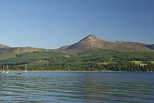
The Isle of Arran (/ˈærən/; Scots: Isle o Arran; Scottish Gaelic: Eilean Arainn) or simply Arran is an island off the west coast of Scotland. It is the largest island in the Firth of Clyde and the seventh-largest Scottish island, at 432 square kilometres (167 sq mi). Historically part of Buteshire, it is in the unitary council area of North Ayrshire. In the 2011 census it had a resident population of 4,629. Though culturally and physically similar to the Hebrides, it is separated from them by the Kintyre peninsula. Often referred to as "Scotland in Miniature", the Island is divided into highland and lowland areas by the Highland Boundary Fault and has been described as a "geologist's paradise".
Arran has been continuously inhabited since the early Neolithic period. Numerous prehistoric remains have been found. From the 6th century onwards, Goidelic-speaking peoples from Ireland colonised it and it became a centre of religious activity. In the troubled Viking Age, Arran became the property of the Norwegian crown, until formally absorbed by the kingdom of Scotland in the 13th century. The 19th-century "clearances" led to significant depopulation and the end of the Gaelic language and way of life. The economy and population have recovered in recent years, the main industry being tourism. However, the increase in tourism and people buying holiday homes on the Island, the second highest rate of such homes in the UK, has led to a shortage of affordable homes on the Island. There is a diversity of wildlife, including three species of tree endemic to the area. (Full article...) Read more ...
Selected articles 76
Portal:Scotland/Selected articles/76
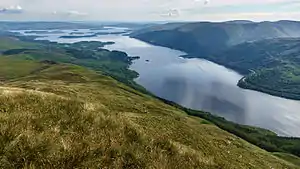
Loch Lomond (/ˈlɒx ˈloʊmənd/; Scottish Gaelic: Loch Laomainn - 'Lake of the Elms') is a freshwater Scottish loch which crosses the Highland Boundary Fault, often considered the boundary between the lowlands of Central Scotland and the Highlands. Traditionally forming part of the boundary between the counties of Stirlingshire and Dunbartonshire, Loch Lomond is split between the council areas of Stirling, Argyll and Bute and West Dunbartonshire. Its southern shores are about 23 kilometres (14 mi) northwest of the centre of Glasgow, Scotland's largest city. The Loch forms part of the Loch Lomond and The Trossachs National Park which was established in 2002.
Loch Lomond is 36.4 kilometres (22.6 mi) long and between 1 and 8 kilometres (0.62–4.97 mi) wide, with a surface area of 71 km2 (27.5 sq mi). It is the largest lake in Great Britain by surface area; in the United Kingdom, it is surpassed only by Lough Neagh and Lough Erne in Northern Ireland. In the British Isles as a whole there are several larger loughs in the Republic of Ireland. The loch has a maximum depth of about 190 metres (620 ft) in the deeper northern portion, although the southern part of the loch rarely exceeds 30 metres (98 ft) in depth. The total volume of Loch Lomond is 2.6 km3 (0.62 cu mi), making it the second largest lake in Great Britain, after Loch Ness, by water volume. (Full article...) Read more ...
Selected articles 77
Portal:Scotland/Selected articles/77
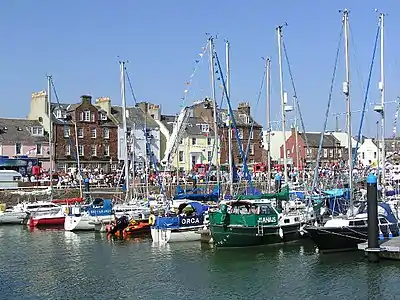
Arbroath (/ɑːrˈbroʊθ/) or Aberbrothock (Scottish Gaelic: Obar Bhrothaig [ˈopəɾ ˈvɾo.ɪkʲ]) is a former royal burgh and the largest town in the council area of Angus, Scotland, with a population of 23,902. It lies on the North Sea coast, some 16 miles (26 km) east-northeast of Dundee and 45 miles (72 km) south-southwest of Aberdeen.
There is evidence of Iron Age settlement, but its history as a town began with the founding of Arbroath Abbey in 1178. It grew much during the Industrial Revolution through the flax and then the jute industry and the engineering sector. A new harbour was created in 1839; by the 20th century, Arbroath was one of Scotland's larger fishing ports.
The town is notable for the Declaration of Arbroath and the Arbroath smokie. Arbroath Football Club holds the world record for the number of goals scored in a professional football match: 36–0 against Bon Accord of Aberdeen in the Scottish Cup in 1885. (Full article...) Read more...
Selected articles 78
Portal:Scotland/Selected articles/78
Carnoustie (/kɑːrˈnuːsti/; Scottish Gaelic: Càrn Ùstaidh) is a town and former police burgh in the council area of Angus, Scotland. It is at the mouth of the Barry Burn on the North Sea coast. In the 2011 census, Carnoustie had a population of 11,394, making it the fourth-largest town in Angus. The town was founded in the late 18th century, and grew rapidly throughout the 19th century due to the growth of the local textile industry. It was popular as a tourist resort from the early Victorian era up to the latter half of the 20th century, due to its seaside location, and is best known for the Carnoustie Golf Links course that often hosts the Open Championship.
Carnoustie can be considered a dormitory town for its nearest city, Dundee, which is 11 miles (18 kilometres) to the west. It is served principally by Carnoustie railway station, and also by Golf Street railway station. Its nearest major road is the A92, north of the town. (Full article...) Read more ...
Selected articles 79
Portal:Scotland/Selected articles/79
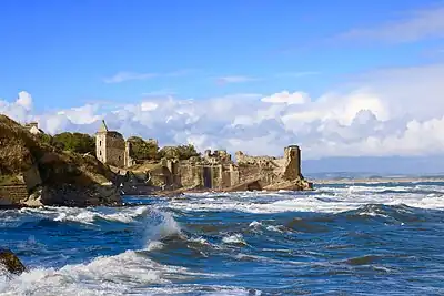
St Andrews Castle is a ruin located in the coastal Royal Burgh of St Andrews in Fife, Scotland. The castle sits on a rocky promontory overlooking a small beach called Castle Sands and the adjoining North Sea. There has been a castle standing at the site since the times of Bishop Roger (1189–1202), son of the Earl of Leicester. It housed the burgh’s wealthy and powerful bishops while St Andrews served as the ecclesiastical centre of Scotland during the years before the Protestant Reformation. In their Latin charters, the Archbishops of St Andrews wrote of the castle as their palace, signing, "apud Palatium nostrum."
The castle's grounds are now maintained by Historic Environment Scotland as a scheduled monument. The site is entered through a visitor centre with displays on its history. Some of the best surviving carved fragments from the castle are displayed in the centre, which also has a shop. (Full article...) Read more...
Selected articles 80
Portal:Scotland/Selected articles/80
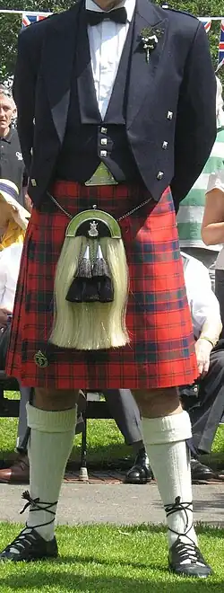
A kilt (Scottish Gaelic: fèileadh [ˈfeːləɣ]; Irish: féileadh) is a garment resembling a wrap-around knee-length skirt, made of twill-woven worsted wool with heavy pleats at the sides and back and traditionally a tartan pattern. Originating in the Scottish Highland dress for men, it is first recorded in the 16th century as the great kilt, a full-length garment whose upper half could be worn as a cloak. The small kilt or modern kilt emerged in the 18th century, and is essentially the bottom half of the great kilt. Since the 19th century, it has become associated with the wider culture of Scotland, and more broadly with Gaelic or Celtic heritage.
Although the kilt is most often worn by men on formal occasions and at Highland games and other sports events, it has also been adapted as an item of informal male clothing, returning to its roots as an everyday garment. Kilts are now made for casual wear in a variety of materials. Alternative fastenings may be used and pockets inserted to avoid the need for a sporran. Kilts have also been adopted as female wear for some sports. (Full article...) Read more ...
Selected articles 81
Portal:Scotland/Selected articles/81
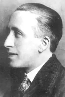
The Scottish Renaissance (Scottish Gaelic: Ath-bheòthachadh na h-Alba; Scots: Scots Renaissance) was a mainly literary movement of the early to mid-20th century that can be seen as the Scottish version of modernism. It is sometimes referred to as the Scottish literary renaissance, although its influence went beyond literature into music, visual arts, and politics (among other fields). The writers and artists of the Scottish Renaissance displayed a profound interest in both modern philosophy and technology, as well as incorporating folk influences, and a strong concern for the fate of Scotland's declining languages.
It has been seen as a parallel to other movements elsewhere, including the Irish Literary Revival, the Harlem Renaissance (in America), the Bengal Renaissance (in Kolkata, India) and the Jindyworobak Movement (in Australia), which emphasised indigenous folk traditions. (Full article...) Read more ...
Selected articles 82
Portal:Scotland/Selected articles/82
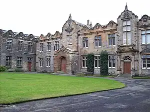
The University of St Andrews (Scots: University o St Andras, Scottish Gaelic: Oilthigh Chill Rìmhinn; abbreviated as St And, from the Latin Sancti Andreae, in post-nominals) is a public university in St Andrews, Scotland. It is the oldest of the four ancient universities of Scotland and, following the universities of Oxford and Cambridge, the third-oldest university in the English-speaking world. St Andrews was founded in 1413 when the Avignon Antipope Benedict XIII issued a papal bull to a small founding group of Augustinian clergy. Along with the universities of Glasgow, Aberdeen, and Edinburgh, St Andrews was part of the Scottish Enlightenment during the 18th century.
St Andrews is made up of a variety of institutions, comprising three colleges — United College (a union of St Salvator's and St Leonard's Colleges), St Mary's College, and St Leonard's College, the last named being a non-statutory revival of St Leonard's as a post-graduate society. There are 18 academic schools organised into four faculties. The university occupies historic and modern buildings located throughout the town. The academic year is divided into two semesters, Martinmas and Candlemas. In term time, over one-third of the town's population are either staff members or students of the university. The student body is known for preserving ancient traditions such as Raisin Weekend, May Dip, and the wearing of distinctive academic dress. (Full article...) Read more ...
Selected articles 83
Portal:Scotland/Selected articles/83
There have been several town walls around Edinburgh, Scotland, since the 12th century. Some form of wall probably existed from the foundation of the royal burgh in around 1125, though the first building is recorded in the mid-15th century, when the King's Wall was constructed. In the 16th century the more extensive Flodden Wall was erected, following the Scots' defeat at the Battle of Flodden in 1513. This was extended by the Telfer Wall in the early 17th century. The walls had a number of gates, known as ports, the most important being the Netherbow Port, which stood halfway down what is now the Royal Mile. This gave access from the Canongate which was, at that time, a separate burgh.
The walls never proved very successful as defensive structures, and were easily breached on more than one occasion. They served more as a means of controlling trade and taxing goods, and as a deterrent to smugglers. By the mid 18th century, the walls had outlived both their defensive and trade purposes, and demolition of sections of the wall began. The Netherbow Port was pulled down in 1764, and demolition continued into the 19th century. Today, a number of sections of the three successive walls survive, although none of the ports remain. (Full article...) Read more ...
Selected articles 84
Portal:Scotland/Selected articles/84
The Royal Banner of the Royal Arms of Scotland, also known as the Royal Banner of Scotland, or more commonly the Lion Rampant of Scotland, and historically as the Royal Standard of Scotland, (Scottish Gaelic: Bratach rìoghail na h-Alba, Scots: Ryal banner o Scotland) or Banner of the King of Scots, is the royal banner of Scotland, and historically, the royal standard of the Kingdom of Scotland. Used historically by the Scottish monarchs, the banner differs from Scotland's national flag, the Saltire, in that its official use is restricted by an Act of the Parliament of Scotland to only a few Great Officers of State who officially represent the Monarchy in Scotland. It is also used in an official capacity at royal residences in Scotland when the Head of State is not present.
The earliest recorded use of the Lion Rampant as a royal emblem in Scotland was by Alexander II in 1222; with the additional embellishment of a double border set with lilies occurring during the reign of Alexander III (1249–1286). This emblem occupied the shield of the royal coat of arms of the ancient Kingdom of Scotland which, together with a royal banner displaying the same, was used by the King of Scots until the Union of the Crowns in 1603, when James VI acceded to the thrones of the kingdoms of England and Ireland. Since 1603, the lion rampant of Scotland has been incorporated into both the royal arms and royal banners of successive Scottish then British monarchs in order to symbolise Scotland, as can be seen today in the Royal Standard of the United Kingdom. Although now officially restricted to use by representatives of the Monarch and at royal residences, the Royal Banner continues to be one of Scotland's most recognisable symbols. (Full article...) Read more ...
Selected articles 85
Portal:Scotland/Selected articles/85

The Queen Mary, historically RMS Queen Mary, is a retired British ocean liner that sailed primarily on the North Atlantic Ocean from 1936 to 1967 for the Cunard-White Star Line and was built by John Brown & Company in Clydebank, Scotland. Queen Mary, along with RMS Queen Elizabeth, was built as part of Cunard's planned two-ship weekly express service between Southampton, Cherbourg and New York. The two ships were a British response to the express superliners built by German, Italian and French companies in the late 1920s and early 1930s.
Queen Mary sailed on her maiden voyage on 27 May 1936 and won the Blue Riband that August; she lost the title to SS Normandie in 1937 and recaptured it in 1938, holding it until 1952, when it was taken by the new SS United States. With the outbreak of World War II, she was converted into a troopship and ferried Allied soldiers during the conflict. (Full article...) Read more ...
Selected articles 86
Portal:Scotland/Selected articles/86
The Kingdom of Scotland (Scottish Gaelic: Rìoghachd na h-Alba; Scots: Kinrick o Scotland, Norn: Kongungdum Skotland) was a sovereign state in northwest Europe traditionally said to have been founded in 843. Its territories expanded and shrank, but it came to occupy the northern third of the island of Great Britain, sharing a land border to the south with the Kingdom of England. During the Middle Ages, Scotland engaged in intermittent conflict with England, most prominently the Wars of Scottish Independence, which saw the Scots assert their independence from the English. Following the annexation of the Hebrides and the Northern Isles from Norway in 1266 and 1472 respectively, and the capture of Berwick by England in 1482, the territory of the Kingdom of Scotland corresponded to that of modern-day Scotland, bounded by the North Sea to the east, the Atlantic Ocean to the north and west, and the North Channel and Irish Sea to the southwest. In 1603, James VI of Scotland became King of England, joining Scotland with England in a personal union. In 1707, during the reign of Queen Anne, the two kingdoms were united to form the Kingdom of Great Britain under the terms of the Acts of Union.
The Crown was the most important element of Scotland's government. The Scottish monarchy in the Middle Ages was a largely itinerant institution, before Edinburgh developed as a capital city in the second half of the 15th century. The Crown remained at the centre of political life and in the 16th century emerged as a major centre of display and artistic patronage, until it was effectively dissolved with the 1603 Union of Crowns. The Scottish Crown adopted the conventional offices of western European monarchical states of the time and developed a Privy Council and great offices of state. Parliament also emerged as a major legal institution, gaining an oversight of taxation and policy, but was never as central to the national life. In the early period, the kings of the Scots depended on the great lords—the mormaers and toísechs—but from the reign of David I, sheriffdoms were introduced, which allowed more direct control and gradually limited the power of the major lordships. In the 17th century, the creation of Justices of Peace and Commissioners of Supply helped to increase the effectiveness of local government. The continued existence of courts baron and the introduction of kirk sessions helped consolidate the power of local lairds. (Full article...) Read more...