Portal:Mountains
| |
|
|
Introduction

A mountain is an elevated portion of the Earth's crust, generally with steep sides that show significant exposed bedrock. Although definitions vary, a mountain may differ from a plateau in having a limited summit area, and is usually higher than a hill, typically rising at least 300 metres (980 ft) above the surrounding land. A few mountains are isolated summits, but most occur in mountain ranges.
Mountains are formed through tectonic forces, erosion, or volcanism, which act on time scales of up to tens of millions of years. Once mountain building ceases, mountains are slowly leveled through the action of weathering, through slumping and other forms of mass wasting, as well as through erosion by rivers and glaciers.
High elevations on mountains produce colder climates than at sea level at similar latitude. These colder climates strongly affect the ecosystems of mountains: different elevations have different plants and animals. Because of the less hospitable terrain and climate, mountains tend to be used less for agriculture and more for resource extraction, such as mining and logging, along with recreation, such as mountain climbing and skiing.
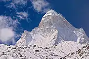
The highest mountain on Earth is Mount Everest in the Himalayas of Asia, whose summit is 8,850 m (29,035 ft) above mean sea level. The highest known mountain on any planet in the Solar System is Olympus Mons on Mars at 21,171 m (69,459 ft). (Full article...)
Selected mountain-related landform

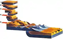
A kame, or knob, is a glacial landform, an irregularly shaped hill or mound composed of sand, gravel and till that accumulates in a depression on a retreating glacier, and is then deposited on the land surface with further melting of the glacier. Kames are often associated with kettles, and this is referred to as kame and kettle or knob and kettle topography. The word kame is a variant of comb (kame, or kaim is the Old Scottish word for comb), which has the meaning "crest" among others. The geological term was introduced by Thomas Jamieson in 1874.
According to White, "kames were formed by meltwater which deposited more or less washed material at irregular places in and along melting ice. At places the material is very well washed and stratified; at others it is more poorly washed, with inclusions of till masses that fell from ice but were covered before they were completely washed. Kame gravels thus tend to be variable and range from fine to coarse grained and even to cobbly and boulder." (Full article...)
Selected mountain range
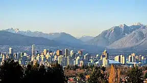
The North Shore Mountains are a mountain range overlooking Vancouver in British Columbia, Canada. Their southernmost peaks are visible from most areas in Vancouver and form a distinctive backdrop for the city.
The steep southern slopes of the North Shore Mountains limit the extent to which the municipalities of Metro Vancouver's North Shore (West Vancouver, the District of North Vancouver, the City of North Vancouver and the Village of Lions Bay) can grow. In many places on the North Shore, residential neighbourhoods abruptly end and rugged forested slopes begin. These forested slopes are crisscrossed by a large network of trails including the Baden-Powell Trail, the Howe Sound Crest Trail, the Binkert/Lions Trail and a wide variety of mountain biking trails. (Full article...)
Selected mountain type
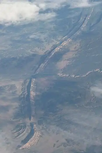
In geology and geomorphology, a hogback or hog's back is a long, narrow ridge or a series of hills with a narrow crest and steep slopes of nearly equal inclination on both flanks. Typically, the term is restricted to a ridge created by the differential erosion of outcropping, steeply dipping (greater than 30–40°), homoclinal, and typically sedimentary strata. One side of a hogback (its backslope) consists of the surface (bedding plane) of a steeply dipping rock stratum called a dip slope. The other side (its escarpment, frontslope or "scarp slope") is an erosion face that cuts through the dipping strata that comprises the hogback. The name "hogback" comes from the Hog's Back of the North Downs in Surrey, England, which refers to the landform's resemblance in outline to the back of a hog. The term is also sometimes applied to drumlins and, in Maine, to both eskers and ridges known as "horsebacks".
Hogbacks are a typical regional topographic expression of outcrops of steeply dipping strata, commonly sedimentary strata, that consist of alternating beds of hard, well-lithified strata, i.e. sandstone and limestone, and either weak or loosely cemented strata, i.e. shale, mudstone, and marl. The surface of a hard, erosion-resistant layer forms the back slope (dip-slope) of the hogback where weaker strata have been preferentially stripped off of it by erosion. The opposite slope that forms the front of a hogback, which is its escarpment or scarp, consists of a slope that cuts across the bedding of the strata. Because of the steeply dipping nature of the strata that forms a hogback, a slight shift in location may take place as the landscape is lowered by erosion, but it will be a matter of feet rather than miles, as might happen with cuestas. (Full article...)
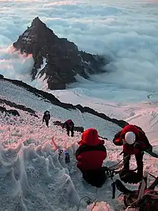
Selected climbing article
_(cropped).jpg.webp)
Glissading is the act of descending a steep snow- or scree-covered slope via a controlled slide on one's feet or buttocks. It is an alternative to other descent methods such as plunge stepping, and may be used to expedite a descent, or simply for the thrill. Glissading involves higher risks of injuries than other forms of descending. Glissading with crampons is especially dangerous and should never be attempted. (Full article...)
Related portals
General images
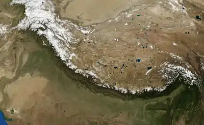
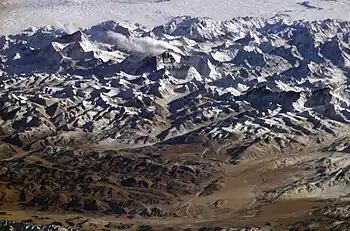 The Himalayas, the highest mountain range on Earth, seen from space (from Mountain range)
 This 1848 "Sketch showing the actual elevation of the Snow Line in different Latitudes" by Alexander Keith Johnston shows the snow lines of mountains in America, Europe and Asia (from Snow line)
 The Ocean Ridge, the world's longest mountain range (chain) (from Mountain range)
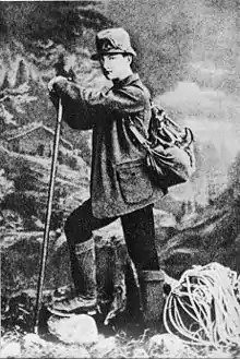
.jpg.webp) Mountaineers, c. 1900 (from Mountaineering)
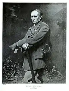
Mountaineers, c. 1900 (from Mountaineering)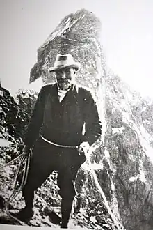 British mountaineer William Cecil Slingsby became known as the father of Norwegian mountaineering and contributed greatly to its popularization with his classic book Norway, the Northern Playground (from Mountaineering)
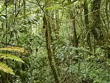
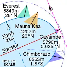 Everest is highest from sea level (green), Mauna Kea is highest from its base (orange), Cayambe is farthest from Earth's axis (pink) and Chimborazo is farthest from Earth's centre (blue) (from Mountain)
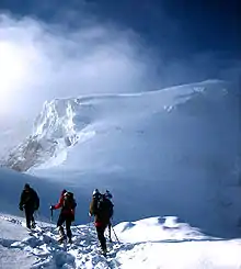
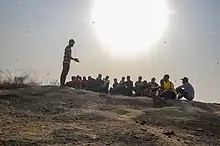 Mountain hikers on the mountain (from Mountaineering)
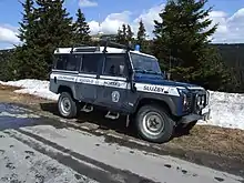 Car of Horská služba (Czech Republic) (from Mountain rescue)
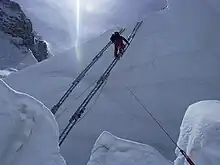 Fixed lines and ladders are distinguishing characteristics of expedition style mountaineering. (from Mountaineering)
 The northern Urals at high latitude and elevation have an alpine climate and barren ground. (from Mountain)
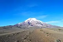
 Mountaineers proceed across snow fields on South Tyrol; other climbers are visible further up the slopes. (from Mountaineering)
 Edelweiss, a plant associated with mountain sports (from Mountaineering)
- Mountaineers climbing in South Tyrol (from Mountain)
.jpg.webp) Iranian oak scrub in the Zagros Mountains (from Montane ecosystems)
Iranian oak scrub in the Zagros Mountains (from Montane ecosystems) Stretcher box in Cumbria, England, prepositioned equipment saves mountain rescue teams having to trudge up mountains with it. (from Mountain rescue)
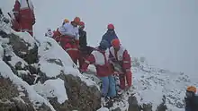 A mountain rescue team in Iran moving a casualty. (from Mountain rescue)
 Choppering out the injured – with Mt. Forbes in the background (from Mountain rescue)
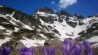
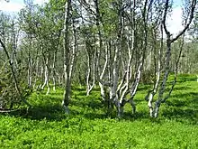 A stand of mountain birch at around 750 m in Trollheimen, typical of Scandinavian subalpine forests (from Montane ecosystems)
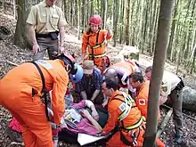 Mountain rescue team members and other services attend to a casualty in Freiburg Germany. (from Mountain rescue)
- Mount Everest, Earth's highest mountain (from Mountain)
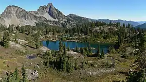
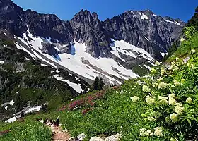 Alpine flora near Cascade Pass (from Montane ecosystems)
 Antique climbing tools (from Mountaineering)
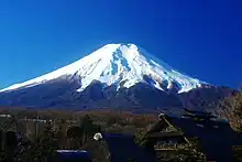 Fuji volcano (from Mountain)
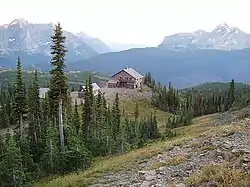 Granite Park Chalet in Glacier National Park, US (from Mountaineering)
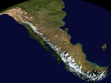 The Andes, the longest mountain range on the surface of the Earth, have a dramatic impact on the climate of South America (from Mountain range)
 A climber taking the final few steps to the 6,160 m (20,210 ft) summit of Imja Tse (Island Peak) in Nepal, 2004 (from Mountaineering)
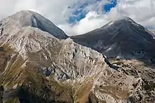
Selected skiing article
A ski area is the terrain and supporting infrastructure where skiing and other snow sports take place. Such sports include alpine and cross-country skiing, snow boarding, tubing, sledding, etc. Ski areas may stand alone or be part of a ski resort. (Full article...)
Subcategories
Need help?
Do you have a question about Mountains that you can't find the answer to? Consider asking it at the Wikipedia reference desk.
Get involved
For editor resources and to collaborate with other editors on improving Wikipedia's Mountains-related articles, see WikiProject Mountains.
Topics
- Africa: Atlas • Kilimanjaro • Mount Kenya massif • Ruwenzori Mountains
- America: Andes • Appalachians • Cascades • Cordilleras • Rockies • Sierra Nevada
- Antarctica: Sentinel Range
- Asia: Altai • Himalaya • Hindu Kush • Caucasus • Karakoram • Pamir
- Australia and Oceania: Maoke Mountains • New Zealand Alps • Snowy Mountains
- Europe: Alps • Ardennes • Balkans • Highlands • Jura • Carpathians • Pyrenees • Scandinavian Mountains • Urals • Vosges
- Alps: Piz Badile • Mont Blanc • Petit Dru • Dufourspitze • Eiger • Großglockner • Grandes Jorasses • Jungfrau • Königspitze • Matterhorn • Mönch • Ortler • Watzmann • Drei Zinnen • Zugspitze
- Andes: Aconcagua • Alpamayo • Chimborazo • Cotopaxi • Fitz Roy • Nevado Huascarán • Illimani • Sajama • Ojos del Salado • Siula Grande • Cerro Torre • Yerupaja
- Himalayas: Eight-thousanders – Mount Everest • K2 • Kangchenjunga • Lhotse • Makalu • Cho Oyu • Dhaulagiri • Manaslu • Nanga Parbat • Annapurna I • Hidden Peak • Broad Peak • Gasherbrum II • Shishapangma – Other – Ama Dablam • Chogolisa • Masherbrum • Shivling
- Rocky Mountains: Mount Chephren • Mount Elbert • Mount Logan • Denali • Mount Robson
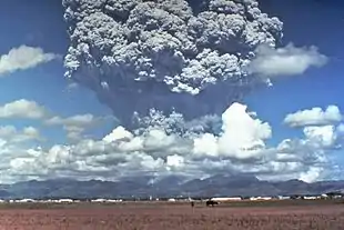
- Volcanos: Etna • Eldfell • Hohentwiel • Mauna Kea • Pinatubo • Puʻu ʻŌʻō • Mount St. Helens • Stromboli • Mount Unzen
Flora and fauna
- Plants: Alpine Rock-Jasmine • Hairy Alpenrose • Edelweiss • Great Yellow Gentian • Glacier Crowfoot • Wulfenia • Dwarf Willow • Queen of the Andes • Arolla Pine
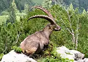
- Animals: Red-billed Chough • Alpine marmot • Alpine Salamander • Rock Ptarmigan • Alpine Ibex • Andean Condor • Bearded Vulture • Alpine Chough • Chamois • Mountain Burnet • European Viper • Himalayan Tahr • Wallcreeper • White-winged Snowfinch • Golden Eagle • Northern Bald Ibis • Yak

- Equipment: Ascenders • Belay devices • Carabiners • Maillons • Harnesses • Hexes • Nuts • Quickdraws • Ropes • Shoes • SLCDs • Slings • Tricams
- Techniques: Abseiling • Redpointing • Anchor • Mantle • Top roping • Climbing grade • Climbing route
- Types of climbing: Big wall climbing • Bouldering • Competition climbing • Free climbing • Ice climbing • Mountain climbing • Rock climbing • Schrofen • Sport climbing
- Klettersteigs: Mannlgrat
- Climbers: Kurt Albert • Pierre Allain •John Bachar • Henry Barber • Catherine Destivelle • Patrick Edlinger • John Gill • Stefan Glowacz • Wolfgang Güllich • Lynn Hill • Alex Honnold • Alexander Huber • John Long • Jeff Lowe • Magnus Midtbø • Adam Ondra • Dean Potter • Alain Robert • Chris Sharma • Todd Skinner • Ueli Steck • Other climbers
- Mountaineering: Alpine Clubs • Boots • Crampons • Ice axes • Mountain huts • Mountain rescue • Ropes • Rucksacks
- Pioneers: Christian Almer • Melchior Anderegg • Hermann von Barth • Walter Bonatti • Meta Brevoort • William Martin Conway • Angelo Dibona • Hans Dülfer • Paul Grohmann • Adolphus Warburton Moore • Paul Preuss • Ludwig Purtscheller • Schlagintweit brothers • Leslie Stephen • Gottlieb Samuel Studer • Tenzig Norgay • Herbert Tichy • Lucy Walker • Edward Whymper • Georg Winkler • Matthias Zurbriggen
- High-altitude mountaineers: Chris Bonington • Hermann Buhl • Kurt Diemberger • Ralf Dujmovits • Günther Dyhrenfurth • Maurice Herzog • Sir Edmund Hillary • Sandy Irvine • Gerlinde Kaltenbrunner • George Mallory • Nives Meroi • Reinhold Messner • Simone Moro • Oh Eun-sun • Edurne Pasaban • Wanda Rutkiewicz • Lionel Terray • Um Hong-Gil • Stephen Venables • Ed Viesturs • Other mountaineers
- Publicists: Karl Blodig • W. A. B. Coolidge • David Breashears • Jon Krakauer • Gaston Rébuffat
- Alps: Eiger climbing history • Exploration of the High Alps • Golden age of alpinism • Silver age of alpinism • Timeline of climbing the Matterhorn
- Himalayas: 1922 British Mount Everest expedition • 1924 British Mount Everest expedition • 1953 British Mount Everest expedition • 1986 K2 disaster • 1996 Mount Everest disaster • 2008 K2 disaster • Timeline of climbing Mount Everest
- Museums: Alpine Club Museum • Messner Mountain Museum
Lists of mountains
Recognized content
- Featured content
- Good content
 Amak Volcano
- Ben Nevis
- Gerlachovský štít
- Glacier Peak
- Hualālai
- Huangshan
- Kohala (mountain)
- Mont Aiguille
- Mont Blanc massif
- Montpelier Hill
- Mount Adams (Washington)
- Mount Bailey (Oregon)
- Mount Baker
- Mount Cleveland (Alaska)
- Mount Edziza volcanic complex
- Mount Elbert
- Mount Garibaldi
- Mount Hood
- Mount Kenya
- Mount Rainier
- Mount Redoubt
- Mount Tehama
- Mount Thielsen
- Mount Vesuvius
- Pinkham Notch
- Roxy Ann Peak
- Silverthrone Caldera
- Snowdon
- Wells Gray-Clearwater volcanic field
- Wilkins Peak
- Yamsay Mountain
Associated Wikimedia
The following Wikimedia Foundation sister projects provide more on this subject:
-
 Commons
Free media repository -
 Wikibooks
Free textbooks and manuals -
 Wikidata
Free knowledge base -
 Wikinews
Free-content news -
 Wikiquote
Collection of quotations -
 Wikisource
Free-content library -
 Wikiversity
Free learning tools -
 Wikivoyage
Free travel guide -
 Wiktionary
Dictionary and thesaurus