Perseverance, Queensland
Perseverance is a rural locality in the Toowoomba Region, Queensland, Australia.[2] In the 2016 census, Perseverance had a population of 62 people.[1]
| Perseverance Queensland | |||||||||||||||
|---|---|---|---|---|---|---|---|---|---|---|---|---|---|---|---|
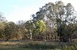
 Paddocks, 2014 | |||||||||||||||
 Perseverance | |||||||||||||||
| Coordinates | 27.3694°S 152.1030°E | ||||||||||||||
| Population | 62 (2016 census)[1] | ||||||||||||||
| • Density | 5.44/km2 (14.09/sq mi) | ||||||||||||||
| Postcode(s) | 4352 | ||||||||||||||
| Area | 11.4 km2 (4.4 sq mi) | ||||||||||||||
| Time zone | AEST (UTC+10:00) | ||||||||||||||
| LGA(s) | Toowoomba Region | ||||||||||||||
| State electorate(s) | Condamine | ||||||||||||||
| Federal division(s) | Maranoa | ||||||||||||||
| |||||||||||||||
Geography
Perseverance is on the Darling Downs in southern Queensland.
The locality is crossed from east to west by the Esk–Hampton Road. Upper Creekbrook Creek forms part of the eastern boundary of Perseverance.
History
Perseverance Creek Provisional School opened on 10 November 1880. On 1 January 1909 it became Perseverance Creek State School. It closed briefly in 1925 to 1926 due to low student numbers. It permanently closed in 1944.[3]
In 1914 land was purchased by the Methodists with the intention to build a church.[4]
References
- Australian Bureau of Statistics (27 June 2017). "Perseverance (SSC)". 2016 Census QuickStats. Retrieved 20 October 2018.
- "Perseverance – locality in Toowoomba Region (entry 49254)". Queensland Place Names. Queensland Government. Retrieved 17 November 2019.
- Queensland Family History Society (2010), Queensland schools past and present (Version 1.01 ed.), Queensland Family History Society, ISBN 978-1-921171-26-0
- "METHODIST SYNODS". The Brisbane Courier. No. 17, 721. Queensland, Australia. 31 October 1914. p. 16. Retrieved 10 September 2021 – via National Library of Australia.
This article is issued from Wikipedia. The text is licensed under Creative Commons - Attribution - Sharealike. Additional terms may apply for the media files.