Pelham, Georgia
Pelham is a city in Mitchell County, Georgia, United States. The population was 3,507 at the 2020 census,[2] down from 3,898 in 2010. Pelham is well known for its agriculture, with vast farming of cotton and pecans in the area.[5]
Pelham, Georgia | |
|---|---|
 Pelham City Hall | |
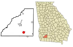 Location in Mitchell County and the state of Georgia | |
| Coordinates: 31°7′36″N 84°9′10″W | |
| Country | United States |
| State | Georgia |
| County | Mitchell |
| Government | |
| • Mayor | James T. Eubanks |
| • City Manager | Craig M. Bennett |
| Area | |
| • Total | 4.08 sq mi (10.56 km2) |
| • Land | 4.08 sq mi (10.56 km2) |
| • Water | 0.00 sq mi (0.00 km2) |
| Elevation | 361 ft (110 m) |
| Population | |
| • Total | 3,507 |
| • Density | 859.98/sq mi (332.08/km2) |
| Time zone | UTC-5 (Eastern (EST)) |
| • Summer (DST) | UTC-4 (EDT) |
| ZIP code | 31779 |
| Area code | 229 |
| FIPS code | 13-59976[3] |
| GNIS feature ID | 0320347[4] |
| Website | cityofpelhamga |
History
Pelham was incorporated in 1881 and named in honor of Confederate officer John Pelham,[6] who was born to a family of slave owners in northeastern Alabama in 1838.[7]
Geography and climate
Pelham is in southeastern Mitchell County at 31°7′36″N 84°9′10″W (31.126629, -84.152703),[8] sitting at the crossroads of US 19 and State Route 93. U.S. 19 passes through the east side of the city and leads northwest 8 miles (13 km) to Camilla, the county seat, and southeast 25 miles (40 km) to Thomasville. State Route 93 passes through the center of town, leading northeast 14 miles (23 km) to Sale City and south 19 miles (31 km) to Cairo, while State Route 65 leads west from Pelham 14 miles (23 km) to Hopeful.
According to the United States Census Bureau, Pelham has a total area of 4.1 square miles (11 km2), all of it recorded as land.[1]
Pelham has a humid subtropical climate, characterized by humid summers and mild winters. It receives an average of 52 inches (1,300 mm) of rain per year. The average number of days with any measurable precipitation is 90. Pelham has on average 233 sunny days per year. The July high is around 93 °F (34 °C), while the January low is 39 °F (4 °C).
Demographics
| Census | Pop. | Note | %± |
|---|---|---|---|
| 1880 | 168 | — | |
| 1890 | 385 | 129.2% | |
| 1900 | 945 | 145.5% | |
| 1910 | 1,880 | 98.9% | |
| 1920 | 2,640 | 40.4% | |
| 1930 | 2,762 | 4.6% | |
| 1940 | 2,579 | −6.6% | |
| 1950 | 4,365 | 69.3% | |
| 1960 | 4,609 | 5.6% | |
| 1970 | 4,539 | −1.5% | |
| 1980 | 4,306 | −5.1% | |
| 1990 | 3,869 | −10.1% | |
| 2000 | 4,126 | 6.6% | |
| 2010 | 3,898 | −5.5% | |
| 2020 | 3,507 | −10.0% | |
| U.S. Decennial Census[9] | |||
2020 census
| Race | Num. | Perc. |
|---|---|---|
| White (non-Hispanic) | 1,174 | 33.48% |
| Black or African American (non-Hispanic) | 2,082 | 59.37% |
| Native American | 6 | 0.17% |
| Asian | 16 | 0.46% |
| Other/Mixed | 111 | 3.17% |
| Hispanic or Latino | 118 | 3.36% |
As of the 2020 United States census, there were 3,507 people, 1,325 households, and 857 families residing in the city.
2000 census
As of the census[3] of 2000, there were 4,126 people, 1,467 households and 999 families in the city. The population density was 1,019.2 inhabitants per square mile (393.5/km2). There were 1,591 housing units at an average density of 393.0 per square mile (151.7/km2). The racial makeup of the city was 56.13% African American, 41.66% White, 0.24% Native American, 0.46% Asian, 0.02% Pacific Islander, 0.78% from other races, and 0.70% from two or more races. Hispanic or Latino of any race were 1.43% of the population.
There were 1,467 households, out of which 33.9% had children younger than 18 living with them, 35.2% were married couples living together, 28.4% had a female householder with no husband present, and 31.9% were non-families. 28.8% of all households were made up of individuals, and 14.7% had someone living alone who was 65 years of age or older. The average household size was 2.60 and the average family size was 3.21.
In the city, the population was spread out, with 32.1% younger than 18, 9.8% from 18 to 24, 23.1% from 25 to 44, 18.2% from 45 to 64, and 16.7% who were 65 or older. The median age was 33 years. For every 100 females, there were 90.0 males. For every 100 females age 18 and older, there were 72.8 males.
The median income for a household in the city was $20,040, and the median income for a family was $24,968. Males had a median income of $21,476 versus $17,161 for females. The per capita income for the city was $10,703. About 29.6% of families and 33.6% of the population were below the poverty line, including 47.0% of those younger than 18 and 19.5% of those age 65 or older.
Education
The Pelham City School District holds pre-school to grade 12, and consists of one elementary school, a middle school and a high school.[11] The district has 101 full-time teachers and over 1,627 students.[12]
- Pelham Elementary School
- Pelham City Middle School
- Pelham High School
Notable people
- Donnie Cochran, former commander of the Blue Angels Precision Air team and first black member
- Don Griffin, two-time Super Bowl winner with San Francisco 49'ers
References
- "2022 U.S. Gazetteer Files: Georgia". United States Census Bureau. Retrieved January 27, 2023.
- "P1. Race – Pelham city, Georgia: 2020 DEC Redistricting Data (PL 94-171)". U.S. Census Bureau. Retrieved January 27, 2023.
- "U.S. Census website". United States Census Bureau. Retrieved January 31, 2008.
- "US Board on Geographic Names". United States Geological Survey. October 25, 2007. Retrieved January 31, 2008.
- "Mitchell County Georgia". www.mitchellcountyga.net. Retrieved January 15, 2016.
- "Pelham". New Georgia Encyclopedia. Retrieved May 18, 2019.
- "The Gallant Pelham". New York Times. April 2013. Retrieved February 14, 2022.
- "US Gazetteer files: 2010, 2000, and 1990". United States Census Bureau. February 12, 2011. Retrieved April 23, 2011.
- "Census of Population and Housing". Census.gov. Retrieved June 4, 2015.
- "Explore Census Data". data.census.gov. Retrieved December 18, 2021.
- Georgia Board of Education, Retrieved June 24, 2010.
- School Stats, Retrieved June 24, 2010.
Municipalities and communities of Mitchell County, Georgia, United States | ||
|---|---|---|
| Cities | 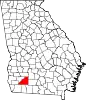 Map of Georgia highlighting Mitchell County | |
| Town | ||
| Unincorporated communities | ||
| Footnotes | ‡This populated place also has portions in an adjacent county or counties | |