Pardis County
Pardis County (Persian: شهرستان پردیس) is in Tehran province, Iran. Its capital is the city of Pardis.
Pardis County
Persian: شهرستان پردیس | |
|---|---|
County | |
.svg.png.webp) Location of Pardis County in Tehran province | |
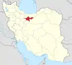
 Location of Tehran province in Iran | |
| Coordinates: 35°41′N 51°49′E[1] | |
| Country | Iran |
| Province | Tehran |
| Capital | Pardis |
| Districts | Central, Bumehen, Jajrud |
| Area | |
| • Total | 276 km2 (107 sq mi) |
| Population (2016)[2] | |
| • Total | 169,060 |
| • Density | 610/km2 (1,600/sq mi) |
| Time zone | UTC+3:30 (IRST) |
| Pardis County can be found at GEOnet Names Server, at this link, by opening the Advanced Search box, entering "9205934" in the "Unique Feature Id" form, and clicking on "Search Database". | |
At the 2006 and 2011 National Censuses, the region's population was a part of the Central District of Tehran County)[3][4] Bumahen, Pardis, and most of Siyahrud Rural District separated from Tehran County on 29 December 2012 to establish Pardis County.[5][6][7] At the 2016 census, the new county's population was 169,060 in 53,367 households.[2] In the south of the county around 5km to Bumehen is the Technology Park, where various R&D institutes and banking companies are located.
Administrative divisions
The population history and structural changes of Pardis County's administrative divisions over three consecutive censuses are shown in the following table. The latest census shows two districts, four rural districts, and two cities.[2]
| Administrative Divisions | 2006[3] | 2011[4] | 2016[2] |
|---|---|---|---|
| Central District2 | |||
| Bagh-e Komesh Rural District2 | |||
| Karasht Rural District | |||
| Pardis (city) | |||
| Bumehen District | 159,184 | ||
| Gol Khandan Rural District | 1,550 | ||
| Karasht Rural District | 5,237 | ||
| Taherabad Rural District2 | |||
| Bumehen (city) | 43,004 | 53,451 | 79,034 |
| Pardis (city) | 25,360 | 37,257 | 73,363 |
| Jajrud District | 9,864 | ||
| Jajrud Rural District | 2,264 | ||
| Saidabad Rural District | 7,600 | ||
| Khosrowabad2 (city) | |||
| Saidabad-e Jajrud2 (city) | |||
| Total | 169,060 | ||
| 1As a part of Tehran County at the 2006 and 2011 censuses 2Established after the 2016 census[8] | |||
References
- OpenStreetMap contributors (5 April 2023). "Pardis County" (Map). OpenStreetMap. Retrieved 5 April 2023.
- "Census of the Islamic Republic of Iran, 1395 (2016)". AMAR (in Persian). The Statistical Center of Iran. p. 23. Archived from the original (Excel) on 12 December 2021. Retrieved 19 December 2022.
- "Census of the Islamic Republic of Iran, 1385 (2006)". AMAR (in Persian). The Statistical Center of Iran. p. 23. Archived from the original (Excel) on 20 September 2011. Retrieved 25 September 2022.
- "Census of the Islamic Republic of Iran, 1390 (2011)" (Excel). Iran Data Portal (in Persian). The Statistical Center of Iran. p. 23. Retrieved 19 December 2022.
- تصویبنامه درخصوص تقسیمات کشوری در استان تهران شماره ۱۹۷۲۱۰/ت۴۶۵۹۰هـ
- "Governor of Tehran: It became a city campus". Dolat (in Persian). Archived from the original on 14 March 2013. Retrieved 14 March 2023.
- "Pardis County". Pardis (in Persian). Archived from the original on 3 July 2015. Retrieved 14 March 2023.
The campus became the 15th county of Tehran province
- "Approval letter regarding some country divisions in Pardis County of Tehran province". Laws and Regulations Portal of Iran (in Persian). Board of Ministers. Archived from the original on 19 April 2021. Retrieved 14 March 2023.
