Pachitea Province
The Pachitea Province is one of eleven provinces of the Huánuco Region in Peru. The capital of this province is Panao.
Pachitea | |
|---|---|
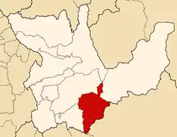 Location of Pachitea in the Huánuco Region | |
| Country | Peru |
| Region | Huánuco |
| Capital | Panao |
| Government | |
| • Mayor | Cayo Rojas Rivera |
| Area | |
| • Total | 2,629.96 km2 (1,015.43 sq mi) |
| Population (2005 census) | |
| • Total | 51,861 |
| • Density | 20/km2 (51/sq mi) |
| UBIGEO | 1008 |
Boundaries
- North: Huánuco Province
- East: Puerto Inca Province
- South: Pasco Region
- West: Ambo Province
Geography
Some of the highest mountains of the province are listed below:[1]
- Awkin Qutu
- Ch'aki Qucha
- Hatun Kasha
- Iskuq
- Khuchi Mach'ay
- K'uchu Hanka
- Marayniyuq
- Mata Punta
- Misa Pata
- Puka Punta
- Puka Qaqa
- Putaqa
- Qantu
- Qayqu
- Qhata Wank'a
- Q'illay Punta
- Q'iru Silla
- Rikacha Tuna
- Rumi Chaka
- Saqra Mach'ay
- Suyru Qucha
- Tinya Qucha
- Walmisa Punta
- Walmish
- Wamanripayuq
- Warmi Pukyu
- Waqurunchu
Political division
The province is divided into four districts, which are:
Ethnic groups
The province is inhabited by indigenous citizens of Quechua descent. Spanish, however, is the language which the majority of the population (52.69%) learnt to speak in childhood, 46.98% of the residents started speaking using the Quechua language (2007 Peru Census).[2]
See also
Sources
- escale.minedu.gob.pe - UGEL map of the Pachitea Province (Huánuco Region)
- inei.gob.pe Archived 2013-01-27 at the Wayback Machine INEI, Peru, Censos Nacionales 2007
| |
|---|---|
This article is issued from Wikipedia. The text is licensed under Creative Commons - Attribution - Sharealike. Additional terms may apply for the media files.