Overberg, Netherlands
Overberg is a village in the Dutch province of Utrecht. It is a part of the municipality of Utrechtse Heuvelrug. It is located on both sides of the Utrecht-Rhenen railway line, but has no station. It is around 5 km west of the centre of Veenendaal, and 25 km east of the city of Utrecht.
Overberg | |
|---|---|
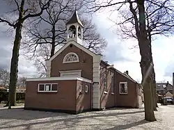 Efratha Church | |
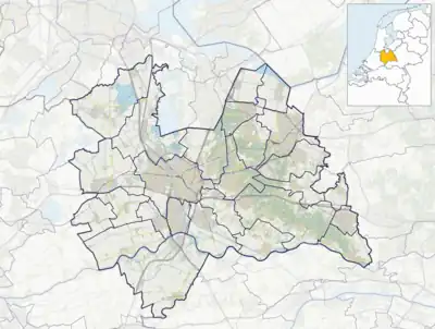 Overberg Location in the Netherlands  Overberg Overberg (Netherlands) | |
| Coordinates: 52°2′21″N 5°29′49″E | |
| Country | Netherlands |
| Province | Utrecht |
| Municipality | Utrechtse Heuvelrug |
| Area | |
| • Total | 9.09 km2 (3.51 sq mi) |
| Elevation | 8 m (26 ft) |
| Population (2021)[1] | |
| • Total | 1,570 |
| • Density | 170/km2 (450/sq mi) |
| Time zone | UTC+1 (CET) |
| • Summer (DST) | UTC+2 (CEST) |
| Postal code | 3959[1] |
| Dialing code | 0343 |
| Major roads | A12 |
The village was first mentioned in 1846 as Overberg, and means "the other side of the hill (Amerongse Berg)".[3] In 1873, the Efratha Church and school were built.[4]
Gallery
 Farm in Overberg
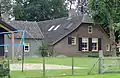 Farm in Overberg
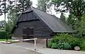 Sheep pen
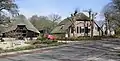
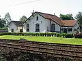 Former railway guard house
References
- "Kerncijfers wijken en buurten 2021". Central Bureau of Statistics. Retrieved 27 March 2022.
- "Postcodetool for 3959AA". Actueel Hoogtebestand Nederland (in Dutch). Het Waterschapshuis. Retrieved 27 March 2022.
- "Overberg - (geografische naam)". Etymologiebank (in Dutch). Retrieved 27 March 2022.
- "Overberg". Plaatsengids (in Dutch). Retrieved 27 March 2022.
Wikimedia Commons has media related to Overberg, the Netherlands.
This article is issued from Wikipedia. The text is licensed under Creative Commons - Attribution - Sharealike. Additional terms may apply for the media files.