Nova Scotia Route 344
Route 344 is a collector road in the Canadian province of Nova Scotia.
Route 344 | ||||
|---|---|---|---|---|
| Route information | ||||
| Maintained by Nova Scotia Department of Transportation and Infrastructure Renewal | ||||
| Length | 47 km[1] (29 mi) | |||
| Major junctions | ||||
| South end | ||||
| North end | ||||
| Location | ||||
| Country | Canada | |||
| Province | Nova Scotia | |||
| Highway system | ||||
| ||||

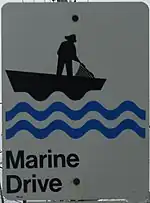
Part of Marine Drive
It is located in Guysborough County and connects Auld's Cove at Trunk 4 with Boylston at Trunk 16.
Communities
- Auld's Cove
- Mulgrave
- Pirate Harbour
- Steep Creek
- Middle Melford
- Sand Point
- Hadleyville-(formerly Oyster Ponds)
- St. Francis Harbour - (formerly Goose Harbour)
- Manassette Lake
- Port Shoreham
- Manchester
- Boylston
Parks
- Port Shoreham Beach Provincial Park
History
The section of the Collector Highway 344 from Auld's Cove and Mulgrave was designated as Trunk Highway 44.
This article is issued from Wikipedia. The text is licensed under Creative Commons - Attribution - Sharealike. Additional terms may apply for the media files.