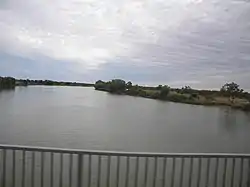
Norman River
The Norman River is a river in the Gulf Country, Queensland, Australia. The river originates in the Gregory Range 200 km southeast of Croydon and flows 420 km northwest to the Gulf of Carpentaria. It is joined by three major tributaries, the Carron, Clara and Yappar Rivers.[1] The river flows through Normanton before entering the Gulf of Carpentaria through the major fishing port of Karumba. The mouth of the river lies in the Gulf Plains Important Bird Area.[2]
| Norman River | |
|---|---|
 Norman River just to the north-east of the town of Normanton, 2013 | |
| Location | |
| Country | Australia |
| State | Queensland |
| Region | North West Queensland |
| Physical characteristics | |
| Source | Gregory Range |
| Mouth | Gulf of Carpentaria |
• location | Karumba |
| Length | 420 km (260 mi) |
| Basin size | 50,445 km2 (19,477 sq mi) |
The record flood of the river occurred in 1974, cresting at 8.8 metres in Normanton and causing the inundation of the town. The river's catchment area covers 50,445 km2.[1]
There are two water storage facilities along the river, Belmore Creek Dam and Glenore Weir, totaling 4,350 ML in capacity.[1]
See also
References
- "Water resources - Overview - Queensland: Basin & Surface Water Management Area: Norman River". Australian Natural Resources Atlas. Department of Sustainability, Environment, Water, Population and Communities. 15 June 2009. Archived from the original on 2 June 2011. Retrieved 14 November 2011.
- BirdLife International (2011) Important Bird Areas factsheet: Gulf Plains. Downloaded from http://www.birdlife.org Archived 10 July 2007 at the Wayback Machine on 01/07/2011
External links
- Flood Warning System for the Norman River. Australian Bureau of Meteorology.