Nimta
Nimta is a locality in North Dumdum Municipality of North 24 Parganas district in the Indian state of West Bengal. It is a part of the area covered by Kolkata Metropolitan Development Authority (KMDA).
Nimta | |
|---|---|
Neighbourhood | |
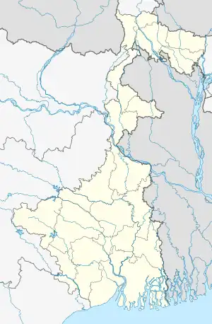 Nimta Location in West Bengal, India  Nimta Nimta (India) | |
| Coordinates: 22.66308°N 88.40907°E | |
| Country | |
| State | West Bengal |
| District | North 24 Parganas |
| Region | Greater Kolkata |
| Government | |
| • Type | Municipality |
| • Body | North Dumdum Municipality |
| Languages | |
| • Official | Bengali, English |
| Time zone | UTC+5:30 (IST) |
| PIN | 700049 |
| Telephone code | +91 33 |
| Vehicle registration | WB |
| Lok Sabha constituency | Dum Dum |
| Vidhan Sabha constituency | Dum Dum Uttar |
| Website | north24parganas |
Geography
M: municipal city/ town, CT: census town,
N: neighbourhood/ administrative location
Owing to space constraints in the small map, the actual locations in a larger map may vary slightly
Location
If Nimta is in the Center; then the East is Birati and Durganagar; West is Kamarhati and Belghoria; North is Agarpara and Panihati and South is Dumdum Cantonment and Baranagar. Nimta Is The Heart Of these Places. Dumdum/Kolkata Airport is just few minutes away from Nimta and it is towards the South-East direction. Dakshineswar is also just few minutes away from Nimta and it is towards the South-West direction.
96% of the population of Barrackpore subdivision (partly presented in the map alongside, all places marked on the map are linked in the full screen map) lives in urban areas. In 2011, it had a density of population of 10,967 per km2. The subdivision has 16 municipalities and 24 census towns.[1]
For most of the cities/ towns information regarding density of population is available in the Infobox. Population data is not available for neighbourhoods. It is available for the entire municipal area and thereafter ward-wise.
Police station
Nimta police station under Barrackpore Police Commissionerate has jurisdiction over North Dumdum municipal area.[2][3]
Kolkata Urban Agglomeration
The following Municipalities, Census Towns and other locations in Barrackpore subdivision were part of Kolkata Urban Agglomeration in the 2011 census: Kanchrapara (M), Jetia (CT), Halisahar (M), Balibhara (CT), Naihati (M), Bhatpara (M), Kaugachhi (CT), Garshyamnagar (CT), Garulia (M), Ichhapur Defence Estate (CT), North Barrackpur (M), Barrackpur Cantonment (CB), Barrackpore (M), Jafarpur (CT), Ruiya (CT), Titagarh (M), Khardaha (M), Bandipur (CT), Panihati (M), Muragachha (CT) New Barrackpore (M), Chandpur (CT), Talbandha (CT), Patulia (CT), Kamarhati (M), Baranagar (M), South Dumdum (M), North Dumdum (M), Dum Dum (M), Noapara (CT), Babanpur (CT), Teghari (CT), Nanna (OG), Chakla (OG), Srotribati (OG) and Panpur (OG).[4]
Transport
Nimta is located at the southern terminus of Kalyani Expressway.[5] Madhusudan Banerjee Road (M.B. Road) connects Nimta with Belgharia (westwards) and Birati and Jessore Road (eastwards) (towards the northern end of Dumdum/Kolkata Airport). Nimta is also connected to Nandannagar (westwards) via Shahid Bimalendu Roy Chowdhury Road. It will be soon connected with Kolkata Metro at Birati.[6]
Private Bus
- 201 Nimta Post Office - Salt Lake Sector-5
- DN2 Dakshineswar – Barasat
Mini Bus
- S185 Nimta Paikpara - Howrah Station
Train
The nearest railway stations are Belgharia railway station on the Sealdah-Ranaghat line and Birati railway station on the Sealdah-Bangaon line.[7][5][8]
Education
The following schools are located in Nimta & Nearby:
- Nimta High School at Nimta is a boys only higher secondary school.[9] It was established in 1875.
- Udaypur Haradayal Nag Adarsha Vidyalaya. V to x only boys. Xi & xii co-ed.
- Udaypur Haradayal Nag Adarsha Vidyalaya for Girls.
- Belgharia Mahakali Girls High School.
- Jatiya Vidyaniketan Girls High School.
- Jatin Das vidyamandir for boys.
- Jatin Das vidyamandir for girls.
- Nimta Alipur School. Co-ed . Madhyamik.
- Shyamaprasad Nagar High School at Nimta is a co-educational higher secondary school.[10]
- Nimta Jibantosh Memorial Girls High School is a girls only, higher secondary school.[9][11]
- Nimta Ishan Chandra Balika Vidyalaya is a girls only high school.[12]
See also
References
- "District Statistical Handbook". North 24 Parganas 2013, Tables 2.1, 2.2, 2.4b. Department of Statistics and Programme Implementation, Government of West Bengal. Archived from the original on 21 January 2019. Retrieved 2 May 2018.
- "District Statistical Handbook". North 24 Parganas 2013, Table 2.1. Department of Statistics and Programme Implementation, Government of West Bengal. Archived from the original on 21 January 2019. Retrieved 15 June 2018.
- "Barrackpore Police Commissionerate". List of Police Stations with telephone numbers. West Bengal Police. Archived from the original on 12 June 2018. Retrieved 15 June 2018.
- "Provisional Population Totals, Census of India 2011" (PDF). Constituents of Urban Agglomeration Having Population Above 1 Lakh. Census of India 2011. Archived from the original (PDF) on 6 March 2016. Retrieved 7 June 2018.
- Google maps
- OpenStreetMap
- "31311 Sealdah-Kalyani Simanta Local". Time Table. indiarailinfo. Retrieved 15 June 2018.
- "33811 Sealdah-Bangaon local". Time Table. India Railinfo. Retrieved 15 June 2018.
- "West Bengal Council of Higher Secondary Education". WBCHSE. Retrieved 29 July 2018.
- "West Bengal Council of Higher Secondary Education". WBCHSE. Retrieved 29 July 2018.
- "When the tough get going". The Telegraph, 25 August 2013. Archived from the original on 29 August 2013. Retrieved 29 July 2018.
- "Affiliated Schools: North 24 Parganas". No. B1 347. West Bengal Board of Secondary Education. Retrieved 29 July 2018.
- "Nimta Adi Kali mandir: সাবর্ণ রায়চৌধুরী পরিবারের স্বপ্নে পাওয়া প্রতিমাই প্রতিষ্ঠিত নিমতা আদি কালীমন্দিরে". Aaj Tak বাংলা (in Bengali). Retrieved 11 July 2023.
North 24 Parganas district topics | |||||||||
|---|---|---|---|---|---|---|---|---|---|
| General |
| ||||||||
| Subdivisions | |||||||||
| Municipalities | |||||||||
| Community development blocks |
| ||||||||
| Rivers | |||||||||
| Transport |
| ||||||||
| Railway stations | |||||||||
| Institutes of higher learning |
| ||||||||
| Lok Sabha constituencies | |||||||||
| Vidhan Sabha constituencies |
| ||||||||
| Former Vidhan Sabha constituencies | |||||||||
| See also |
| ||||||||
| Kolkata Municipal Corporation |
|
|---|---|
| Kolkata Urban Agglomeration Outside KMC |
|