Newfoundland and Labrador Route 514
Route 514, also known as Charlottetown Highway, is a 29.5-kilometre-long (18.3 mi) north-south Highway in southeastern Labrador in the Canadian province of Newfoundland and Labrador. It connects the towns of Charlottetown and Pinsent's Arm with the Trans-Labrador Highway (Route 510). The road is unpaved.
Route 514 | ||||
|---|---|---|---|---|
| Charlottetown Highway | ||||
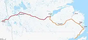 Route 514 highlighted in Maroon | ||||
| Route information | ||||
| Maintained by Newfoundland and Labrador Department of Transportation and Infrastructure | ||||
| Length | 29.5 km (18.3 mi) | |||
| Major junctions | ||||
| South end | ||||
| Pinsent's Arm Road (Route 511-10) in Charlottetown | ||||
| North end | Main Street in Charlottetown | |||
| Location | ||||
| Country | Canada | |||
| Province | Newfoundland and Labrador | |||
| Highway system | ||||
|
| ||||
| ||||

Route description
Route 514 begins at an intersection with Route 510 at Charlottetown Junction and its way northeast through remote hilly terrain for several kilometres, where it crosses a river and passes by several lakes. The highway now enters the Charlottetown town limits and now has intersection with a local road, Pinsent's Arm Road (Route 511-10), which provides access to the town of Pinsent's Arm. Route 514 now passes by the Charlottetown Airport before passing through neighbourhoods and coming to an end at a T-Intersection in downtown.[1]
Major intersections
| Location | km | mi | Destinations | Notes | |
|---|---|---|---|---|---|
| Charlottetown Junction | 0.0 | 0.0 | Southern terminus | ||
| Charlottetown | 27.9 | 17.3 | Pinsent's Arm Road (Route 511-10) - Pinsent's Arm | ||
| 29.0 | 18.0 | Access road into airport | |||
| 29.5 | 18.3 | Main Street - | Northern terminus | ||
| 1.000 mi = 1.609 km; 1.000 km = 0.621 mi | |||||
References
- Google (March 18, 2020). "Route 514" (Map). Google Maps. Google. Retrieved March 18, 2020.
- "Air Labrador Route Map". Archived from the original on 2017-03-02. Retrieved 2017-03-01.