Nelia, Queensland
Nelia is an outback town in the locality of Julia Creek in the Shire of Mckinlay, Queensland, Australia.[1]
| Nelia Queensland | |
|---|---|
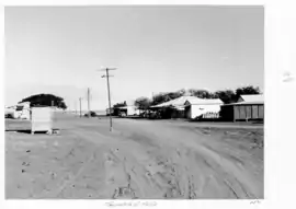
 Nelia, 1952 | |
 Nelia | |
| Coordinates | 20.6533°S 142.2147°E |
| Postcode(s) | 4823 |
| Time zone | AEST (UTC+10:00) |
| Location |
|
| LGA(s) | Shire of McKinlay |
| State electorate(s) | Traeger |
| Federal division(s) | Kennedy |
Geography
The town is just north off the Flinders Highway, 1,680 kilometres (1,040 mi) north west of the state capital, Brisbane.
The Inlander rail service from Townsville to Mount Isa on the Great Northern railway passes through Nelia, which is served by Nelia railway siding (20.6540°S 142.2134°E).[2]
History

The area was named by explorer William Landsborough after a friend of his wife. European settlement began in the 1870s with the establishment of the Willibah and Benannee runs.
Nelia Post Office opened on 23 June 1909 (a receiving office had been open from 1908).[3]
A townsite was surveyed in 1912 and the first land sales took place in 1913.[4]
Nelia State School opened on 4 May 1926 and closed in 1932. It reopened in 1953 and closed permanently in 1960.[5]
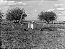
An artesian bore was constructed in 1928 to provide water to the town. Due to not following government advice, the bore flowed suddenly and dramatically sending water in all directions.[6]
The post office celebrated its centenary in 2009.[7]
In February 2019 flooding damaged the railway line, resulting in the derailment of a Pacific National freight train with 81 wagons at Nelia.[8] A 1.2-kilometre (0.75 mi) rail deviation was constructed around the derailment.[9]
Amenities
The Nelia branch of the Queensland Country Women's Association has its rooms at the QCWA Hall at 4 Main Street.[10]
Education
There are no schools in Nelia. The nearest primary school is in the town of Julia Creek. The nearest secondary school is in Richmond (102 kilometres (63 mi) to the east, but it only offers education to Year 10. The nearest secondary schools offering education to Year 12 are in Cloncurry (188 kilometres (117 mi) to the west) and in Hughenden (217 kilometres (135 mi) to the east).[11] Distance eductation and boarding schools are other secondary schooling options.
References
- "Nelia – town in Shire of Mckinlay (entry 24020)". Queensland Place Names. Queensland Government. Retrieved 27 January 2020.
- "Nelia – railway station in Mckinlay Shire (entry 24022)". Queensland Place Names. Queensland Government. Retrieved 14 April 2020.
- Premier Postal History. "Post Office List". Premier Postal Auctions. Retrieved 10 May 2014.
- "Nelia". McKinlay Shire Council. Retrieved 14 July 2013.
- Queensland Family History Society (2010), Queensland schools past and present (Version 1.01 ed.), Queensland Family History Society, ISBN 978-1-921171-26-0
- "ARTESIAN WATER". The Brisbane Courier. Queensland, Australia. 10 April 1928. p. 18. Retrieved 14 April 2020 – via Trove.
- Burton, Reg (18 June 2009). "Nelia celebrates post office centenary". North Queensland Register. Archived from the original on 14 July 2014. Retrieved 14 July 2013.
- Nugent, Victoria (20 February 2019). "North west floods: Nelia derailed train recovery set to begin". Queensland Country Life. Retrieved 14 April 2020.
- Major, Tom (16 April 2019). "Cattle, infrastructure losses following Queensland floods could near $2b, farm lobby says". ABC News. Retrieved 14 April 2020.
- "Branch locations". Queensland Country Women's Association. Archived from the original on 26 December 2018. Retrieved 26 December 2018.
- "Queensland Globe". State of Queensland. Retrieved 14 April 2020.