Nehusha
Nehusha (Hebrew: נְחוּשָׁה, lit. Steadfast) is a moshav in central Israel. Located five kilometres north-east of Beit Guvrin, it falls under the jurisdiction of Mateh Yehuda Regional Council. In 2021 it had a population of 1,505.[1]
Nehusha
Nehusha نحوشا | |
|---|---|
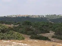 Moshav Nehusha as seen from the hill of Khirbat Umm Burj | |
 Nehusha | |
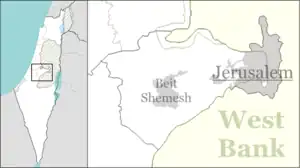
| Coordinates: 31°37′48″N 34°57′16″E | |
| Country | Israel |
| District | Jerusalem |
| Council | Mateh Yehuda |
| Affiliation | Hapoel HaMizrachi |
| Founded | 1955 |
| Population (2021)[1] | 1,505 |
| Website | www.nechusha.org.il |
History
The moshav was established in 1955 on the land of the depopulated Palestinian village of Umm Burj.[2] but collapsed in 1968. It was re-established in 1981. Its name is derived from the name of the Biblical town of Ir-Nachash (1 Chronicles 4:12)[3] nearby and from Psalms 18:35 (where it is translated as brass, although its meaning is steadfast or firm);
Who traineth my hands for war, so that mine arms do bend a bow of brass.
Archaeology
In 2004, an archaeological excavation was conducted at Nehusha by Rona Avissar on behalf of Bar Ilan University's Department of Land of Israel Studies and Archaeology.[4]
Gallery
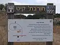 Signpost showing description of ancient ruin, Hurvat Qayit
 The ancient ruin of Qayit, near Nehusha
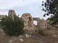 Ruin of Qayit near Moshav Nehusha
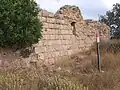 Ruin of Qayit near Nehusha

References
- "Regional Statistics". Israel Central Bureau of Statistics. Retrieved 22 February 2023.
- Khalidi, Walid (1992), All That Remains: The Palestinian Villages Occupied and Depopulated by Israel in 1948, Washington D.C.: Institute for Palestine Studies, pp. 217, 224, ISBN 0-88728-224-5,
- Carta's Official Guide to Israel and Complete Gazetteer to all Sites in the Holy Land. (3rd edition 1993) Jerusalem, Carta, p. 361, ISBN 965-220-186-3 (English)
- Israel Antiquities Authority, Excavators and Excavations Permit for Year 2004, Survey Permit # B-283
External links
- Village website (in Hebrew)