Murray River Council
The Murray River Council is a local government area in the Riverina region of New South Wales, Australia. This area was formed in 2016 from the merger of Murray Shire with Wakool Shire.[3]
| Murray River Council New South Wales | |||||||||||||||
|---|---|---|---|---|---|---|---|---|---|---|---|---|---|---|---|
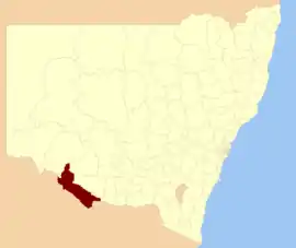 Location in New South Wales | |||||||||||||||
| Coordinates | 35°24′S 144°19′E | ||||||||||||||
| Population |
| ||||||||||||||
| • Density | 0.9844/km2 (2.5496/sq mi) | ||||||||||||||
| Established | 12 May 2016 | ||||||||||||||
| Area | 11,865 km2 (4,581.1 sq mi)[3] | ||||||||||||||
| Mayor | Chris Bilkey | ||||||||||||||
| Region | Riverina | ||||||||||||||
| State electorate(s) | Murray | ||||||||||||||
| Federal division(s) | Farrer | ||||||||||||||
| Website | Murray River Council | ||||||||||||||
| |||||||||||||||
The combined area comprises 11,865 square kilometres (4,581 sq mi) and covers the northern bank of the Murray River and hinterland from Moama downstream to Tooleybuc. At the time of its establishment, the estimated population of the area was 11,456.[3]
Main towns and villages
The largest town in Murray River Council is Moama in the far south east. Other towns and localities in the area include Barham, Bunnaloo, Burraboi, Caldwell, Cunninyeuk, Koraleigh, Kyalite, Mathoura, Moulamein, Murray Downs, Speewa, Tantonan, Tooleybuc, Wakool and Womboota.
Heritage listings
The Murray River Council has a number of heritage-listed sites, including:
- Barham, 319 Main Road: Barham Bridge over Murray River[4]
- Cunninyeuk, 94 Noorong Road (Main Road): Gee Gee Bridge over Wakool River[5]
- Moama, Hunt Street: Moama Historic Precinct[6]
- Swan Hill, 386 Main Road: Coonamit Bridge over Wakool River[7]
- Swan Hill, 67 Main Road (East): Swan Hill-Murray River Road Bridge[8]
- Tooleybuc, 222 Main Road: Tooleybuc Bridge[9]
- Wakool, Moulamein Highway: Murray Downs Homestead[10]
Demographics
Council
The Administrator of the Murray River Council from 2016 to September 2017 was David Shaw.
Murray River Council has nine councillors elected proportionally from three wards – Moama, Greater Murray and Greater Wakool. All councillors are elected for a fixed four-year term of office.[3]
The most recent election was held on 9 September 2017, and the makeup of the council by order of election is as follows:
| Party | Councillors | |
|---|---|---|
| Independent and Unaligned | 9 | |
| Total | 9 | |
| Ward | Councillor | Party | Notes | |
|---|---|---|---|---|
| Greater Murray Ward[11] | Geoff Wise | Unaligned | ||
| Thomas Weyrich | Independent | |||
| Tony Aquino | Independent | |||
| Greater Wakool Ward[12] | Neil Gorey | Unaligned | ||
| Alan Mathers | Independent | |||
| Ann Crowe | Unaligned | |||
| Moama Ward[13] | Nicole Cohen | Independent | ||
| Chris Bilkey | Independent | Mayor | ||
| Gen Campbell | Independent | |||
Main towns in shire
In 2021 census the shire had a population of 12,850.
| Population | ||
| Locality | 2016 | 2021 |
| Barham | 1,159 | 1,569 |
| Bunnaloo | 101 | 107 |
| Burraboi | 63 | 196 |
| Caldwell | 33 | 42 |
| Cunninyeuk | 37 | 24 |
| Dilpurra | 22 | 29 |
| Koraleigh | 353 | 291 |
| Kyalite | 82 | 87 |
| Mallan | 53 | 45 |
| Population | ||
| Locality | 2016 | 2021 |
| Mathoura | 938 | 1,002 |
| Moama | 5,620 | 7,213 |
| Moulamein | 484 | 489 |
| Murray Downs | 265 | 274 |
| Speewa | 98 | 115 |
| Stony Crossing | 17 | 27 |
| Tantonan | 24 | 15 |
| Tooleybuc | 277 | 336 |
| Wakool | 297 | 262 |
| Womboota | 105 | 90 |
|}
See also
References
- Australian Bureau of Statistics (27 June 2017). "Murray River (A)". 2016 Census QuickStats. Retrieved 8 December 2017.
- "3218.0 – Regional Population Growth, Australia, 2017–18". Australian Bureau of Statistics. 27 March 2019. Retrieved 27 March 2019. Estimated resident population (ERP) at 30 June 2018.
- "Murray River Council". Stronger Councils. Government of New South Wales. 12 May 2016. Retrieved 13 May 2016.
- "Barham Bridge over Murray River". New South Wales State Heritage Register. Department of Planning & Environment. H01456. Retrieved 18 May 2018.
 Text is licensed by State of New South Wales (Department of Planning and Environment) under CC-BY 4.0 licence.
 - "Gee Gee Bridge over Wakool River (under consideration for removal)". New South Wales State Heritage Register. Department of Planning & Environment. H01469. Retrieved 18 May 2018. Text is licensed by State of New South Wales (Department of Planning and Environment) under CC-BY 4.0 licence.
- "Moama Historic Precinct". New South Wales State Heritage Register. Department of Planning & Environment. H00600. Retrieved 18 May 2018. Text is licensed by State of New South Wales (Department of Planning and Environment) under CC-BY 4.0 licence.
- "Coonamit Bridge over Wakool River". New South Wales State Heritage Register. Department of Planning & Environment. H01464. Retrieved 18 May 2018. Text is licensed by State of New South Wales (Department of Planning and Environment) under CC-BY 4.0 licence.
- "Swan Hill-Murray River Road Bridge". New South Wales State Heritage Register. Department of Planning & Environment. H01481. Retrieved 18 May 2018. Text is licensed by State of New South Wales (Department of Planning and Environment) under CC-BY 4.0 licence.
- "Tooleybuc Bridge over Murray River". New South Wales State Heritage Register. Department of Planning & Environment. H01482. Retrieved 18 May 2018. Text is licensed by State of New South Wales (Department of Planning and Environment) under CC-BY 4.0 licence.
- "Murray Downs Homestead". New South Wales State Heritage Register. Department of Planning & Environment. H01438. Retrieved 18 May 2018. Text is licensed by State of New South Wales (Department of Planning and Environment) under CC-BY 4.0 licence.
- "Murray River – Greater Murray Ward". NSW Local Council Elections 2017. NSW Electoral Commission. Retrieved 15 September 2017.
- "Murray River – Greater Wakool Ward". NSW Local Council Elections 2017. NSW Electoral Commission. Retrieved 15 September 2017.
- "Murray River – Moama Ward". NSW Electoral Commission. Retrieved 15 September 2017.