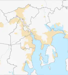
Mornington, Tasmania
Mornington is a residential locality in the local government area (LGA) of Clarence in the Hobart LGA region of Tasmania. The locality is about 4 kilometres (2.5 mi) north-east of the town of Rosny Park. The 2016 census recorded a population of 2265 for the state suburb of Mornington.[1]
| Mornington Hobart, Tasmania | |||||||||||||||
|---|---|---|---|---|---|---|---|---|---|---|---|---|---|---|---|
 Mornington | |||||||||||||||
| Coordinates | 42°51′30″S 147°24′14″E | ||||||||||||||
| Population | 2,265 (2016 census)[1] | ||||||||||||||
| Postcode(s) | 7018 | ||||||||||||||
| Location | 4 km (2 mi) NE of Rosny Park | ||||||||||||||
| LGA(s) | Clarence | ||||||||||||||
| Region | Hobart | ||||||||||||||
| State electorate(s) | Franklin | ||||||||||||||
| Federal division(s) | Franklin | ||||||||||||||
| |||||||||||||||
It is a suburb of the City of Clarence. It is part of greater Hobart, located approximately 7 kilometres from the CBD. It is located between Warrane and Cambridge, is nearby to Mount Rumney and runs parallel to the Tasman Highway.
Mornington is a primarily residential suburb, although it is also home to the Mornington Industrial Estate and is served by Rosny Park for commercial services. The main facilities are Clarence Council Depot, Main Roads and Transport Depot, a Service Tasmania vehicle inspection facility, a Fire and Ambulance Service, and MacKillop College.
History
Mornington was gazetted as a locality in 1970.[2]
Geography
Most of the boundaries are survey lines.[3]
Road infrastructure
Route A3 (Tasman Highway) runs through from north-west to north-east, and Route B33 (South Arm Highway) runs from north-west to south-east.[2][4]
References
- "2016 Census Quick Stats Mornington (Tas.)". quickstats.censusdata.abs.gov.au. Australian Bureau of Statistics. 23 October 2017. Retrieved 2 April 2021.
- "Placenames Tasmania – Mornington". Placenames Tasmania. Select "Search", enter "9237L", click "Search", select row, map is displayed, click "Details". Retrieved 2 April 2021.
- Google (2 April 2021). "Mornington, Tasmania" (Map). Google Maps. Google. Retrieved 2 April 2021.
- "Tasmanian Road Route Codes" (PDF). Department of Primary Industries, Parks, Water & Environment. May 2017. Archived from the original (PDF) on 1 August 2017. Retrieved 2 April 2021.
