Montezuma, Kansas
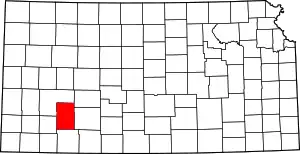
Montezuma is a city in Gray County, Kansas, United States.[1] As of the 2020 census, the population of the city was 975.[3]
Montezuma, Kansas | |
|---|---|
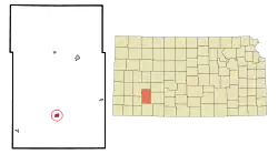
 Location within Gray County and Kansas | |
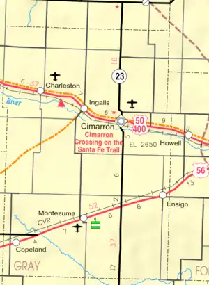
 KDOT map of Gray County (legend) | |
| Coordinates: 37°35′33″N 100°27′00″W[1] | |
| Country | United States |
| State | Kansas |
| County | Gray |
| Founded | 1879 |
| Incorporated | 1917 |
| Named for | Moctezuma II |
| Area | |
| • Total | 0.98 sq mi (2.55 km2) |
| • Land | 0.98 sq mi (2.55 km2) |
| • Water | 0.00 sq mi (0.00 km2) |
| Elevation | 2,779 ft (847 m) |
| Population | |
| • Total | 975 |
| • Density | 990/sq mi (380/km2) |
| Time zone | UTC-6 (CST) |
| • Summer (DST) | UTC-5 (CDT) |
| ZIP code | 67867 |
| Area code | 620 |
| FIPS code | 20-47875 |
| GNIS ID | 2395379[1] |
History
Montezuma was founded in 1879, and relocated in 1912 to the Santa Fe Railroad.[4] It was named for Moctezuma II, ruler of the Aztec empire.[5]
Geography
According to the United States Census Bureau, the city has a total area of 0.76 square miles (1.97 km2), all of it land.[6]
Climate
According to the Köppen Climate Classification system, Montezuma has a semi-arid climate, abbreviated "BSk" on climate maps.[7]
Demographics
| Census | Pop. | Note | %± |
|---|---|---|---|
| 1920 | 163 | — | |
| 1930 | 424 | 160.1% | |
| 1940 | 340 | −19.8% | |
| 1950 | 509 | 49.7% | |
| 1960 | 543 | 6.7% | |
| 1970 | 606 | 11.6% | |
| 1980 | 730 | 20.5% | |
| 1990 | 838 | 14.8% | |
| 2000 | 966 | 15.3% | |
| 2010 | 966 | 0.0% | |
| 2020 | 975 | 0.9% | |
| U.S. Decennial Census | |||
2010 census
As of the census[8] of 2010, there were 966 people, 366 households, and 249 families residing in the city. The population density was 1,271.1 inhabitants per square mile (490.8/km2). There were 390 housing units at an average density of 513.2 per square mile (198.1/km2). The racial makeup of the city was 95.7% White, 0.1% African American, 0.9% Native American, 2.5% from other races, and 0.8% from two or more races. Hispanic or Latino of any race were 11.0% of the population.
There were 366 households, of which 30.1% had children under the age of 18 living with them, 59.6% were married couples living together, 5.7% had a female householder with no husband present, 2.7% had a male householder with no wife present, and 32.0% were non-families. 28.7% of all households were made up of individuals, and 16.1% had someone living alone who was 65 years of age or older. The average household size was 2.50 and the average family size was 3.14.
The median age in the city was 36.8 years. 24.9% of residents were under the age of 18; 8.1% were between the ages of 18 and 24; 24.4% were from 25 to 44; 19.1% were from 45 to 64; and 23.5% were 65 years of age or older. The gender makeup of the city was 45.5% male and 54.5% female.
2000 census
As of the census[9] of 2000, there were 966 people, 335 households, and 235 families residing in the city. The population density was 1,365.0 inhabitants per square mile (527.0/km2). There were 362 housing units at an average density of 511.5 per square mile (197.5/km2). The racial makeup of the city was 93.58% White, 0.21% Native American, 0.21% Pacific Islander, 3.73% from other races, and 2.28% from two or more races. Hispanic or Latino of any race were 9.21% of the population.
There were 335 households, out of which 32.2% had children under the age of 18 living with them, 62.1% were married couples living together, 6.0% had a female householder with no husband present, and 29.6% were non-families. 27.2% of all households were made up of individuals, and 13.7% had someone living alone who was 65 years of age or older. The average household size was 2.55 and the average family size was 3.13.
In the city, the population was spread out, with 25.6% under the age of 18, 8.4% from 18 to 24, 21.6% from 25 to 44, 15.6% from 45 to 64, and 28.8% who were 65 years of age or older. The median age was 39 years. For every 100 females, there were 79.9 males. For every 100 females age 18 and over, there were 73.7 males.
The median income for a household in the city was $36,719, and the median income for a family was $41,528. Males had a median income of $31,500 versus $23,750 for females. The per capita income for the city was $19,052. About 5.6% of families and 11.0% of the population were below the poverty line, including 17.8% of those under age 18 and 6.2% of those age 65 or over.
Economy
The Gray County Wind Farm near Montezuma is the largest wind farm in Kansas.
Education
Montezuma is a part of USD 371 South Gray Schools. USD 371 and USD 476 share South Gray High School. The South Gray High School mascot is the Rebels.[10]
Prior to school unification, the Montezuma High School mascot was the Indians.[11] The Montezuma Indians won the Kansas State High School boys class BB basketball championship in 1955.[12]
References
- U.S. Geological Survey Geographic Names Information System: Montezuma, Kansas
- "2019 U.S. Gazetteer Files". United States Census Bureau. Retrieved July 24, 2020.
- "Profile of Montezuma, Kansas in 2020". United States Census Bureau. Archived from the original on November 28, 2021. Retrieved November 28, 2021.
- Kansas State Historical Society (1916). Biennial Report of the Board of Directors of the Kansas State Historical Society. Kansas State Printing Plant. pp. 198.
- "Profile for Montezuma, Kansas". ePodunk. Retrieved June 10, 2014.
- "US Gazetteer files 2010". United States Census Bureau. Archived from the original on July 2, 2012. Retrieved July 6, 2012.
- Climate Summary for Montezuma, Kansas
- "U.S. Census website". United States Census Bureau. Retrieved July 6, 2012.
- "U.S. Census website". United States Census Bureau. Retrieved January 31, 2008.
- "South Gray Schools". USD 371. Retrieved January 4, 2017.
- "Montezuma Indians Pace Santa Fe Trail Conference", Garden City Telegram, 26 December 1959, p.5.
- "Basketball". KSHSAA. Retrieved January 3, 2017.
Further reading
External links
- Montezuma - Directory of Public Officials
- USD 371, local school district
- Montezuma City Map, KDOT
