Monte San Lorenzo
Monte San Lorenzo, also known as Monte Cochrane, is a mountain on the border between Argentina and Chile in Patagonia, reaching a height of 3,706 metres (12,159 ft).[4] The Chilean name of Cochrane comes from the nearby town of Cochrane where climbers often approach the mountain. The peak was first climbed by Alberto María de Agostini in 1943.
| San Lorenzo | |
|---|---|
| Monte Cochrane | |
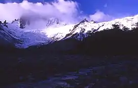 San Lorenzo showing the route of ascent from the Chilean side. | |
| Highest point | |
| Elevation | 3,706 m (12,159 ft)[1] |
| Prominence | 3,319 m (10,889 ft)[2] Ranked 60th |
| Isolation | 135 km (84 mi) |
| Listing | Ultra |
| Coordinates | 47°35′30″S 72°18′24″W[2] |
| Geography | |
 San Lorenzo Location of Monte San Lorenzo | |
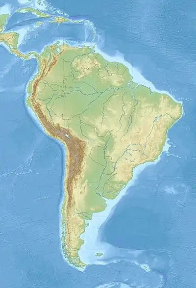
| Location | Patagonia Santa Cruz, Argentina/ Aisén, Chile border |
| Parent range | Andes |
| Climbing | |
| First ascent | 1943 by Alberto María de Agostini[3] |
The mountain is covered by three large glaciers (two in Argentina and one in Chile). The Argentine glaciers show clear evidence of retreat.[5]
Incident
The peak gained further notoriety in 2014 when professional ski-mountaineers JP Auclair and Andreas Fransson perished on its slopes in a large avalanche.
Gallery
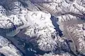 NASA image of San Lorenzo as seen from the south
References
- "Monte San Lorenzo, Argentina/Chile" Peakbagger.com. Retrieved 2011-11-20.
- "Argentina and Chile, Southern - Patagonia Ultra Prominences" Peaklist.org. Retrieved 2011-11-20.
- Peter Barry, "San Lorenzo", American Alpine Journal, 1973, p. 475. Available at AAJ Online (PDF).
- World Wildlife Fund; C.Michael Hogan. 2010. Magellanic subpolar forests. Encyclopedia of Earth, National Council for Science and the Environment. Washington DC
- USGS. "P 1386-I Chile and Argentina - Wet Andes: Northern Patagonian Andes". Retrieved 2006-11-04.
This article is issued from Wikipedia. The text is licensed under Creative Commons - Attribution - Sharealike. Additional terms may apply for the media files.