Montagudet
Montagudet (French pronunciation: [mɔ̃taɡydɛ]) is a commune in the Tarn-et-Garonne department in the Occitanie region in southern France.
Montagudet | |
|---|---|
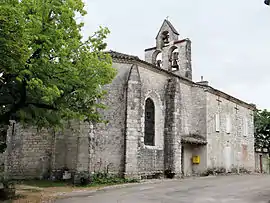 The church of Saint-Sulpice-de-Bourges, in Montagudet | |
Location of Montagudet | |
 Montagudet  Montagudet | |
| Coordinates: 44°14′42″N 1°05′32″E | |
| Country | France |
| Region | Occitania |
| Department | Tarn-et-Garonne |
| Arrondissement | Castelsarrasin |
| Canton | Pays de Serres Sud-Quercy |
| Intercommunality | Pays de Serres en Quercy |
| Government | |
| • Mayor (2020–2026) | Jean Benois[1] |
| Area 1 | 12.18 km2 (4.70 sq mi) |
| Population | 193 |
| • Density | 16/km2 (41/sq mi) |
| Time zone | UTC+01:00 (CET) |
| • Summer (DST) | UTC+02:00 (CEST) |
| INSEE/Postal code | 82116 /82110 |
| Elevation | 91–237 m (299–778 ft) (avg. 200 m or 660 ft) |
| 1 French Land Register data, which excludes lakes, ponds, glaciers > 1 km2 (0.386 sq mi or 247 acres) and river estuaries. | |
Geography
The Séoune forms part of the commune's northern border. The Barguelonnette forms most of the commune's southern border.
References
- "Répertoire national des élus: les maires" (in French). data.gouv.fr, Plateforme ouverte des données publiques françaises. 13 September 2022.
- "Populations légales 2020". The National Institute of Statistics and Economic Studies. 29 December 2022.
Wikimedia Commons has media related to Montagudet.
This article is issued from Wikipedia. The text is licensed under Creative Commons - Attribution - Sharealike. Additional terms may apply for the media files.