Miniara
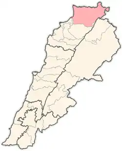
Miniara (Arabic: منياره) (also transliterated Minyara) is a village in Akkar Governorate, Lebanon, 9 kilometers east of the Mediterranean Sea, and 3 kilometers south of Halba. The population is between 7,000 and 10,000.
Miniara
منياره | |
|---|---|
Village | |
 Miniara Location within Lebanon | |
| Coordinates: 34°31′57″N 36°03′38.76″E | |
| Country | |
| Governorate | Akkar Governorate |
| District | Akkar District |
| Time zone | UTC+2 (EET) |
| • Summer (DST) | UTC+3 (EEST) |
| Dialing code | +961 |
History
In 1838, Eli Smith noted the village (named Menyarah), whose inhabitants were Greek Orthodox, located west of esh-Sheikh Mohammed.[1]
In 1856 it was named Menyarah on Kiepert's map of Palestine/Lebanon published that year,[2]
Miniara is the birthplace of Ibrahim Beik El-Sarraf, the first member of the Lebanese parliament to represent the Christian seat of Akkar for 2 terms when Lebanon was still a French Mandate, and his younger brother "Afandi" Zeki EL Sarraf the first mayor in the municipality of Akkar in his village Miniara. Dr Yacoub El Sarraf, son of Ibrahim El Sarraf, was elected the Minister of Health of Lebanon in 1964[3] and was known for treating poor people free of charge and his many public services.--. The current mayor of the village of Miniara is Toni Naim Aboud since 1998.
Demographics
The population is religiously diverse. A Christian village but of several different denominations with a majority of Greek Orthodox and including Melkite Greek Catholic, Maronite Catholic, and Evangelical.[4]
Education
The majority of Miniara's teenage population is either in high school or has completed high school.
Miniara has both private and public schools.
Private Schools
- Saint Joseph's High School
- Saint Joseph's Elementary School
- Ecole Nationale Orthodoxe (E.N.O)
- Modern School
Public Schools
- Miniara Female Public School
- Miniara Public High School
- Miniara Boys Public School
References
- Robinson and Smith, 1841, vol 3, 2nd appendix, p. 183
- Kiepert, 1856, Map of Northern Palestine/Lebanon
- "Ministers of Health". The Ministry of Public Health.
- "Municipal and ikhtiyariah elections in Northern Lebanon" (PDF). The Monthly. March 2010. p. 21. Archived from the original on 3 June 2016. Retrieved 4 November 2016.
{{cite web}}: CS1 maint: bot: original URL status unknown (link)
Bibliography
External links
- Minyara, Localiban
- Al Mustaqbal - article on Fouad Ibrahim Sarraf accessed January 13, 2007.
