Miarinarivo (district)
Miarinarivo is a district of Itasy in Madagascar.[1][2] It is located approximately 100 km east of Antananarivo.
Miarinarivo | |
|---|---|
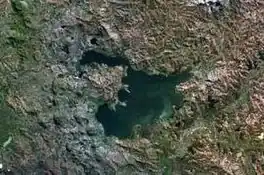 aerial photo, in the middle: Itasy lake and Ampefy | |
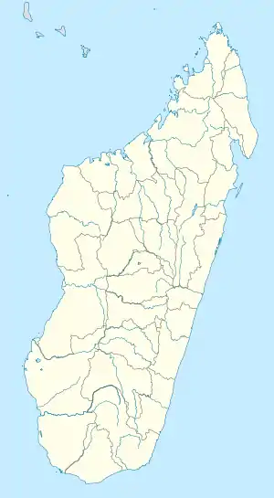 Miarinarivo Location in Madagascar | |
| Coordinates: 18°57′39″S 46°54′00″E | |
| Country | |
| Region | Itasy |
| District | Miarinarivo |
| Area | |
| • Land | 17.9 km2 (6.9 sq mi) |
| Population | |
| • Ethnicities | Merina |
| Time zone | UTC3 (EAT) |
| Postal code | 117 |
Municipalities
The district is formed by 12 municipalities:
- Ambatomanjaka
- Analavory
- Andolofotsy
- Anosibe Ifanja
- Manazary
- Mandiavato
- Miarinarivo
- Miarinarivo II
- Sarobaratra Ifanja
- Soamahamanina
- Soavimbahoaka
- Zoma Bealoka
Sights
- Geysers in Analavory.
- Lily falls of the Sakay River near Ampefy.
References
- Repoblikan'i Madagasikara: Tanindrazana – Fahafahana – Fandrosoana (PDF). Ministere de L'Agriculture, de L’Elevage et de La Peche. October 2007. pp. 42–44. Archived from the original (PDF) on 2018-06-12. Retrieved 2018-06-09.
- "Madagascar: Administrative Division". citypopulation. Retrieved 10 June 2018.
Capital: Miarinarivo | ||
| Arivonimamo (22) - 112 |  | |
| Miarinarivo (12) - 117 | ||
| Soavinandriana (15) - 118 | ||
3 districts; 49 communes | ||
This article is issued from Wikipedia. The text is licensed under Creative Commons - Attribution - Sharealike. Additional terms may apply for the media files.