Mastwijk
Mastwijk is a village in the Dutch province of Utrecht. It is a part of the municipality of Montfoort, and lies about 6 km southeast of Woerden.
Mastwijk | |
|---|---|
Village | |
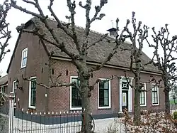
 Farm Schurenburg | |
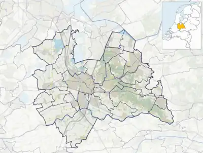
 Mastwijk Location in the Netherlands  Mastwijk Mastwijk (Netherlands) | |
| Coordinates: 52.05498°N 4.95935°E | |
| Country | Netherlands |
| Province | Utrecht |
| Municipality | Montfoort |
| Area | |
| • Total | 5.89 km2 (2.27 sq mi) |
| Population (2021)[1] | |
| • Total | 460 |
| • Density | 78/km2 (200/sq mi) |
| Time zone | UTC+1 (CET) |
| • Summer (DST) | UTC+2 (CEST) |
| Postal code | 3417[1] |
| Dialing code | 0348 |
It was first mentioned in 1217 as Mastwyck. Wijk means settlement, but mast either means pole or fodder.[2] Mastwijk used to have its own place name sign, however nowadays it reads Montfoort. The polder around Mastwijk is situated dates around 1200. Schurenburg was a fortified house which was first mentioned 1341. It was demolished in the 18th century. The farm on the estate still bears the name. In 1840, Mastwijk was home to 44 people.[3]
References
- "Kerncijfers wijken en buurten 2021". Central Bureau of Statistics. Retrieved 28 March 2022.
- "Mastwijk - (geografische naam)". Etymologiebank (in Dutch). Retrieved 28 March 2022.
- "Mastwijk". plaatsengids (in Dutch). Retrieved 28 March 2022.
Wikimedia Commons has media related to Mastwijk.
This article is issued from Wikipedia. The text is licensed under Creative Commons - Attribution - Sharealike. Additional terms may apply for the media files.