Maripasoula Airport
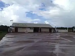
Maripasoula Airport (IATA: MPY, ICAO: SOOA) is an airport 3.5 km (1.9 NM) north of Maripasoula, a commune in the arrondissement of Saint-Laurent-du-Maroni in French Guiana. It is near the Lawa River, which forms the border between French Guiana and Suriname.
Maripasoula Airport | |||||||||||
|---|---|---|---|---|---|---|---|---|---|---|---|
 Maripasoula airport | |||||||||||
| Summary | |||||||||||
| Airport type | Public | ||||||||||
| Operator | Conseil Général de la Guyane | ||||||||||
| Serves | Maripasoula, French Guiana | ||||||||||
| Elevation AMSL | 377 ft / 115 m | ||||||||||
| Coordinates | 3°39′27″N 54°02′14″W | ||||||||||
| Map | |||||||||||
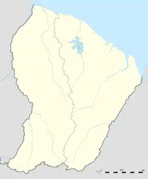 MPY Location of airport in French Guiana | |||||||||||
| Runways | |||||||||||
| |||||||||||
The Maripasoula non-directional beacon (Ident: MP) is located on the field.[3]
Airlines and destinations
| Airlines | Destinations |
|---|---|
| Air Guyane Express | Cayenne, Grand Santi, Saint-Laurent du Maroni, Saül[4] |
References
- Airport information for MPY at Great Circle Mapper.
- Google Maps - Maripasoula
- Maripasoula NDB
- "Air Guyane Express". Retrieved 23 August 2010.
External links
This article is issued from Wikipedia. The text is licensed under Creative Commons - Attribution - Sharealike. Additional terms may apply for the media files.