Manakambahiny Est
Manakambahiny Est is a municipality in Madagascar. It belongs to the district of Ambatondrazaka, which is a part of Alaotra-Mangoro Region. The population of the commune was estimated to be approximately 8,000 in 2001 commune census.[2]
Manakambahiny Est
Manakambahiny Atsinanana | |
|---|---|
 Manakambahiny Est Location in Madagascar | |
| Coordinates: 17°51′S 48°46′E | |
| Country | |
| Region | Alaotra-Mangoro |
| District | Ambatondrazaka |
| Elevation | 1,106 m (3,629 ft) |
| Population (2001)[2] | |
| • Total | 8,000 |
| Time zone | UTC3 (EAT) |
| Postal code | 503 |
Primary and junior level secondary education are available in town. The majority 80% of the population of the commune are farmers, while an additional 18% receives their livelihood from raising livestock. The most important crop is rice, while other important products are bananas, sugarcane, cassava and sweet potatoes. Services provide employment for 2% of the population.[2]
National Parks
The entrance of the Zahamena National Park is situated at 4 km from Manakambahiny Est.
References
- Estimated based on DEM data from Shuttle Radar Topography Mission
- "ILO census data". Cornell University. 2002. Retrieved 2008-03-06.
Capital: Ambatondrazaka | ||
| Ambatondrazaka (21) | 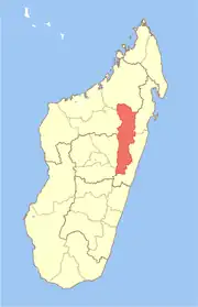 | |
| Amparafaravola (21) | ||
| Andilamena (8) | ||
| Anosibe An'ala (11) | ||
| Moramanga (22) | ||
5 districts; 82 communes | ||
This article is issued from Wikipedia. The text is licensed under Creative Commons - Attribution - Sharealike. Additional terms may apply for the media files.