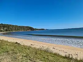
Maloneys Beach, New South Wales
Maloneys Beach is a suburb of Batemans Bay in Eurobodalla Shire, New South Wales, Australia.[2][3] It lies on the north bank of the Clyde estuary, north of Batemans Bay and 274 km south of Sydney. At the 2016 census, it had a population of 371.[1]
| Maloneys Beach New South Wales | |||||||||||||||
|---|---|---|---|---|---|---|---|---|---|---|---|---|---|---|---|
 | |||||||||||||||
 Maloneys Beach Location in New South Wales | |||||||||||||||
| Coordinates | 35°41′56″S 150°15′13″E | ||||||||||||||
| Population | 371 (2016 census)[1] | ||||||||||||||
| Postcode(s) | 2536 | ||||||||||||||
| Location |
| ||||||||||||||
| LGA(s) | Eurobodalla Shire | ||||||||||||||
| Region | South Coast | ||||||||||||||
| County | St Vincent | ||||||||||||||
| Parish | Benandarah | ||||||||||||||
| State electorate(s) | Bega | ||||||||||||||
| Federal division(s) | Gilmore | ||||||||||||||
| |||||||||||||||
References
- Australian Bureau of Statistics (27 June 2017). "Maloneys Beach". 2016 Census QuickStats. Retrieved 11 November 2020.
- "Maloneys Beach". Geographical Names Board. Retrieved 11 November 2020.
- "Maloneys Beach". OpenStreetMap. Retrieved 11 November 2020.
| Cities | |
|---|---|
| Towns & Townships |
|
| Local government areas | |
| National parks | |
| Rivers and other waterbodies | |
This article is issued from Wikipedia. The text is licensed under Creative Commons - Attribution - Sharealike. Additional terms may apply for the media files.