Luinjeberd
Luinjeberd (West Frisian: Lúnbert) is a village in the Heerenveen municipality in the province of Friesland, the Netherlands. It had a population of around 430 in January 2017.[3]
Luinjeberd
Lúnbert | |
|---|---|
Village | |
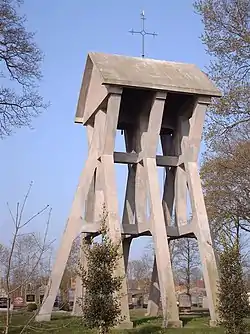 Luinjeberd bell tower | |
 Coat of arms | |
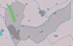 Location in the Heerenveen municipality | |
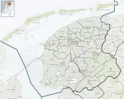 Luinjeberd Location in the Netherlands  Luinjeberd Luinjeberd (Netherlands) | |
| Coordinates: 52°59′25″N 5°55′16″E | |
| Country | |
| Province | |
| Municipality | |
| Area | |
| • Total | 6.45 km2 (2.49 sq mi) |
| Elevation | −0.5 m (−1.6 ft) |
| Population (2021)[1] | |
| • Total | 425 |
| • Density | 66/km2 (170/sq mi) |
| Postal code | 8459[1] |
| Dialing code | 0513 |
History
The village was first mentioned in 1281 as Lyedingaberde, and means "village of the people of Ludo (person)".[4] Luinjeberd was home to 586 people. The bell tower dates from 1921.[5]
Before 1934, Luinjeberd was part of the Aengwirden municipality.[5]
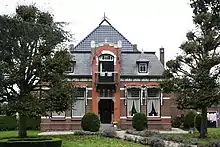
Farm at Luinjeberd
References
- "Kerncijfers wijken en buurten 2021". Central Bureau of Statistics. Retrieved 30 March 2022.
- "Postcodetool for 8459BK". Actueel Hoogtebestand Nederland (in Dutch). Het Waterschapshuis. Retrieved 30 March 2022.
- Kerncijfers wijken en buurten 2017 - CBS Statline
- "Luinjeberd - (geografische naam)". Etymologiebank (in Dutch). Retrieved 30 March 2022.
- "Luinjeberd". Luinjeberd (in Dutch). Retrieved 30 March 2022.
External links
![]() Media related to Luinjeberd at Wikimedia Commons
Media related to Luinjeberd at Wikimedia Commons
This article is issued from Wikipedia. The text is licensed under Creative Commons - Attribution - Sharealike. Additional terms may apply for the media files.