Los Angeles's 4th City Council district
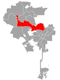
Los Angeles's 4th City Council District is one of the fifteen districts in the Los Angeles City Council. It is currently represented by Democrat Nithya Raman since 2020 after she defeated David Ryu in that year's election. The district is situated in Central Los Angeles, the southern San Fernando Valley, and eastern Santa Monica Mountains.
Los Angeles's 4th City Council district | |
|---|---|
 | |
| Government | |
| • Councilmember | . Nithya Raman . D–Silver Lake |
| Population (2020) | |
| • Total | 272,039 |
| Demographics | |
| • White | 60.9% |
| • Asian | 16% |
| • Hispanic | 14.5% |
| • Black | 4.4% |
| • Other | 0.2% |
| Website | councildistrict4 |
| Registered voters (2017) 167,235 | |
The district was created in 1925 after a new city charter was passed, which replaced the former at-large voting system for a nine-member council with a district system with a 15-member council. The council district includes many of the city's tourist destinations, such as the Hollywood Boulevard district, the La Brea Tar Pits and Los Angeles County Museum of Art, Farmers Market and The Grove, Griffith Park with the Hollywood Sign and Griffith Observatory, the Hollywood Bowl, and district adjacent Universal Studios.
Geography
The district is at the center of Los Angeles, with the unusually shaped district reaching into Koreatown and Mid-Wilshire on the south; through the Miracle Mile, Fairfax District, and Hollywood Hills into Sherman Oaks on the west; through much of Hollywood and over Cahuenga Pass into North Hollywood on the north; and through Los Feliz and Griffith Park into much of Silver Lake on the east.[1]
It is encompassed in California's 30th and 32nd congressional districts as well as California's 24th, 26th, and 27th State Senate districts and California's 44th, 46th, 51st, and 52nd State Assembly districts.
Historical boundaries
The district was preceded by the Fourth Ward, which was established in 1878 and added three seats to the Los Angeles Common Council, alongside the fifth ward. It included parts of Los Angeles to the west of the Los Angeles River, including the new neighborhood of Boyle Heights.[2][3] The district was obsolete when the at-large district was first established in 1889.
In 1889, the ward was re-established as a single-member ward, as part of the passing of the 1888 charter. It elected one member through a plurality vote before the ward became obsolete when the at-large district was re-established again in 1909.[4]
In 1925, the district was created and was originally bounded on the north by Santa Monica Boulevard, east by Vermont or Hoover Avenue, south by Washington Boulevard and west by Western Avenue.[5][6] It was described later the same year as simply "Wilshire and Pico Heights."[7] In 1928, with "the exception that seven precincts are added to it in the territory bounded by Vermont Avenue and Hoover Street and Sunset Boulevard and Melrose Avenue," the boundaries remained at "Hoover street on the east, Western avenue on the west, Melrose avenue on the north and Washington street on the south."[8]
In 1933, "due to the exceptional growth of the western part of the city, a general movement toward the ocean was necessary."[9][10] In 1937, it was bounded on the west by Crenshaw Boulevard, on the north by the 5th district and Exposition Boulevard, on the east by the city boundary and on the south by Vernon Avenue.[11] By 1940, the "general trend is westward and northeastward, due to heavy construction in the San Fernando Valley and the beach areas."[12] In 1955, it encompassed "much of the Wilshire district and in general [was] bounded by Fountain Avenue, Wilshire Boulevard, Fairfax Avenue and Catalina Street."[13]
By 1975, it was moved to Central Los Angeles, with the boundaries at Fairfax and Highland Avenues on the west, to Santa Monica Boulevard on the north, the Pasadena Freeway on the east and Olympic Boulevard on the south.[14] In 1986, it was described as "a contorted district that included the old areas as well as Atwater, Griffith Park, Forest Lawn Drive and parts of the central San Fernando Valley to Colfax Avenue and Victory Boulevard."[15] In 1989, the district stretched from Hancock Park to Studio City.[16]
List of members representing the district
1878–1889
| Dates | Councilmembers | Areas represented | |||||||||||
|---|---|---|---|---|---|---|---|---|---|---|---|---|---|
| Councilmember | Party | Electoral history | Councilmember | Party | Electoral history | Councilmember | Party | Electoral history | |||||
| Multi-member ward established December 5, 1878 | |||||||||||||
| December 5, 1878 – December 5, 1879 |
.jpg.webp) William H. Workman |
Democratic | Elected in 1878. Re-elected in 1879. [data missing] |
Samuel J. Beck |
Republican | Elected in 1878. Re-elected in 1879. Retired to run for City Tax Collector. |
Samuel M. Perry |
Republican | Elected in 1878. Lost re-election. |
1878–1889 Downtown and Boyle Heights | |||
| December 5, 1879 – December 11, 1880 |
O. H. Bliss |
Democratic | Elected in 1879. [data missing] | ||||||||||
| December 11, 1880 – December 10, 1881 |
Bernard Cohn |
Democratic | Elected in 1880. Re-elected in 1881. Retired to run for Mayor. |
Burdette Chandler |
Democratic | Elected in 1880. Re-elected in 1881. Lost re-election. | |||||||
| December 10, 1881 – December 9, 1882 |
George Kerckhoff |
Democratic | Elected in 1881. Re-elected in 1882. [data missing] | ||||||||||
| December 9, 1882 – December 8, 1883 |
Joseph W. Wolfskill |
Republican | Elected in 1882. Re-elected in 1883. [data missing] |
Alfred L. Bush |
Republican | Elected in 1882. Resigned. | |||||||
| Vacant | |||||||||||||
| December 8, 1883 – December 9, 1884 |
D. E. Miles |
Democratic | Elected in 1883. Re-elected in 1884. [data missing] |
 Frank Sabichi |
Democratic | Elected in 1883. [data missing] | |||||||
| December 9, 1884 – December 10, 1885 |
Milton Santee |
Republican | Elected in 1884. Re-elected in 1885. [data missing] |
James D. Bullis |
Republican | Elected in 1884. Re-elected in 1885. [data missing] | |||||||
| December 10, 1885 – December 13, 1886 |
Samuel M. Perry |
Republican | Elected in 1885. Re-elected 1886. [data missing] | ||||||||||
| December 13, 1886 – December 12, 1887 |
Joseph Hyans |
Democratic | Elected in 1886. Resigned. |
John Lovell |
Republican | Elected in 1886. Re-elected in 1888. [data missing] | |||||||
| Vacant | |||||||||||||
| December 12, 1887 – December 10, 1888 |
Bernard Cohn |
Democratic | Elected in 1887. Re-elected in 1888. Redistricted to the single-member ward and retired. |
Burdette Chandler |
Democratic | Elected in 1887. [data missing] | |||||||
| December 10, 1888 – February 21, 1889 |
Anthony McNally |
Democratic | Elected in 1888. Redistricted to the 7th ward and lost re-election. |
Edward R. Threlkeld |
Democratic | Elected in 1888. Redistricted to the single-member ward and lost re-election. | |||||||
| Multi-member ward eliminated February 21, 1889 | |||||||||||||
1889–1909
| Councilmember | Party | Dates | Electoral history | Areas represented |
|---|---|---|---|---|
| Single-member ward established February 25, 1989 | ||||
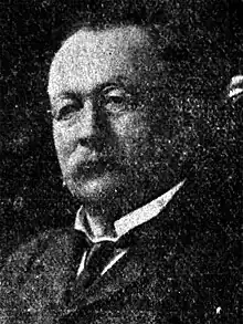 Jacob Frankenfield (South Park) |
Republican | February 25, 1889 – December 5, 1890 |
Elected in 1889. [data missing] |
1889–1909 Alvarado Terrace, Wilshire Center, South Park, Westlake |
William H. Rhodes (Wilshire Center) |
Republican | December 5, 1890 – December 12, 1894 |
Elected in 1890. Re-elected in 1892. [data missing] | |
Samuel H. Kingery (Wilshire Center) |
Democratic | December 12, 1894 – December 16, 1896 |
Elected in 1894. [data missing] | |
 Herman Silver (Westlake) |
Republican | December 16, 1896 – December 12, 1900 |
Elected in 1896. Re-elected in 1898. Retired to run for Mayor of Los Angeles. | |
.png.webp) Pomeroy W. Powers (Alvarado Terrace) |
Republican | December 12, 1900 – December 5, 1902 |
Elected in 1900. Retired to run for Mayor of Los Angeles. | |
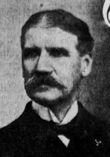 Theodore Summerland (Alvarado Terrace) |
Republican | December 5, 1902 – December 13, 1906 |
Elected in 1902. Re-elected in 1904. [data missing] | |
.jpg.webp) Niles Pease (Westlake) |
Republican | December 13, 1906 – December 10, 1909 |
Elected in 1906. Retired. | |
| Single-member ward eliminated December 10, 1909 | ||||
1925–present
| Councilmember | Party | Dates | Electoral history | Areas represented |
|---|---|---|---|---|
| District established July 1, 1925 | ||||
.jpg.webp) Boyle Workman (Mid-Wilshire) |
Democratic | July 1, 1925 – June 30, 1927 |
Redistricted from the at-large district and re-elected in 1925. Lost re-election. |
1925–1933 Mid-Wilshire and Pico-Union |
 William M. Hughes (Harvard Heights) |
Independent | July 1, 1927 – June 30, 1929 |
Elected in 1927. Lost re-election. | |
 Robert L. Burns (Wilshire Center) |
Republican | July 1, 1929 – June 30, 1945 |
Elected in 1929. Re-elected in 1933. Re-elected in 1935. Re-elected in 1937. Re-elected in 1939. Re-elected in 1941. Retired. | |
| 1933–1940 Wilshire Center, Windsor Square, Hancock Park | ||||
 Harold A. Henry (Windsor Square) |
Republican | July 1, 1945 – May 1, 1966 |
Elected in 1945. Re-elected in 1947. Re-elected in 1949. Re-elected in 1951. Re-elected in 1953. Re-elected in 1955. Re-elected in 1959. Re-elected in 1963. Re-elected in 1965. Died. | |
| 1940–1955 Hancock Park, Fairfax District, and Mid-Wilshire | ||||
| Vacant | May 1, 1966 – May 24, 1966 |
1955–1975 Central Los Angeles (Atwater Village, Griffith Park) | ||
 John Ferraro (Hancock Park) |
Democratic | May 24, 1966 – April 17, 2001 |
Appointed to finish Henry's term. Elected in 1967. Re-elected in 1971. Re-elected in 1975. Re-elected in 1979. Re-elected in 1983. Re-elected in 1987. Re-elected in 1991. Re-elected in 1995. Re-elected in 1999. Died. | |
| 1989–2021 Hancock Park, Studio City, Atwater, Griffith Park | ||||
| Vacant | April 17, 2001 – November 1, 2001 |
|||
.jpg.webp) Tom LaBonge (Silver Lake) |
Democratic | November 1, 2001 – June 30, 2015 |
Elected to finish Ferraro's term. Re-elected in 2003. Re-elected in 2007. Re-elected in 2011. Retired. | |
.jpg.webp) David Ryu (East Hollywood) |
Democratic | July 1, 2015 – December 14, 2020 |
Elected in 2015. Lost re-election. | |
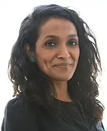 Nithya Raman (Silver Lake) |
Democratic | December 14, 2020 – |
Elected in 2020. | 2021–present Koreatown, Mid-Wilshire, Miracle Mile, Fairfax District, Hollywood Hills, Sherman Oaks, Hollywood |
See also
- Los Angeles City Council districts
- Los Angeles City Council
References
- Hernández, Caitlin (November 18, 2022). "LA City Council In 2023: Your Guide To Who's Who (And What They Do)". LAist.
- "The Ward Boundaries". Los Angeles Herald. November 12, 1878.
- "The Black Pioneers of Los Angeles County: The Counting of African Americans in the 1880 Federal Census". Homestead Museum. February 22, 2021.
In the city's First Ward including the northern part of downtown, [...].
- Stevens, Mark H. The Road to Reform: Los Angeles' Municipal Elections of 1909: Part II. Vol. 86. University of California Press. pp. 325–368.
- "First Map Showing City Council's Districts," Los Angeles Times, January 16, 1925, page 1
- "Here Are the Hundred and Twelve Aspirants for the City's Fifteen Councilmanic Seats," Los Angeles Times, May 3, 1925, page 7 Includes a map.
- "Who's Who in Council Race," Los Angeles Times, May 3, 1925, page A-7
- "Council Areas' Lines Changed," Los Angeles Times, December 29, 1928, page A-1
- "District Lines Approved," Los Angeles Times, December 24, 1932, page A-1
- "City Reapportionment Measure Gets Approval," Los Angeles Times, January 19, 1933 With map of all districts.
- "New Council Zones Defined," Los Angeles Times, January 7, 1937, page A-18
- "Proposed New Alignment for City Voting Precincts," Los Angeles Times, November 30, 1940, page A-3 Includes a map.
- "Council Contests in Seven Districts," Los Angeles Times, April 3, 1955, page B-1
- Doug Shuit, "5 Council Members Coasting Through Campaigns," Los Angeles Times, March 23, 1975, page E-1
- "Los Angeles' Realigned Council Districts," Los Angeles Times," September 21, 1986, page B-3
- Laureen Lazaarovici and Harold Meyerson, "John Ferraro on Deck," L.A. Weekly, August 11-17, 1989
- Note: Access to most Los Angeles Times links requires the use of an LAPL library card.
_edit1.jpg.webp)

