Loikaw
Loikaw (Burmese: လွိုင်ကော်မြို့; MLCTS: lwuing kau mrui., pronounced [lwàɪ(ŋ)kɔ̀ mjo̰]) is the capital of Kayah State in Myanmar. It is located in the Karen Hills area, near the State's northern tip, just above an embayment on the Pilu River.[2] The inhabitants are mostly Kayah (Karenni). Myanmar's largest hydropower plant built (by the Japanese as war reparation) is located about 20 km (12 mi) east of Loikaw at Lawpita Falls.
Loikaw
လွိုင်ကော်မြို့ Lwègaw[1] | |
|---|---|
Town | |
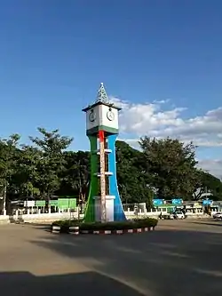 | |
 Loikaw Location in Myanmar | |
| Coordinates: 19°40′27″N 97°12′34″E | |
| Country | |
| Division | |
| District | Loikaw |
| Township | Loikaw |
| Elevation | 2,900 ft (884 m) |
| Population (2014) | 51,349 |
| Time zone | UTC+6.30 (MST) |
The town of Loikaw comprises 13 urban wards, namely Naungya, Daw-ukhu, Mainglon, Mingala, Dhammayon, Zaypaing, Shwetaung, Landama, Dawtanma, Dawnoeku, Shansu, and Minsu wards.[3]
History
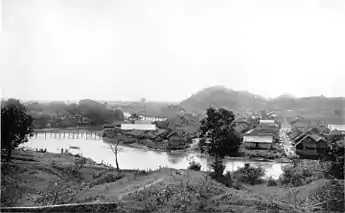
Loikaw was the Headquarters of the Political Officer in Charge of the Karenni States, part of the Princely States of British Burma, in 1922 during British rule in Burma. The town was located in the only flat part of the Karenni area. In 1892 it numbered four huts. As an Agent of the British government he was exercising control over the local Karenni Rulers, being supervised by the Superintendent at Taunggyi.[4] The headquarters of the American Baptist Mission to Hill Karens was also located in Loikaw.
As with the rest of Kayah State, outsider access to Loikaw has been restricted post-independence, with special permits required to secure entry.[5] Since the 2021 coup, Loikaw has been the scene of intense fighting between the Burmese military and ethnic armed groups opposed to military control, forcing many of the city's residents to flee.[6]
Demographics
2014
| Year | Pop. | ±% |
|---|---|---|
| 1973 | — | |
| 1983 | 33,665 | — |
| 2014 | 51,349 | +52.5% |
| Source: Ministry of Labor, Immigration, and Population data | ||
The 2014 Myanmar Census reported that Loikaw had a population of 51,349, constituting 40.0% of Loikaw Township's total population.[3]
Climate
Loikaw has a tropical savanna climate (Köppen Aw) bordering on a humid subtropical climate (Cwa).
| Climate data for Loikaw (1991–2020) | |||||||||||||
|---|---|---|---|---|---|---|---|---|---|---|---|---|---|
| Month | Jan | Feb | Mar | Apr | May | Jun | Jul | Aug | Sep | Oct | Nov | Dec | Year |
| Average high °C (°F) | 27.7 (81.9) |
30.2 (86.4) |
32.8 (91.0) |
33.8 (92.8) |
31.3 (88.3) |
29.1 (84.4) |
28.2 (82.8) |
28.0 (82.4) |
28.8 (83.8) |
28.8 (83.8) |
28.0 (82.4) |
26.7 (80.1) |
29.4 (84.9) |
| Daily mean °C (°F) | 18.6 (65.5) |
20.7 (69.3) |
24.0 (75.2) |
26.5 (79.7) |
26.1 (79.0) |
25.0 (77.0) |
24.5 (76.1) |
24.3 (75.7) |
24.6 (76.3) |
23.9 (75.0) |
21.5 (70.7) |
18.8 (65.8) |
23.2 (73.8) |
| Average low °C (°F) | 9.5 (49.1) |
11.2 (52.2) |
15.2 (59.4) |
19.3 (66.7) |
20.8 (69.4) |
21.0 (69.8) |
20.8 (69.4) |
20.7 (69.3) |
20.5 (68.9) |
19.1 (66.4) |
15.1 (59.2) |
10.9 (51.6) |
17.0 (62.6) |
| Average precipitation mm (inches) | 9.3 (0.37) |
2.7 (0.11) |
14.1 (0.56) |
41.1 (1.62) |
139.9 (5.51) |
142.1 (5.59) |
155.6 (6.13) |
226.5 (8.92) |
191.6 (7.54) |
131.4 (5.17) |
38.4 (1.51) |
10.2 (0.40) |
1,102.7 (43.41) |
| Average precipitation days (≥ 1.0 mm) | 1.0 | 0.3 | 1.3 | 5.0 | 14.2 | 18.3 | 19.4 | 21.5 | 17.1 | 11.1 | 4.2 | 1.4 | 114.7 |
| Source: World Meteorological Organization[7] | |||||||||||||
Transport
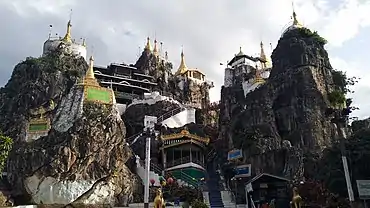
Air
Loikaw is linked to Yangon and Mandalay by air.
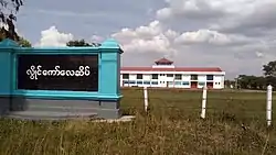
Rail
Loikaw is linked by the newly constructed Aungpan-Pinlaung-Loikaw rail line.
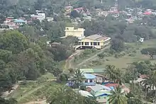
Buses
There are express buses from loikaw to Yangon, Mandalay and other towns.
Education
The town is home to Loikaw University, Technological University, Loikaw, Computer University, Loikaw. Loikaw Education College
Health care
Loikaw General Hospital serves not only locals in the state but also to those in the southern part of neighbouring Shan State. The existing buildings of the hospital were built in 1964. Due to increase demands, new two two-storey buildings were constructed with the 1.945 billion yen funding from Japan International Cooperation Agency (JICA).[8]
See also
- Loikaw Airport
- Kayah State Cultural Museum
- Lawpita Hydropower Plants
References
- "Lwègaw (Variant)" Loikaw at GEOnet Names Server, United States National Geospatial-Intelligence Agency
- Bitsch, Jørgen (1966) Why Buddha Smiles Taplinger Publishing, New York, pages 55–56, OCLC 421824
- "Loikaw Township Report" (PDF). 2014 Myanmar Population and Housing Census. October 2017.
- Imperial Gazetteer of India, v. 15, p. 36.
- "A guide to Loikaw, Kayah State (Myanmar) – Against the Compass". 2016-10-08. Retrieved 2022-01-14.
- "Burmese flee bombardment as junta 'makes example' of city of Loikaw". the Guardian. 2022-01-14. Retrieved 2022-01-14.
- "World Meteorological Organization Climate Normals for 1991–2020". World Meteorological Organization. Retrieved 16 October 2023.
- "Loikaw to get new hospital buildings funded by JICA – Global New Light Of Myanmar". Global New Light Of Myanmar. 2015-02-11. Archived from the original on February 12, 2015. Retrieved 2017-10-08.
{{cite news}}: CS1 maint: unfit URL (link)
External links
 Media related to Loikaw at Wikimedia Commons
