Lock and Dam No. 11
General Zebulon Pike Lock and Dam No. 11 is a lock and dam located between Dubuque, Iowa, and rural Grant County, Wisconsin, on the Upper Mississippi River.
| Lock and Dam No. 11 | |
|---|---|
 Lock and Dam No. 11 as seen from a drone. | |
| Official name | General Zebulon Pike Lock and Dam No. 11 |
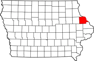
| Location | Dubuque, Iowa / Jamestown, Grant County, Wisconsin |
| Coordinates | 42.540278°N 90.644167°W |
| Construction began | 1934 |
| Opening date | 14 September 1937 |
| Operator(s) | |
| Dam and spillways | |
| Impounds | Upper Mississippi River |
| Length | 1,478 ft (450 m) |
| Reservoir | |
| Creates | Pool 11 |
| Total capacity | 170,000 acre⋅ft (0.21 km3) |
| Catchment area | 81,600 sq mi (211,000 km2) |
Lock and Dam No. 11 Historic District | |
  | |
| Location | 11 Lime Street, Dubuque, Iowa |
| Area | 114.2 acres (46.22 ha) |
| Built | 1937 |
| Architect | Abbott, Edwin E.; multiple |
| Architectural style | lock and dam |
| MPS | Upper Mississippi River 9-Foot Navigation Project MPS |
| NRHP reference No. | 04000171[1] |
| Added to NRHP | March 10, 2004 |
It was opened to navigation 14 September 1937.
Description
The movable portion of the dam is 1,478 feet (450.5 m) long and consists of 13 tainter gates and three roller gates. The non-movable part is a 3,340 feet (1,018.0 m) long non-overflow earthen dam that connects to the Wisconsin shore.
The main lock is 110 feet (33.5 m) wide by 600 feet (182.9 m) long. There is also an incomplete auxiliary lock.[2]
The lock and dam are listed on the National Register of Historic Places.[1]
Gallery
- Lock and Dam No. 11

 Aerial view to the west—Iowa bank
 Aerial view, with Eagle Point Bridge (1940)

See also
References
- "National Register Information System". National Register of Historic Places. National Park Service. March 13, 2009.
- "Lock & Dam 11" (PDF). U.S. Army Corps of Engineers. Archived from the original (PDF) on January 6, 2014. Retrieved January 5, 2014.
External links
- Lock and Dam No. 11 - U.S. Army Corps of Engineers (Official site)
 Media related to Lock and Dam No. 11 (Upper Mississippi River) at Wikimedia Commons
- USGS.gov: Reach 1, Pool 11
- USACE Civil Works Digital Project Notebook
- Historic American Engineering Record (HAER) No. IA-23, "Mississippi River 9-Foot Channel Project, Lock & Dam No. 11, Upper Mississippi River, Dubuque, Dubuque County, IA", 50 photos, 16 data pages, 3 photo caption pages
| Topics | |
|---|---|
| Lists by state |
|
| Lists by insular areas | |
| Lists by associated state | |
| Other areas | |
| Related | |
This article is issued from Wikipedia. The text is licensed under Creative Commons - Attribution - Sharealike. Additional terms may apply for the media files.