Llangattock Lingoed
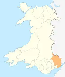
Llangattock Lingoed (Welsh: Llangatwg Lingoed) is a small rural village in Monmouthshire, south east Wales. It is located approximately five miles north of Abergavenny, between Abergavenny and Grosmont, a few miles south of the Wales-England border. Offa's Dyke Path passes through the village. The village is near the Black Mountains and the Brecon Beacons National Park.
Llangattock Lingoed
| |
|---|---|
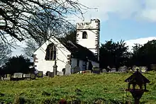 Church of St Cadoc | |
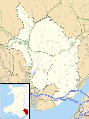 Llangattock Lingoed Location within Monmouthshire | |
| OS grid reference | SO362201 |
| Principal area | |
| Preserved county | |
| Country | Wales |
| Sovereign state | United Kingdom |
| Post town | ABERGAVENNY |
| Postcode district | NP7 |
| Dialling code | 01873 |
| Police | Gwent |
| Fire | South Wales |
| Ambulance | Welsh |
| UK Parliament | |
Amenities and history
The parish church is St Cadoc's and both the village and the church have a long and interesting history sandwiched as they are in the Welsh Marches between border castles and the historical personalities holding sway at any given time.[1]
The Old Court is a Grade II* listed building situated in the village.[2]
The Cistercian Way long distance footpath that circumnavigates all of Wales also passes through the village.
References
- St. Cadoc's church history Archived 2007-09-24 at the Wayback Machine
- Good Stuff (5 June 1952). "Old Court including Former Cider House, Granary and Stable Range - Grosmont - Monmouthshire - Wales". British Listed Buildings. Retrieved 26 February 2017.
External links
- The parish name
- Map sources for Llangattock Lingoed