Liberty Corner, New Jersey
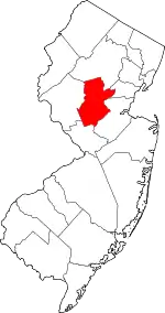
Liberty Corner is an unincorporated community and census-designated place (CDP)[5] located in Bernards Township, in Somerset County, in the U.S. state of New Jersey.[6][7] Liberty Corner is about 3+3⁄4 miles (6.0 km) south of Bernardsville. Liberty Corner has a post office with ZIP code 07938.[8] The Liberty Corner Historic District was listed on the state and national registers of historic places in 1991.
Liberty Corner, New Jersey | |
|---|---|
 | |
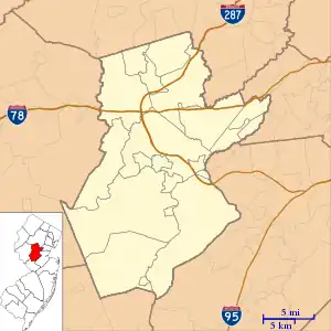 Liberty Corner Location in Somerset County  Liberty Corner Location in New Jersey  Liberty Corner Location in the United States | |
| Coordinates: 40°39′53″N 074°34′39″W | |
| Country | |
| State | |
| County | Somerset |
| Township | Bernards |
| Area | |
| • Total | 1.93 sq mi (5.00 km2) |
| • Land | 1.92 sq mi (4.98 km2) |
| • Water | 0.01 sq mi (0.02 km2) |
| Elevation | 236 ft (72 m) |
| Population | |
| • Total | 1,877 |
| • Density | 976.59/sq mi (377.00/km2) |
| Time zone | UTC−05:00 (Eastern (EST)) |
| • Summer (DST) | UTC−04:00 (EDT) |
| ZIP Code | 07938 |
| Area code | 908 |
| FIPS code | 34-40140[4] |
| GNIS feature ID | 877746[2] |
Demographics
As of the 2020 United States census, the population was 1877.[3]
| Census | Pop. | Note | %± |
|---|---|---|---|
| 2020 | 1,877 | — | |
| U.S. Decennial Census[9] 2020[3] | |||
History
In 1722, the area was known by its primary landholder, John Annin, as "Annin's Corner." This was changed to "Liberty Corner" during the American Revolution.[10]
On August 29, 1781, the First Brigade of the French Army, the Expédition Particulière, under command of the French general Comte de Rochambeau, camped here by Bullion's Tavern, along the route to Yorktown, Virginia. The next day they marched to the campground at Somerset Courthouse, now Millstone. The American Continental Army marched nearby along different roads as part of this joint effort.[11][12]
The Bonnie Brae School for boys was an orphanage in the area. It was founded in 1916 as a "working farm" for boys.[13][14] in 2018 it accepts boys that have been emotionally maltreated.[15]
Historic district
Liberty Corner Historic District | |
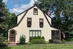 Eclectic Revival style house | |
| Location | Roughly, junction of Church Street and Valley and Lyons Roads, and area West and Southwest |
|---|---|
| Area | 142.3 acres (57.6 ha) |
| Built | 1869 |
| Built by | James A. Goltra |
| Architectural style | Colonial Revival, Italianate, Queen Anne |
| NRHP reference No. | 91001477[16] |
| NJRHP No. | 2473[17] |
| Significant dates | |
| Added to NRHP | October 11, 1991 |
| Designated NJRHP | August 16, 1991 |
The Liberty Corner Historic District is a historic district in the village. The district was added to the National Register of Historic Places on October 11, 1991, for its significance in community development and architecture from 1865 to 1935.[18]
Education
Liberty Corner Elementary, built in c. 1904, is located in the area. It is the oldest school in the Bernards Township School District. It once instructed grades 1 through 8. In 2018, it taught 550 students in grades K-5.[19]
Points of interest
- The United States Golf Association and the USGA Museum
Gallery
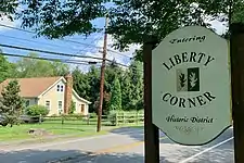 Historic district
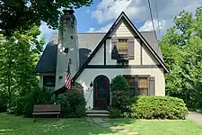 Eclectic Revival style house
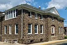 Liberty Corner Elementary School
Notable people
People who were born in, residents of, or otherwise closely associated with Liberty Corner include:
- The Kienast quintuplets (born 1970), lived here from just after their birth in 1970 to at least 1984[20]
- William Henry Johnson, known as Zip the Pinhead was born here sometime before 1858.
References
- "ArcGIS REST Services Directory". United States Census Bureau. Retrieved October 11, 2022.
- "Liberty Corner". Geographic Names Information System. United States Geological Survey, United States Department of the Interior.
- Census Data Explorer: Liberty Corner CDP, New Jersey, United States Census Bureau. Accessed June 15, 2023.
- Geographic Codes Lookup for New Jersey, Missouri Census Data Center. Accessed June 9, 2023.
- State of New Jersey Census Designated Places - BVP20 - Data as of January 1, 2020, United States Census Bureau. Accessed December 1, 2022.
- Gordon, Thomas Francis (1834). "A Gazetteer of the State of New Jersey: Comprehending a General View of Its Physical and Moral Condition, Together with a Topographical and Statistical Account of Its Counties, Towns, Villages, Canals, Rail Roads, &c., Accompanied by a Map".
- Locality Search, State of New Jersey. Accessed December 14, 2014.
- "Free ZIP Code Lookup with area code, county, geocode, MSA/PMSA, population". www.zipinfo.com. Retrieved February 3, 2019.
- "Census of Population and Housing". Census.gov. Retrieved June 4, 2016.
- "Local Interest - Historical Society of The Somerset Hills". www.historicalsocietyofsomersethills.org. Archived from the original on February 10, 2012. Retrieved February 3, 2019.
- "Nova Cæsarea: A Cartographic Record of the Garden State, 1666–1888: Historical Background Maps, Road Maps". Princeton University Library.
Louis-Alexandre Berthier. de Buillon's tavern à Summerset court house
- Selig, Robert A. "The Washington–Rochambeau Revolutionary Route in The State of New Jersey, 1781 – 1783: An Historical and Architectural Survey" (PDF). New Jersey Historic Trust. pp. 194–202.
- "History Of The Piper - Bonnie Brae - Liberty Corner, NJ". bonnie-brae.org. Retrieved February 3, 2019.
- "Bonnie Brae : 100 Year History". Issuu. Retrieved February 3, 2019.
- "Family Support". www.morrissussexresourcenet.org. Retrieved February 3, 2019.
- "National Register Information System – (#91001477)". National Register of Historic Places. National Park Service. November 2, 2013.
- "New Jersey and National Registers of Historic Places – Somerset County" (PDF). New Jersey Department of Environmental Protection – Historic Preservation Office. September 30, 2020. p. 2.
- Foster, Janet W. (February 25, 1991). "National Register of Historic Places Inventory/Nomination: Liberty Corner Historic District". National Park Service. With accompanying 80 photos
- "History and Philosophy - Liberty Corner Elementary School". libertycorner.bernardsboe.com. Retrieved February 3, 2019.
- Dowd, Maureen (March 5, 1984). "Quintuplets' Father Lost Struggle in the Limelight". The New York Times. Retrieved February 3, 2019 – via NYTimes.com.
External links
 Media related to Liberty Corner, New Jersey at Wikimedia Commons
- "French Army Encampment". Historical Marker Database.
