Levakant
Levakant (Russian: Левакант; Tajik: Левакант, Kalininabad (Калилининобод) until February 1996, Sarband (Сарбанд) until January 2018),[2] is a city in south-west Tajikistan. It is part of Khatlon Region, located just east of the regional capital Bokhtar and about 120 km south of the national capital Dushanbe.[3] The Golovnaya Dam on the river Vakhsh lies directly to its east.
Levakant
Левакант | |
|---|---|
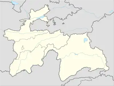 Levakant Location in Tajikistan | |
| Coordinates: 37°52′N 68°55′E | |
| Country | |
| Region | Khatlon Region |
| Elevation | 672 m (2,205 ft) |
| Population (2020) | |
| • City | 17,700 |
| • Urban | 48,300 |
| Official languages | |
Its population is estimated at 17,700 for the city proper and 48,300 for the city with the outlying communities (2020).[4]
Levakant is home to Tajikistan's only fertilizer manufacturing plant, Tajik Azot.
Climate
Levakant has a hot-summer Mediterranean climate (Köppen climate classification Csa).
| Climate data for Sarband | |||||||||||||
|---|---|---|---|---|---|---|---|---|---|---|---|---|---|
| Month | Jan | Feb | Mar | Apr | May | Jun | Jul | Aug | Sep | Oct | Nov | Dec | Year |
| Average high °C (°F) | 7.9 (46.2) |
11.0 (51.8) |
16.7 (62.1) |
23.8 (74.8) |
29.4 (84.9) |
35.4 (95.7) |
37.1 (98.8) |
35.5 (95.9) |
31.0 (87.8) |
24.6 (76.3) |
16.9 (62.4) |
10.5 (50.9) |
23.3 (74.0) |
| Average low °C (°F) | −1.1 (30.0) |
1.0 (33.8) |
5.9 (42.6) |
11.3 (52.3) |
15.1 (59.2) |
18.6 (65.5) |
20.1 (68.2) |
18.1 (64.6) |
13.1 (55.6) |
8.6 (47.5) |
3.9 (39.0) |
0.9 (33.6) |
9.6 (49.3) |
| Average precipitation mm (inches) | 43 (1.7) |
52 (2.0) |
77 (3.0) |
55 (2.2) |
35 (1.4) |
3 (0.1) |
0 (0) |
0 (0) |
0 (0) |
14 (0.6) |
26 (1.0) |
39 (1.5) |
344 (13.5) |
| Source: Climate-data.org | |||||||||||||
Subdivisions
Before ca. 2018, Levakant was the seat of Sarband District, which covered the present city of Levakant.[5] The city of Levakant covers Levakant proper and two jamoats. These are as follows:[6]
| Jamoat | Population (Jan. 2015)[6] |
|---|---|
| Guliston | 18,151 |
| Vahdat | 8,040 |
See also
References
- "КОНСТИТУЦИЯ РЕСПУБЛИКИ ТАДЖИКИСТАН". prokuratura.tj. Parliament of Tajikistan. Retrieved 9 January 2020.
- Renaming of a number of cities, districts and settlements of Khatlon Province
- Republic of Tajikistan, map showing administrative division as of January 1, 2004, "Tojikkoinot" Cartographic Press, Dushanbe
- "Population of the Republic of Tajikistan as of 1 January 2020" (PDF) (in Russian). Statistics office of Tajikistan. Retrieved 8 October 2020.
- "Population of the Republic of Tajikistan as of 1 January 2015" (PDF) (in Russian). Statistics office of Tajikistan. Archived from the original (PDF) on 2 July 2015. Retrieved 3 October 2020.
- Jamoat-level basic indicators, United Nations Development Programme in Tajikistan, accessed 8 October 2020
Capital: Bokhtar | |||||||||||||||||||||||||||||||||||||||||||||||
|  | ||||||||||||||||||||||||||||||||||||||||||||||
|
| |||||||||||||||||||||||||||||||||||||||||||||||
| |||||||||||||||||||||||||||||||||||||||||||||||