Le Carbet
Le Carbet (French pronunciation: [lə kaʁbe], [lə kaʁbɛ]; Martinican Creole: Kabé) is a village and commune in the French overseas department of Martinique.
Le Carbet | |
|---|---|
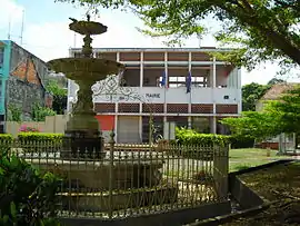 The town hall of Le Carbet | |
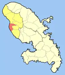 Location of the commune (in red) within Martinique | |
Location of Le Carbet | |
| Coordinates: 14°42′40″N 61°10′50″W | |
| Country | France |
| Overseas region and department | Martinique |
| Arrondissement | Saint-Pierre |
| Intercommunality | CA Pays Nord Martinique |
| Government | |
| • Mayor (2020–2026) | Jean-Claude Ecanvil[1] |
| Area 1 | 36.00 km2 (13.90 sq mi) |
| Population | 3,424 |
| • Density | 95/km2 (250/sq mi) |
| Demonym | Carbétien.ne |
| Time zone | UTC−04:00 (AST) |
| INSEE/Postal code | 97204 /97221 |
| Elevation | 0–570 m (0–1,870 ft) |
| 1 French Land Register data, which excludes lakes, ponds, glaciers > 1 km2 (0.386 sq mi or 247 acres) and river estuaries. | |
Population
| Year | Pop. | ±% p.a. |
|---|---|---|
| 1967 | 3,364 | — |
| 1974 | 3,128 | −1.03% |
| 1982 | 2,711 | −1.77% |
| 1990 | 3,014 | +1.33% |
| 1999 | 3,316 | +1.07% |
| 2007 | 3,722 | +1.45% |
| 2012 | 3,736 | +0.08% |
| 2017 | 3,535 | −1.10% |
| Source: INSEE[3] | ||
References
- "Répertoire national des élus: les maires" (in French). data.gouv.fr, Plateforme ouverte des données publiques françaises. 4 May 2022.
- "Populations légales 2020". The National Institute of Statistics and Economic Studies. 29 December 2022.
- Population en historique depuis 1968, INSEE
External links
- Base Mérimée: Search for heritage in the commune, Ministère français de la Culture. (in French)
Wikimedia Commons has media related to Le Carbet.
This article is issued from Wikipedia. The text is licensed under Creative Commons - Attribution - Sharealike. Additional terms may apply for the media files.