Lantier, Quebec
Lantier is a village and municipality in the Laurentides region of Quebec, Canada, part of the Les Laurentides Regional County Municipality.
Lantier | |
|---|---|
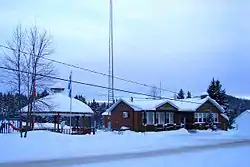 Municipal hall | |
| Motto: En pleine nature (Surrounded by nature) | |
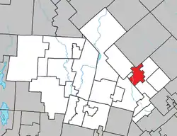 Location within Les Laurentides RCM | |
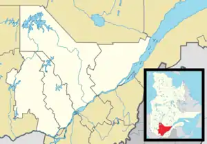 Lantier Location in central Quebec | |
| Coordinates: 46°09′N 74°15′W[1] | |
| Country | |
| Province | |
| Region | Laurentides |
| RCM | Les Laurentides |
| Constituted | January 1, 1948 |
| Government | |
| • Mayor | Richard Forget |
| • Federal riding | Laurentides—Labelle |
| • Prov. riding | Bertrand |
| Area | |
| • Total | 48.80 km2 (18.84 sq mi) |
| • Land | 42.97 km2 (16.59 sq mi) |
| Population (2011)[3] | |
| • Total | 828 |
| • Density | 19.3/km2 (50/sq mi) |
| • Pop 2006-2011 | |
| • Dwellings | 762 |
| Time zone | UTC−5 (EST) |
| • Summer (DST) | UTC−4 (EDT) |
| Postal code(s) | |
| Area code | 819 |
| Highways | |
| Website | www.municipalite. lantier.qc.ca |
Demographics
Population trend:[4]
- Population in 2011: 828 (2006 to 2011 population change: 0.4%)
- Population in 2006: 825
- Population in 2001: 654
- Population in 1996: 631 (or 634 when adjusted for 2001 boundaries)
- Population in 1991: 680
Private dwellings occupied by usual residents: 370 (total dwellings: 762)
Mother tongue:
- English as first language: 8.6%
- French as first language: 88.3%
- English and French as first language: 0%
- Other as first language: 3.1%
Education
Sainte Agathe Academy (of the Sir Wilfrid Laurier School Board) in Sainte-Agathe-des-Monts serves English-speaking students in this community for both elementary and secondary levels.[5]
References
- "Reference number 34131 in Banque de noms de lieux du Québec". toponymie.gouv.qc.ca (in French). Commission de toponymie du Québec.
- "Geographic code 78015 in the official Répertoire des municipalités". www.mamh.gouv.qc.ca (in French). Ministère des Affaires municipales et de l'Habitation.
- Statistics Canada 2011 Census - Lantier census profile
- Statistics Canada: 1996, 2001, 2006, 2011 census
- "About Us." Saint Agathe Academy. Retrieved on September 4, 2017. See Elementary zone map and Secondary zone map - Note that all areas covered in the elementary map are also covered in the secondary one.
Places adjacent to Lantier, Quebec | |
|---|---|
| Cities/towns | |
|---|---|
| Municipalities | |
| Townships | |
| Parishes | |
| Villages | |
| |
This article is issued from Wikipedia. The text is licensed under Creative Commons - Attribution - Sharealike. Additional terms may apply for the media files.