Lake Valley, California
Lake Valley | |
|---|---|
 | |
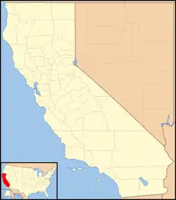 Lake Valley Location in California  Lake Valley Lake Valley (the United States) | |
| Coordinates: 38°55′48″N 120°00′17″W | |
| Country | United States |
| State | California |
| County | El Dorado County |
| Elevation | 6,207 ft (1,892 m) |
Lake Valley (formerly, Bigler Lake Valley)[2] is an unincorporated community in El Dorado County, California.[1] It extends for 8 miles (13 km) along the Upper Truckee River from Lake Tahoe to Meyers,[2] at an elevation of 6207 feet (1892 m).[1]
The place was founded in or before 1853.[2] There was a pony express remount station at the top of the valley in the early 1860s.[3][4] There used to be a railroad that ran down Lake Valley and terminated at a pier in Bijou.[5]
References
- U.S. Geological Survey Geographic Names Information System: Lake Valley, California
- Durham, David L. (1998). California's Geographic Names: A Gazetteer of Historic and Modern Names of the State. Clovis, Calif.: Word Dancer Press. p. 510. ISBN 1-884995-14-4.
- "Pony Express National Historic Trail". National Park Service.
- United States Geological Survey (1891). Pyramid Peak Sheet (JPEG) (Topographic map). 1:125,000. Reston, VA: United States Geological Survey. Retrieved July 17, 2018.
- United States Geological Survey (1891). Markleeville Sheet (JPEG) (Topographic map). 1:125,000. Reston, VA: United States Geological Survey. Retrieved July 17, 2018.
Municipalities and communities of El Dorado County, California, United States | ||
|---|---|---|
| Cities | 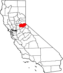 El Dorado County map | |
| CDPs | ||
| Unincorporated communities |
| |
| Former settlements | ||
| Footnotes | ‡This CDP also has portions in an adjacent county or counties | |
This article is issued from Wikipedia. The text is licensed under Creative Commons - Attribution - Sharealike. Additional terms may apply for the media files.