Labatut-Rivière
Labatut-Rivière (French pronunciation: [labaty ʁivjɛʁ]; Occitan: L'Abatut) is a commune in the Hautes-Pyrénées department in south-western France.
Labatut-Rivière | |
|---|---|
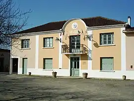 La mairie de Labatut-Rivière | |
.svg.png.webp) Coat of arms | |
Location of Labatut-Rivière | |
 Labatut-Rivière  Labatut-Rivière | |
| Coordinates: 43°31′40″N 0°02′03″E | |
| Country | France |
| Region | Occitania |
| Department | Hautes-Pyrénées |
| Arrondissement | Tarbes |
| Canton | Val d'Adour-Rustan-Madiranais |
| Intercommunality | Adour Madiran |
| Government | |
| • Mayor (2020–2026) | Robert Maisonneuve[1] |
| Area 1 | 12.71 km2 (4.91 sq mi) |
| Population | 381 |
| • Density | 30/km2 (78/sq mi) |
| Time zone | UTC+01:00 (CET) |
| • Summer (DST) | UTC+02:00 (CEST) |
| INSEE/Postal code | 65240 /65700 |
| Elevation | 148–226 m (486–741 ft) (avg. 156 m or 512 ft) |
| 1 French Land Register data, which excludes lakes, ponds, glaciers > 1 km2 (0.386 sq mi or 247 acres) and river estuaries. | |
The Church of the Assumption

Church of the Assumption, Labatut-Rivière.
The church was restored in 1846, while the most recent restoration work was carried out in 2007. There is a cemetery that includes a chapel to Darré Libéros.
References
- "Répertoire national des élus: les maires" (in French). data.gouv.fr, Plateforme ouverte des données publiques françaises. 13 September 2022.
- "Populations légales 2020". The National Institute of Statistics and Economic Studies. 29 December 2022.
Wikimedia Commons has media related to Labatut-Rivière.
This article is issued from Wikipedia. The text is licensed under Creative Commons - Attribution - Sharealike. Additional terms may apply for the media files.