La Vallée-du-Richelieu Regional County Municipality
La Vallée-du-Richelieu (The Valley of the Richelieu) is a regional county municipality in the Montérégie region in southwestern Quebec, Canada. Its seat is McMasterville.
La Vallée-du-Richelieu | |
|---|---|
-MRC_Vall%C3%A9e_du_Richelieu-Bureau-chef-2022-09-13.jpg.webp) | |
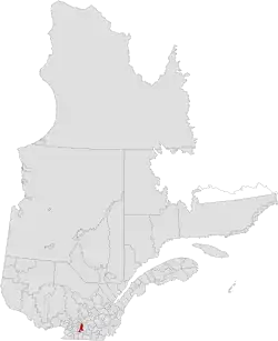 Location in province of Quebec. | |
| Coordinates: 45°34′N 73°12′W[1] | |
| Country | |
| Province | |
| Region | Montérégie |
| Effective | January 1, 1982 |
| County seat | McMasterville |
| Government | |
| • Type | Prefecture |
| • Prefect | Gilles Plante |
| Area | |
| • Total | 605.50 km2 (233.78 sq mi) |
| • Land | 588.60 km2 (227.26 sq mi) |
| Population (2016)[3] | |
| • Total | 124,420 |
| • Density | 211.4/km2 (548/sq mi) |
| • Change 2011-2016 | |
| • Dwellings | 49,971 |
| Time zone | UTC−5 (EST) |
| • Summer (DST) | UTC−4 (EDT) |
| Area code(s) | 450 and 579 |
| Website | www |
| [4] | |
It surrounds the Richelieu River as the river flows north from Lake Champlain in the United States to the Saint Lawrence River northeast of Montreal at Sorel-Tracy, Quebec. Dramatically different from the mountainous terrain to the south, the river valley is a vast plain that has been developed with extensive farmlands.
In the 21st century, the Richelieu River is very popular for both U.S. and Canadian recreational boaters, providing a connection that can bring boaters all the way from the outlet of the Saint Lawrence River to New York Harbor. A number of old fortifications exist dating back to the 17th century; they were built by the French in an effort to try to prevent the Iroquois from using the river as a way to attack the French settlers in the area. Fort Richelieu is at the mouth of the Richelieu River. Fort St. Louis (now Fort Chambly) at Chambly, Fort Sainte-Thérèse, and Fort Saint-Jean at Saint-Jean-sur-Richelieu, are on the way. Fort St. Anne Isle La Motte, Vermont in Lake Champlain is near the river's source. The region is informally known as la Vallée-des-Forts.
Subdivisions
There are 13 subdivisions within the RCM:[2]
Demographics
Population
| 2021 | 2016 | 2011 | |
|---|---|---|---|
| Population | 131,803 (+5.9% from 2016) | 124,420 (+6.5% from 2011) | 116,773 (+9.4% from 2006) |
| Land area | 587.84 km2 (226.97 sq mi) | 588.60 km2 (227.26 sq mi) | 588.88 km2 (227.37 sq mi) |
| Population density | 224.2/km2 (581/sq mi) | 211.4/km2 (548/sq mi) | 198.3/km2 (514/sq mi) |
| Median age | 42.0 (M: 41.6, F: 42.4) | 40.7 (M: 40.1, F: 41.2) | 39.5 (M: 38.9, F: 40.0) |
| Private dwellings | 53,796 (total) 52,785 (occupied) | 49,971 (total) | 46,215 (total) |
| Median household income | $100,000 | $84,889 | $74,521 |
|
|
| ||||||||||||||||||||||||||||||
| [10][3] | ||||||||||||||||||||||||||||||||
Language
| Canada Census Mother Tongue - La Vallée-du-Richelieu Regional County Municipality, Quebec[10] | ||||||||||||||||||
|---|---|---|---|---|---|---|---|---|---|---|---|---|---|---|---|---|---|---|
| Census | Total | French |
English |
French & English |
Other | |||||||||||||
| Year | Responses | Count | Trend | Pop % | Count | Trend | Pop % | Count | Trend | Pop % | Count | Trend | Pop % | |||||
2016 |
123,485 |
114,405 | 92.6% | 3,990 | 3.2% | 1105 | 0.80% | 3985 | 2.14% | |||||||||
2011 |
115,690 |
108,230 | 93.55% | 4,060 | 3.51% | 925 | 0.80% | 2,475 | 2.14% | |||||||||
2006 |
105,870 |
98,870 | 93.39% | 4,035 | 3.81% | 595 | 0.56% | 2,370 | 2.24% | |||||||||
2001 |
118,635 |
108,215 | 91.22% | 6,950 | 5.86% | 1,050 | 0.88% | 2,420 | 2.04% | |||||||||
1996 |
112,920 |
102,310 | n/a | 90.60% | 7,145 | n/a | 6.33% | 965 | n/a | 0.85% | 2,500 | n/a | 2.21% | |||||
Transportation
References
- "Reference number 141084 in Banque de noms de lieux du Québec". toponymie.gouv.qc.ca (in French). Commission de toponymie du Québec.
- "Geographic code 570 in the official Répertoire des municipalités". www.mamh.gouv.qc.ca (in French). Ministère des Affaires municipales et de l'Habitation.
- "Census Profile, 2016 Census La Vallée-du-Richelieu, Municipalité régionale de comté [Census division], Quebec". Statistics Canada. Retrieved November 25, 2019.
- "La Vallée-du-Richelieu Regional County Municipality (Code 2457) Census Profile". 2011 census. Government of Canada - Statistics Canada.
- "2021 Community Profiles". 2021 Canadian Census. Statistics Canada. February 4, 2022. Retrieved 2023-10-19.
- "2016 Community Profiles". 2016 Canadian Census. Statistics Canada. August 12, 2021. Retrieved 2019-11-25.
- "2011 Community Profiles". 2011 Canadian Census. Statistics Canada. March 21, 2019. Retrieved 2014-02-08.
- "2006 Community Profiles". 2006 Canadian Census. Statistics Canada. August 20, 2019.
- "2001 Community Profiles". 2001 Canadian Census. Statistics Canada. July 18, 2021.
- Statistics Canada: 1996, 2001, 2006, 2011 census
External links
Adjacent Counties & Equivalent Territories | ||||||||||||||||
|---|---|---|---|---|---|---|---|---|---|---|---|---|---|---|---|---|
| ||||||||||||||||