Kompienga Province
Kompienga is one of the 45 provinces of Burkina Faso, located in its Est Region.
Kompienga | |
|---|---|
Province | |
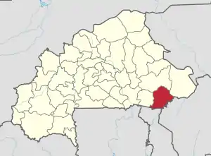 Location in Burkina Faso | |
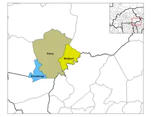 Provincial map of its departments | |
| Coordinates: 11°25′N 0°55′E | |
| Country | |
| Region | Est Region |
| Capital | Pama |
| Area | |
| • Province | 6,998 km2 (2,702 sq mi) |
| Population (2019 census)[1] | |
| • Province | 117,672 |
| • Density | 17/km2 (44/sq mi) |
| • Urban | 13,579 |
| Time zone | UTC+0 (GMT 0) |
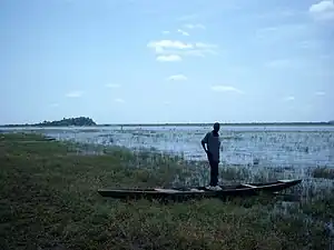
The capital of Kompienga is Pama. The province also borders the country of Togo. The Kompienga Dam located in the province is the country's first hydro-electric dam and is responsible for much of Ouagadougou's electricity supply.[2]
Departments
| Department | Capital city | Population (Census 2006)[3] |
|---|---|---|
| Kompienga Department | Kompienga | 29,609 |
| Madjoari Department | Madjoari | 9,550 |
| Pama Department | Pama | 36,503 |
See also
References
- Citypopulation.de Population of provinces in Est Region
- Manson, K.; Knight (2006). "IV: The East". Burkina Faso. Bradt Travel Guides, The Globe Pequot Press Inc. p. 196. ISBN 1841621544. Retrieved June 17, 2008.
- "National 2006 census preliminary results" (PDF). Archived from the original (PDF) on 2015-07-21. Retrieved 2014-10-16.
This article is issued from Wikipedia. The text is licensed under Creative Commons - Attribution - Sharealike. Additional terms may apply for the media files.