Khyber Pass Road, New Zealand
Khyber Pass Road is a street in the Auckland City Centre, New Zealand, connecting Upper Symonds Street to Broadway in Newmarket. The road is intersected by both the Western Line and the Auckland Southern Motorway.
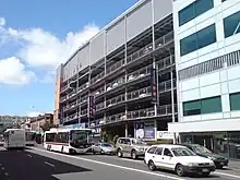 Khyber Pass Road in 2010 | |
| Length | 1.6 km (0.99 mi) |
|---|---|
| Location | Newton, Grafton and Newmarket, New Zealand |
| Postal code | 1023 |
| Coordinates | 36.8657°S 174.7695°E |
| West end | Symonds Street |
| East end | Broadway |
History
.jpg.webp)
.jpg.webp)
Khyber Pass began life as a dirt track, during the early settlement of Auckland in the 1840s.[1] As the road was seen as a dangerous frontier, it was named after the Khyber Pass in modern-day Pakistan, which at the time was glamorised as the frontier of British India.[2][3] The road, along with Great South Road, was a part of the route used by soldiers travelling south during the Invasion of the Waikato in the 1860s.[4] The spelling Kyber Pass was commonly used, up until the early 1940s.[5][6]
The part of the road close to Newmarket was known as Hobson's Bridge, referring to an old wooden bridge that existed on modern-day Davis Crescent, which crossed Hobson's Creek, a former waterway.[7] The road was the southern border of the township of Auckland in 1852, so that an ordinance stopping loose cattle could be applied to a larger area.[8][9]
During the late 1850s and 1860s, the land adjacent to Khyber Pass was subdivided and sold as suburban housing, including sections such as the Kyber Pass Village[10][11] and Kyber Pass Estate.[12][13]
The area became a centre for brewers in the mid-19th century, due to the presence of a natural spring.[4][14] The Captain Cook Inn opened by Thomas Hancock on the road in 1859. Originally brewing beer just for the tavern, by 1862 the brewery had become a commercial venture for Hancock.[14] Richard Seccombe opened a brewery opposite the Inn in 1861 called the Great Northern Brewery, later known as Lion Brewery.[14]
In 1872, the Auckland City Council purchased land on Khyber Pass, where water reservoirs and pumping stations were established.[15]
The Captain Cook Inn was demolished in 1968.[14] The last brewery site on the road was the Lion Brewery, which sold its premises in 2008, and was later redeveloped as a satellite campus of the University of Auckland.[4][14]
Notable locations
- Church of the Holy Sepulchre, an Anglican church built in 1881 to replace the church that was a part of the Anglican section of the Symonds Street Cemetery.[16]
- Grafton railway station, a railway station on the Western Line opened in 2010, replacing the earlier Boston Road railway station to the southwest.[17]
- Number Four Khyber Reservoir, a water reservoir at the corner of Symonds Street and Khyber Pass.
- St David's Presbyterian Church, a church which opened in 1927 as a World War I memorial and Presbyterian church,[18] and closed in 2020.[19]
- St Peter's College, a Catholic boys' secondary school opened in 1939.[20]
- The University of Auckland Newmarket Campus, is an engineering and science campus in the former Lion Brewery site.[21]
Gallery
.jpg.webp)
 The Khyber Reservoir
 St Peter's College, looking south along Mountain Road across the Khyber Pass Road intersection.
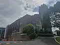 St David's Presbyterian Church
.jpg.webp) The Lion Brewery, which was converted into a University of Auckland campus in 2016
The Lion Brewery, which was converted into a University of Auckland campus in 2016
References
- Eliott, G. Eliot (3 December 1892). "Reminiscence of Early Days in Auckland". Evening Post. Vol. XLIV, no. 13. p. 1 (supplement) – via Papers Past.
- Sulzberger, Jack (1991). "A Bellicose Lot". New Zealand Geographic. Retrieved 25 February 2023.
- McLintock, A. H., ed. (1966). "Development - Roads". An Encyclopaedia of New Zealand. Retrieved 25 February 2023.
- Haworth, Jenny (2016). Auckland Then and Now. United Kingdom: Pavilion Books. p. 76-77. ISBN 978-1-910904-79-4. Wikidata Q116870435.
- "Bant It!". Manawatu Times. Vol. 68, no. 265. 8 November 1943. p. 6 – via Papers Past.
- "Social Notes". Waikato Times. Vol. 126, no. 21128. 1 June 1940. p. 17 (supplement) – via Papers Past.
- "Ask Phoebe: Dedwood a stage in Ponsonby's history". The New Zealand Herald. 24 January 2011. Retrieved 25 February 2023.
- "Proclamation". Daily Southern Cross. Vol. IX, no. 554. 19 October 1852. p. 3 – via Papers Past.
- "The Southern Cross. Friday, May 27, 1853". Daily Southern Cross. Vol. X, no. 617. 27 May 1853. p. 2 – via Papers Past.
- "Kyber Pass Village, Kyber Pass Road". Daily Southern Cross. Vol. XVI, no. 1214. 22 April 1859. p. 1 – via Papers Past.
- "Kyber Pass village, Kyber Pass Road, 49 village allotments". Auckland Libraries Heritage Collections. Retrieved 25 February 2023.
- "Kyber Pass Estate". The New Zealand Herald. Vol. II, no. 420. 18 March 1865. p. 2 – via Papers Past.
- "Kyber Pass estate, comprising 120 choice building allotments". Auckland Libraries Heritage Collections. Retrieved 25 February 2023.
- Goodall, Fiona (20 August 2009). "Brewery looks back on 140 years". Western Leader. Stuff. Retrieved 25 February 2023.
- "Auckland's Water Service Reservoirs". Engineering New Zealand. Retrieved 23 February 2023.
- "Church of the Holy Sepulchre and Hall". New Zealand Heritage List/Rārangi Kōrero. Heritage New Zealand. Retrieved 26 February 2023.
- Dearnaley, Mathew (9 April 2010). "Enter the station here, here, here ... or here". The New Zealand Herald. Retrieved 25 July 2010.
- "St David's memorial church". Ministry for Culture and Heritage. 22 October 2021. Retrieved 26 February 2023.
- "St David's Presbyterian Church". St David's Presbyterian Church. Archived from the original on 8 February 2021.
- O'Neill, J. C. (1968). The History of the Work of the Christian Brothers in New Zealand (Unpublished thesis – DipEd). University of Auckland. p. 102.
- Gibson, Anne (15 July 2016). "Auckland University thinks big with wind tunnel testing". The New Zealand Herald. Retrieved 25 February 2023.