Kematen in Tirol
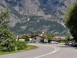
Kematen in Tirol is a municipality in the district Innsbruck-Land located about 12 km west of Innsbruck. The Melach river flows into the Inn river in Kematen. Kematen was first mentioned as "Caminata" around 600.
Kematen in Tirol | |
|---|---|
 | |
 Coat of arms | |
 Kematen in Tirol Location within Austria | |
| Coordinates: 47°15′15″N 11°16′20″E | |
| Country | Austria |
| State | Tyrol |
| District | Innsbruck Land |
| Government | |
| • Mayor | Klaus Gritsch |
| Area | |
| • Total | 6.99 km2 (2.70 sq mi) |
| Elevation | 610 m (2,000 ft) |
| Population (2018-01-01)[2] | |
| • Total | 2,931 |
| • Density | 420/km2 (1,100/sq mi) |
| Time zone | UTC+1 (CET) |
| • Summer (DST) | UTC+2 (CEST) |
| Postal code | 6175 |
| Area code | 05232 |
| Vehicle registration | IL |
| Website | www.kematen.org |
Population
| Year | Pop. | ±% |
|---|---|---|
| 1869 | 586 | — |
| 1880 | 534 | −8.9% |
| 1890 | 506 | −5.2% |
| 1900 | 546 | +7.9% |
| 1910 | 654 | +19.8% |
| 1923 | 601 | −8.1% |
| 1934 | 649 | +8.0% |
| 1939 | 708 | +9.1% |
| 1951 | 2,180 | +207.9% |
| 1961 | 1,550 | −28.9% |
| 1971 | 1,650 | +6.5% |
| 1981 | 2,100 | +27.3% |
| 1991 | 2,258 | +7.5% |
| 2001 | 2,582 | +14.3% |
| 2011 | 2,571 | −0.4% |
Geography
Kematen is located in the Inn Valley, at the confluence of the Melach River (from the Sellrain Valley) into the River Inn. The municipal area lies mainly on the alluvial cone of the Melach south of the Inn. The Inn and Melach rivers form the northern and western boundaries of the municipality. Here lies the geographical (less the cultural) border between the Upper Inn Valley and the Lower Inn Valley.
History
The village name Kematen probably goes back to the Latin caminata, which means "heated chamber". The place is first mentioned in documents around 1143 as "Kemenatin" in records of the Dießen Abbey founded by the Counts of Dießen-Andechs. The Wilten Abbey also had property in Kematen.
References
- "Dauersiedlungsraum der Gemeinden Politischen Bezirke und Bundesländer - Gebietsstand 1.1.2018". Statistics Austria. Retrieved 10 March 2019.
- "Einwohnerzahl 1.1.2018 nach Gemeinden mit Status, Gebietsstand 1.1.2018". Statistics Austria. Retrieved 9 March 2019.