Kelmarsh
Kelmarsh is a village and civil parish in West Northamptonshire, England.[1][2] The population (including Haselbech) of the civil parish at the 2011 Census was 208.[3] The village is on the A508, close to its junction with the A14 about 5 miles (8 km) south of Market Harborough and 11 miles (18 km) north of Northampton.[1]
| Kelmarsh | |
|---|---|
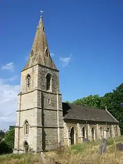
 St Denys' Church | |
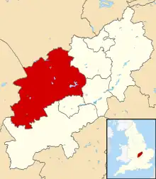
.svg.png.webp) Kelmarsh Location within Northamptonshire | |
| Population | 208 (2011) |
| OS grid reference | SP7379 |
| Unitary authority | |
| Ceremonial county | |
| Region | |
| Country | England |
| Sovereign state | United Kingdom |
| Post town | Northampton |
| Postcode district | NN6 |
| Dialling code | 01604 |
| Police | Northamptonshire |
| Fire | Northamptonshire |
| Ambulance | East Midlands |
| UK Parliament | |
The villages name probably means, 'marsh marked out by poles or posts'. The place-name is identical to Chelmarsh, Shropshire; the initial K- reflects Old Norse influence.[4]
Buildings
Kelmarsh Hall is its principal building.
Kelmarsh Tunnel is a former railway tunnel at Kelmarsh now open as part of the Brampton Valley Way.
Between 1859 and 1960 the village was served by Kelmarsh railway station about 2 miles (3.2 km) north-east of the village running trains south to Northampton and north to Market Harborough.
References
- Ordnance Survey: Landranger map sheet 141 Kettering & Corby (Market Harborough & Stamford) (Map). Ordnance Survey. 2014. ISBN 9780319229866.
- "Ordnance Survey Election Maps". www.ordnancesurvey.co.uk. Ordnance Survey. Retrieved 3 April 2016.
- "Civil Parish population 2011". Neighbourhood Statistics. Office for National Statistics. Retrieved 5 July 2016.
- "Key to English Place-names".
