Kapiri Mposhi District
Kapiri Mposhi District is a district of Zambia, located in Central Province. The capital lies at Kapiri Mposhi. As of the 2010 Zambian Census, the district had a population of 240,638 people.[1]
Kapiri Mposhi District | |
|---|---|
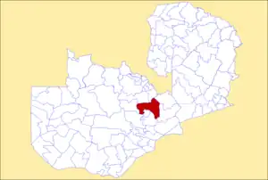 District location in Zambia | |
| Country | |
| Province | Central Province |
| Capital | Kapiri Mposhi |
| Government | |
| • Mr | M Sydney |
| Area | |
| • Total | 17,219 km2 (6,648 sq mi) |
| Population (2015) | |
| • Total | 294,971 |
| • Density | 17/km2 (44/sq mi) |
| Time zone | UTC+2 (CAT) |
Geography
The district borders with Copperbelt Province and with the districts of Chibombo, Chisamba, Kabwe, Luano, Masaiti, Mkushi, Mpongwe and Ngabwe.
Municipalities
It is composed by 14 municipalities:
| Municipality | Pop. (2010)[2] |
|---|---|
| Kapiri Mposhi | 14,792 |
| Chango'ndo | 23,935 |
| Chibwelo | 44,783 |
| Chipepo | 14,323 |
| Kakwelesa | 25,556 |
| Kampumba | 6,080 |
| Kapandwe | 3,852 |
| Kashitu | 7,506 |
| Lunchu | 32,138 |
| Lwanchele | 15,117 |
| Mpunde | 25,832 |
| Mushimbili | 18,634 |
| Mukumbwe | 15,546 |
| Ngabwe | 5,692 |
References
- "Districts of Zambia". Statoids. Retrieved February 11, 2010.
- Central statistics office of Zambia: 2010 Census Archived 2015-11-13 at the Wayback Machine
| Central Province | |
|---|---|
| Copperbelt Province | |
| Eastern Province | |
| Luapula Province | |
| Lusaka Province | |
| Muchinga Province | |
| Northern Province | |
| North-Western Province | |
| Southern Province | |
| Western Province | |
This article is issued from Wikipedia. The text is licensed under Creative Commons - Attribution - Sharealike. Additional terms may apply for the media files.