Kampong Kulapis
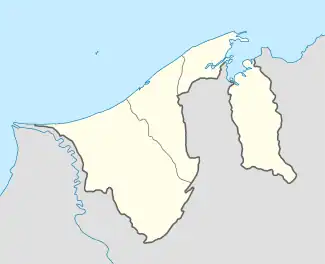
Kampong Kulapis is a village in the west of Brunei-Muara District, Brunei, about 13 miles (21 km) from the capital Bandar Seri Begawan.[1] It has an area of 486.71 hectares (1,202.7 acres);[3] the population was 1,766 in 2016.[2] It is one of the villages within Mukim Sengkurong.The postcode is BG2521.[4]
Kampong Kulapis | |
|---|---|
 Location in Brunei | |
| Coordinates: 4°51′15″N 114°49′17″E | |
| Country | Brunei |
| District | Brunei-Muara |
| Mukim | Sengkurong |
| Area | |
| • Total | 486.71 ha (1,202.69 acres) |
| Population (2016)[2] | |
| • Total | 1,766 |
| • Density | 360/km2 (940/sq mi) |
| Time zone | UTC+8 (BNT) |
| Postcode | BG2521 |
Name
The origin of the village was not fully established despite that several claims were made which the first included where it is another community with a tree-related name is Kampong Kulapis. Once a small community, Kampong Kulapis subsequently united with Kampong Damuan, which was a community named for the Damuan River. The combined village was now known by the name Kulapis, which was derived from the name of a particular kind of wood.[5]
Another claimed that the it originated from the Damuan River which flows from the upper reaches of the Kulapis river to the Kampong Ayer river in Bandar Brunei. The Damuan River was a very popular communication mechanism used by Brunei traders in the 10th century to the middle of the 19th century. Around the middle of the 19th century, the name 'Damuan' was changed to 'Kulapis' and remains until today. Kulapis was taken in conjunction with the name 'son of the fish' which was called by the people of Kampong Damuan at that time. An event had occurred in the upstream of Damuan River where a large group of kulapis fish had already been carried by the salty tidal current to the upstream of Damuan River thus preventing the traders of Kampong Damuan who wanted to go to 'Pangkalan Damuan'. A large group of kulapis fish was found at Dhuha time by some Damuan traders who wanted to go to the business bases. The kelp fish almost covered the surface of the river so that it was difficult for the traders' boats to pass and they had to cancel their wish to go to the two bases of Kampong Damuan for three days.[6]
Geography
The adjacent villages include Kampong Tanjong Nangka to the north, Kampong Mulaut to the north-east, Kampong Bebatik to the east and south-east, Kampong Batong to the south and south-west, and Kampong Katimahar to the west and north-west.[7] The village is hilly, forested, lowland and marshy suitable for farming.[6]
Demography
The total population at this point is about 1,706 people including 99 elderly people and 28 orphans. The ethnicity of Kampong Kulapis is the Kedayan ethnicity and their occupation is mostly farming and breeding. When the fruit season arrives, many residents of Kampong Kulapis set up permanent or temporary huts to be used as a place to sell their fruits. Fruits are picked or collected from privately owned pulau buah (fruit orchards) close to their homes and also from their crops in Bukit Panjang.[6]
Infrastructure
Basic facilities and services such as taxi and public bus transport facilities from Kampong Kulapis to Bandar Seri Begawan run according to schedule every day. Paved roads make it easy for villagers to connect to important places or to their respective workplaces. The children of this village attend Awang Haji Mohammad Yussof Katimahar Primary School and secondary students study at Masin Secondary School and Saiyiddina Hussin Secondary School in Jerudong. Sengkurong Clinic is a health center for the residents of Kampung Kulapis apart from the residents of other villages. Electricity, water supply, and telephone are the most important basic facilities to improve the well-being and standard of living of the people here.[6]
Pehin Khatib Abdullah Mosque is the village mosque; it was inaugurated in May 2017 by Sultan Hassanal Bolkiah and can accommodate 700 worshippers.[8] The mosque is a waqf by an anonymous donor.[9]
References
- Awang Mohammad Rouhan bin Haji Hassan (2007). "Sejarah Kampong Kulapis" (PDF). Pusaka (in Malay). No. 14. Pusat Sejarah Brunei. pp. 38–42. Retrieved 12 January 2018.
- "Population and Housing Census Update Final Report 2016" (PDF). www.deps.gov.bn. Department of Statistics. December 2018. Retrieved 18 July 2021.
- "Blog Kpg Kulapis - Maklumat dan Info Terkini: Sejarah Kampong Kulapis". kpgkulapis.blogspot.com (in Malay). 8 October 2009. Retrieved 12 January 2018.
- "Buku Poskod Edisi Kedua (Kemaskini 26 Disember 2018)" (PDF). post.gov.bn (in Malay). Brunei Postal Services Department. 26 December 2018. Retrieved 18 July 2021.
- Mohd Yunos, Rozan (2013). SEMINAR UNITED NATIONS GROUP OF EXPERTS ON GEOGRAPHICAL NAMES ASIA, SOUTHEAST DIVISION (PDF). p. 14.
- KOMPILASI RENCANA KNK 2015 (PDF) (in Malay). Kenali Negera Kitani. 2015. pp. 136–140.
- Brunei Darussalam street directory : quick & easy reference maps. Brunei Press Sdn. Bhd. 2014. pp. 80–81, 90–91. ISBN 9789991732411. OCLC 932264901.
- "Berkenan rasmi masjid baru Kulapis – Media Permata Online". Media Permata Online (in Malay). 20 May 2017. Retrieved 12 January 2018.
- "New Waqaf mosque in Kg Kulapis – Borneo Bulletin Online". Borneo Bulletin. 16 May 2017. Archived from the original on 12 January 2018. Retrieved 12 January 2018.